2007 Year Review
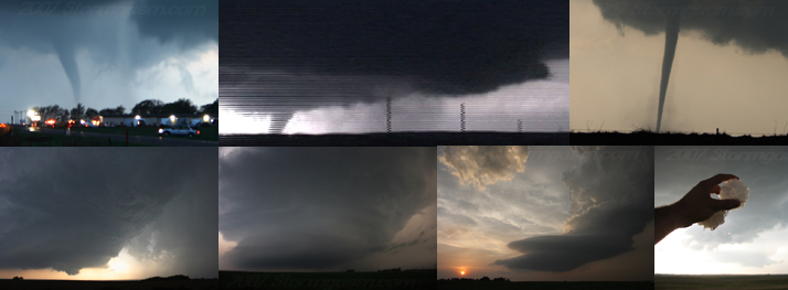
A look at the big 2007 tornado days for the Stormgasm Team
|
March 23rd was a great day in the high plains of New Mexico. Nothing better than chasing beautiful tornadic supercells in March! Simon witnessed 2 tornadoes on a long-lived supercell, which tracked NNE along the NM/TX border.
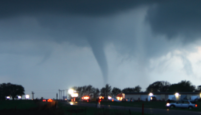
March 28th was a HUGE day for storm chasers; strong tornadic supercells developed from the Texas Panhandle to South Dakota. Wedge tornadoes were reported in TX, OK, KS, NE, and CO! Tom, Anna, and Simon witnessed 2 tornadoes during the evening and nighttime hours on a violent supercell in the eastern TX Panhandle.
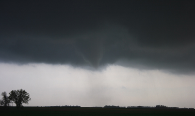
April 13th looked 'Big', but it looked big early in the afternoon across NW TX. Many forecasters were focused on Central and Eastern Texas for violent tornadic supercells. A supercell early in the afternoon did produce a wedge tornado near Seymour, TX, which Simon briefly witnessed. Simon then got really lucky and witnessed a tornado develope on the Southwest side of Fort Worth, TX from what seemed to be merely a squall line, but actually the line had broken into individual supercells!
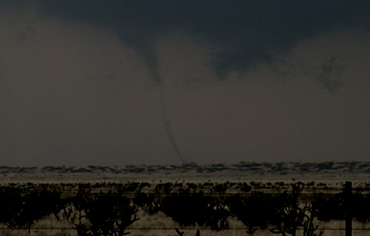
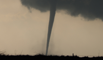
April 23rd was an interesting day; supercells developed along a retreating warm fron in western Kansas and along a differential heating boundary across the eastern TX Panhandle. An LP Supercell, which developed off the dryline and shortly died, drew many chasers deep into the Panhandle away from the tornadic supercells in Kansas. Simon and Mark witnessed 4-5 tornadoes on this day.
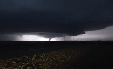
April 24th was expected to produce a tornado outbreak, which it did in the cold-core setup across eastern CO, but not where many forecasters expected. Instead, a tail-end-charley late-day tornadic supercell produced several weak tornadoes, which some vehicles passed through with no damage including the TIV seen on the Storm Chasers TV series on the Discovery Channel. Funny, because normal cars were easily driving through the weak tornado, so no one needed the TIV to survive. Jim, Simon and Mark witnessed the tornadoes produced by this little storm.
May 4th was a very interesting day, a strong CAP and dry air mixing ahead of the dryline in KS kept Simon south along the better moisture gradient along the dryline in NW OK, which proved to his advantage as he witnessed a beautiful tornadic supercell that produced a tornado, which resembled the twister on the classic movie 'Wizard of Oz'. Unfortunately, later that night the retreating dryline produced a tornadic supercell, which produced an EF5 (F5) tornado that annihilated the town of Greensburg, KS.
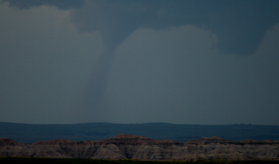
June 6th took Simon and Anna to South Dakota where they witnessed a beautiful supercell and tornado over the Badlands almost directly over the same area Simon witnessed a tornado 2 years before on June 7th, 2005! The supercell became outflow dominant and raced across South Dakota as an MCC, which then developed into a multi-state squall line. |
|

Home
| Storm Store | Photo
Gallery | Message
Board | Storm Chases | Latest
News
Stock Footage | About
| Contact | Editorial
| Weather Links
Copyright 2004 Stormgasm.com. All rights reserved.