April 24th, 2007
Kansas Tornadoes
|
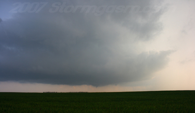
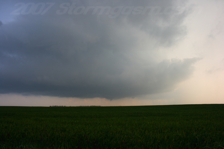
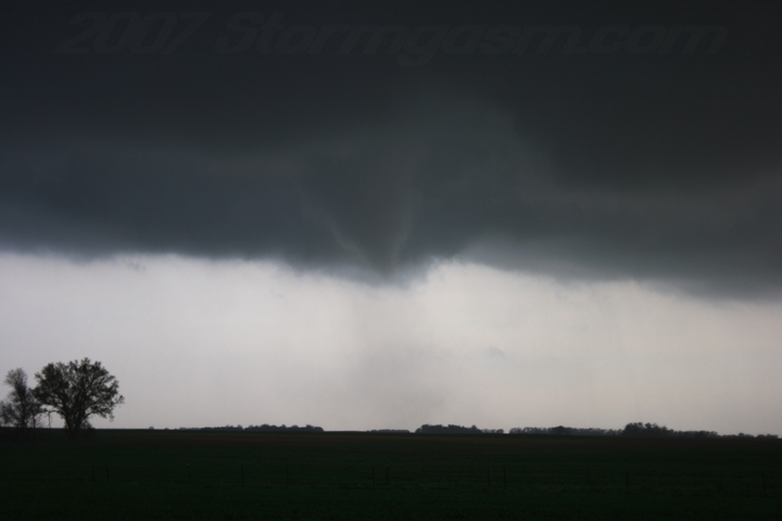
Simon Brewer and Mark McGowen documented 3-4 tornadoes in Central Kansas. Target was North-Central Kansas, but wished we could have woke up earlier to go after the incredible cold-core tornadoes in Colorado. A line of early convection fired over SW Oklahoma and continued to develop northward into southern Kansas, so we opted to play the unaffected airmass in North Central Kansas hoping to get some cells along the dryline/warm-front intersection. Cells fired along the dryline late in the afternoon, but the northern cell was quickly undercut by a southward surging cold front/old-warm-front. More cells fired southward along the dryline, and all the cells were too close to each other, so we drove south toward the southern most cells. Eventually we caught the tail-end-charlie and witnessed 3-4 tornadoes; one tornadic circulation had multiple spinups for about 15 minutes or more, but was very weak.
|
|

Home
| Storm Store | Photo
Gallery | Message
Board | Storm Chases | Latest
News
Stock Footage | About
| Contact | Editorial
| Weather Links
Copyright 2004 Stormgasm.com. All rights reserved.