April 23rd, 2007
Kansas Tornado Outbreak
|
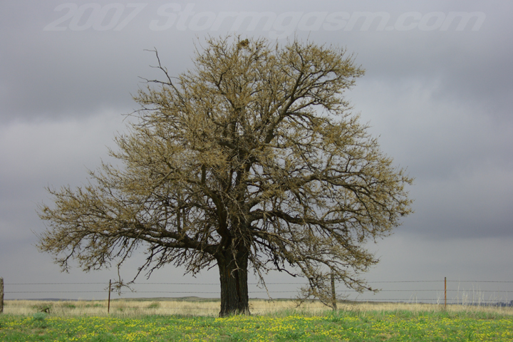
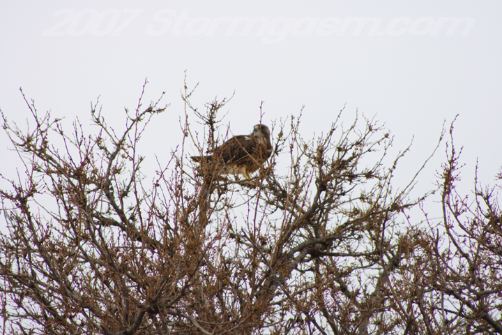
Simon Brewer documented 4-5 tornadoes in Southwestern Kansas; at one time there were 2 and possibly 3 tornadoes on the simultaneously on the ground. Target was the northeastern TX Panhandle/OK Panhandle, because I was hoping to catch storms firing off the dryline, but a strong north-south differential-heating-boundary developed on the edge of a strong cirrus canopy. Checked some data and repositioned near the NW OK/TX Panhandle border near the town of Catesby, OK. A nice supercell developed on the boundary and quickly developed strong rotation. It appeared a brief tornado touched down northwest of Catesby, while the wall cloud showed a multi-vortex appearance, but can't confirm if there was an actual touchdown. Eventually we witnessed numerous tornadoes (probably 3-5) in the vicinity of Protection, KS. The first pic is early in the day in the eastern Oklahoma Panhandle of a tree with a hawk perched in the upper branches. I zoomed in on the hawk in the second picture.
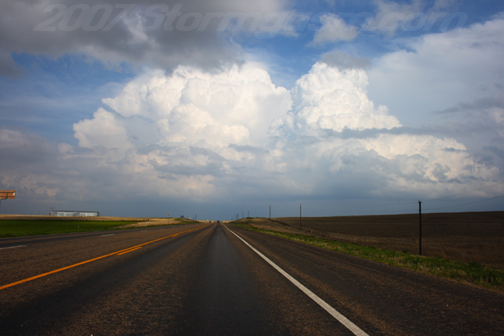
This is a storm developing east of Perryton, TX; had two seperate updrafts, but both were pretty crisp.
Storm near Follet, TX approaching the TX/OK border; was rapidly developing into a nice little supercell.
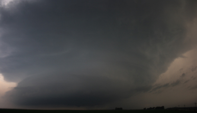
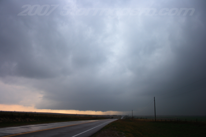
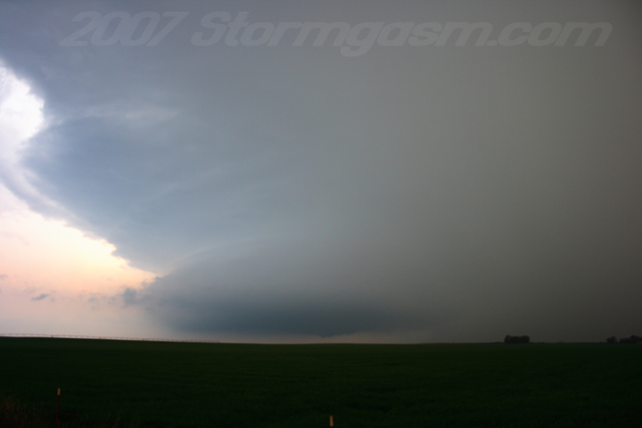
Wall cloud developing southwest of Catesby, OK; notice developing tail cloud on the right.
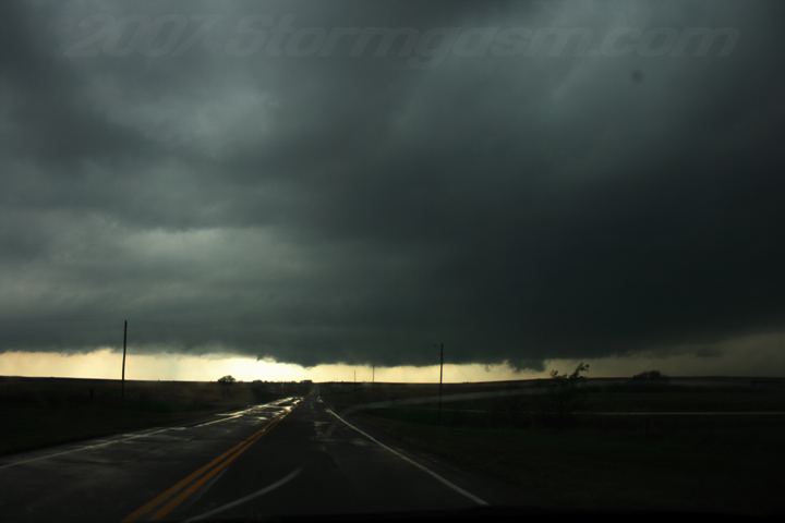
Wall cloud west of Catesby, OK; very strong rotation and nice tail cloud at this point.
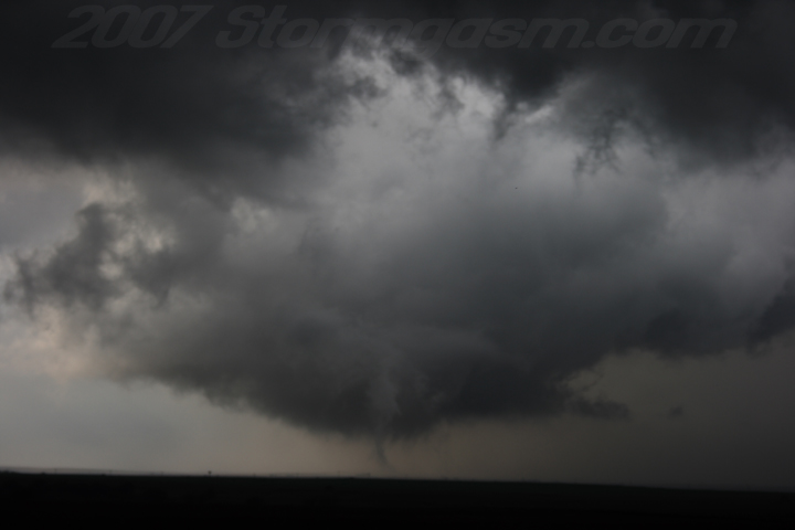
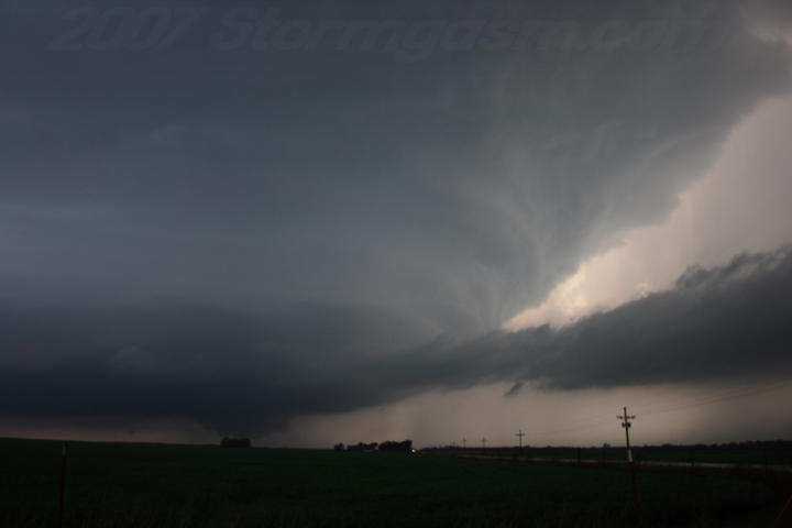
At the time of this photo the wall could was showing very rapid rotation with 'scud fingers' just above ground level; it appeared at the time a quick vortex intesified as the wall cloud was occluding and a short lived tornado touched down, which is shown in the picture.
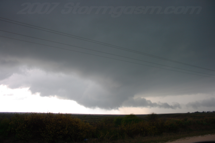
Nice shot of the supercell as it approached Laverne, OK.
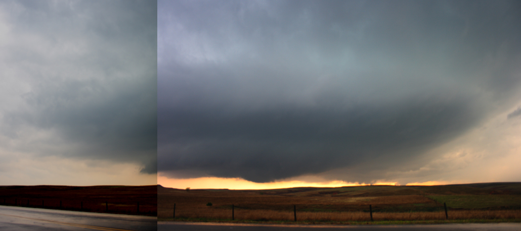
This is near the KS/OK border on SR183; it is a panoramic (combined 2 pics) of the supercell.
This is a picture of the supercell, which had a tornado on the ground, but can't see it in the pic, when the supercell was SSW of Protection, KS. I was east of Protection, KS at that time.
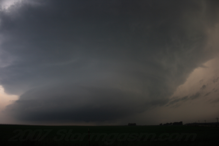
Supercell shows amazing structure!
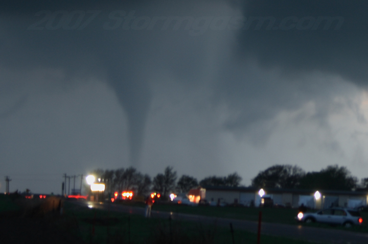
We drove west to Protection to get some video of the tornadoes; I was amazed at how well this turned out, because I was hand holding the camera with a very slow shutter speed.
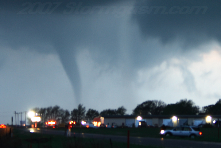
In this picture I set the camera on the roof of the car, so it was not as blurry.
Tornado WNW of Protection, KS
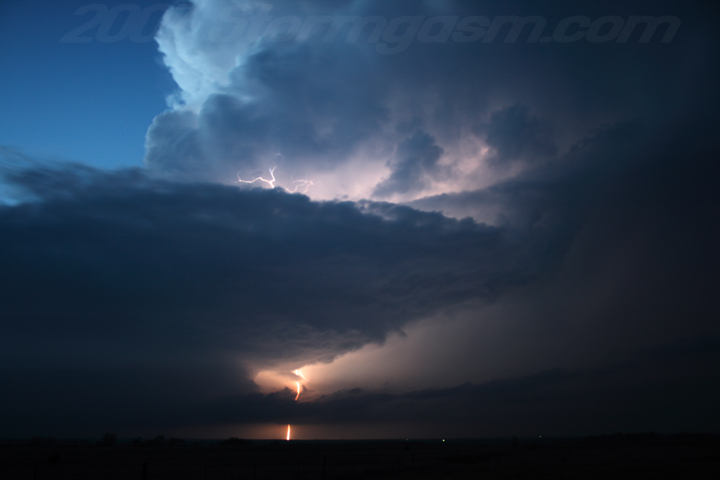
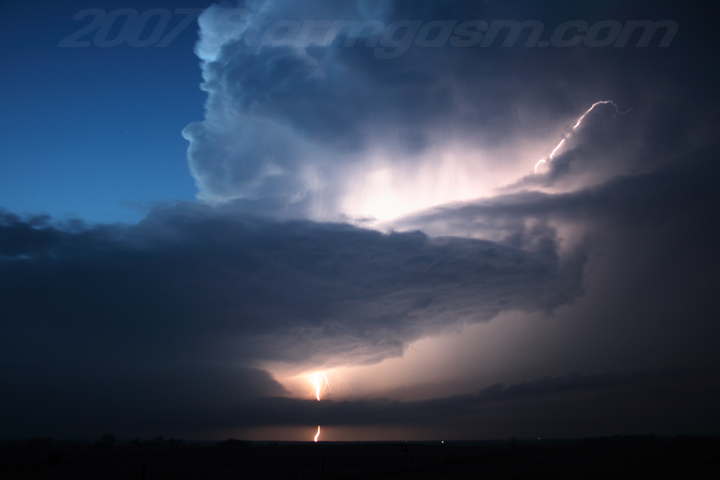
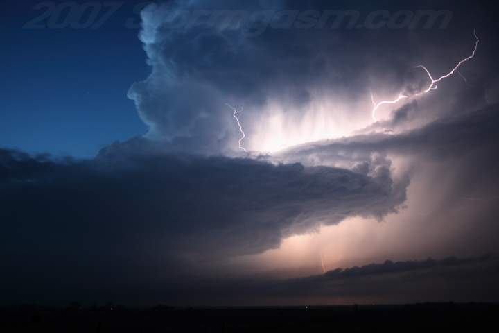
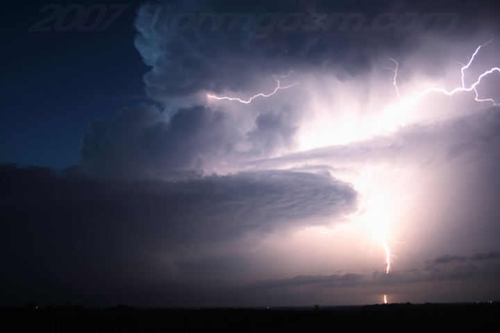
After witnessing multiple tornadoes near Protection we drove east a few miles and let the supercell get NNW of us, so that we could take lightning pictures of the updraft. The shots actually came out very well; much better than I expected.
Notice the big beaver's tail feeding into the updraft!
Lucky for me quite a few bolts occurred in the vault, so I got to see some nice structure. After this picture, or somewhere around that time, Dan Robinson and another guy (sorry, can't remember his name) pulled up and they began taking pics or video, and we chatted about the events of the day.
|
|


Home
| Storm Store | Photo
Gallery | Message
Board | Storm Chases | Latest
News
Stock Footage | About
| Contact | Editorial
| Weather Links
Copyright 2004 Stormgasm.com. All rights reserved.