Borah Peak, Idaho: Part 2
August 12th - August 16th 2008 Trip
|
We left Anna at the beginning of 'Chicken Out Ridge', because she was not feeling well due to possible dehydration, fatigue, elevation sickness, or a combination of all three. Brandon, Shawn, and I continued the climb over 'Chicken Out Ridge' and the final push to the summit. I know this climb might not be significant to most people, but to us at the time it was our Everest. The tallest mountain I had ascended to that point was Guadalupe Peak (8,751 feet) in southwestern Texas, so this was a big step. |
|
The image on the right shows Brandon and Shawn continuing along the ridge without Anna. |
 |
|
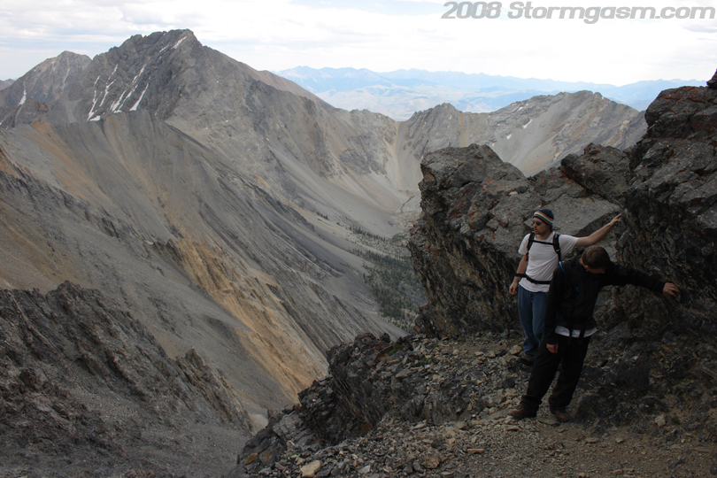
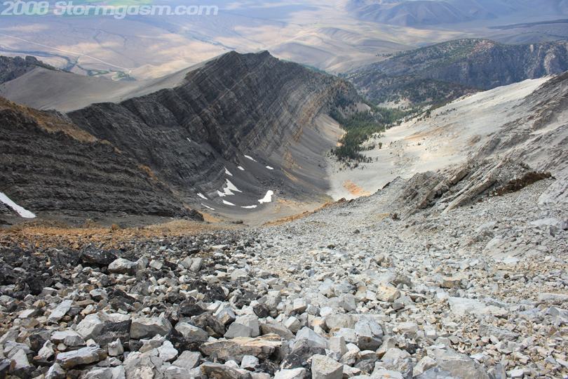
Image on the right shows Shawn looking over the great ravine below. The trail up the southwest ridge can be seen far below. |
 |
|
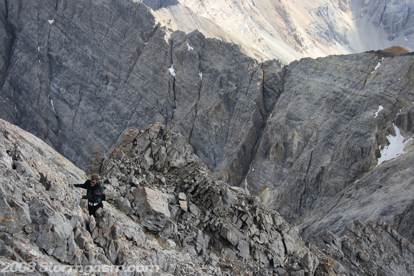
Image on the right shows Shawn climbing up the ridge. |
 |
|
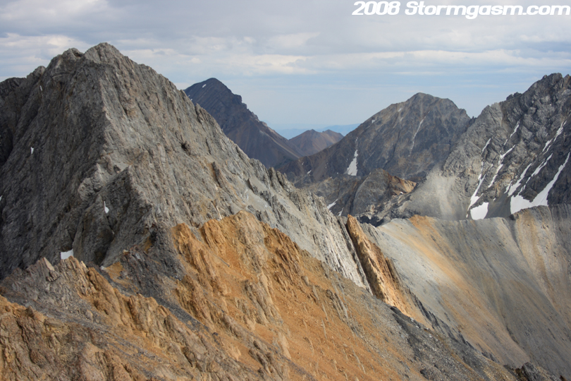
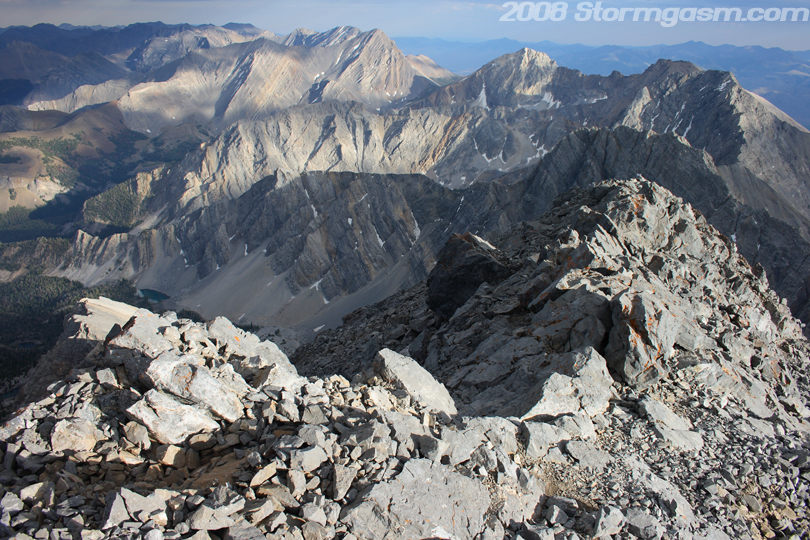
Image on the right shows our incredible view of Lost River Range Peaks to our southeast. |
 |
|
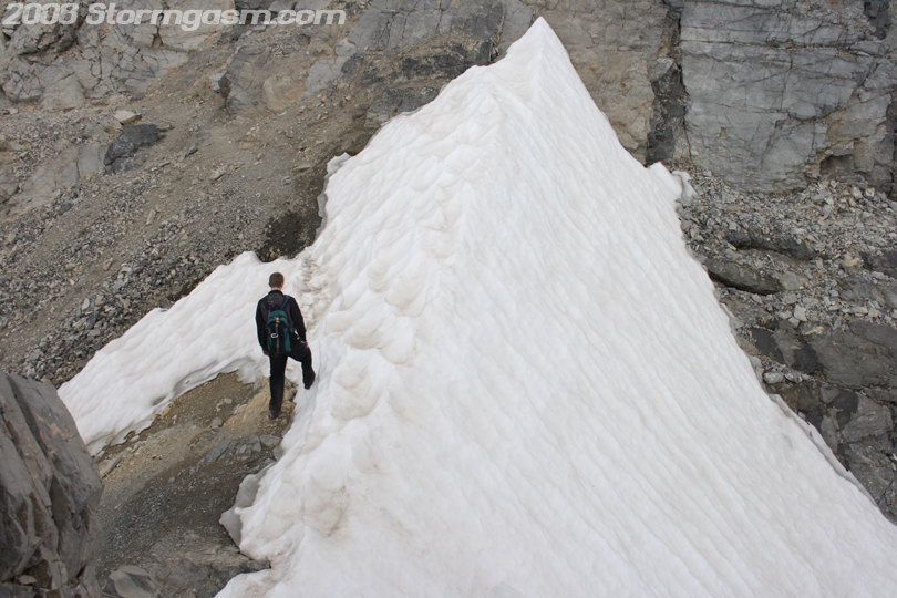
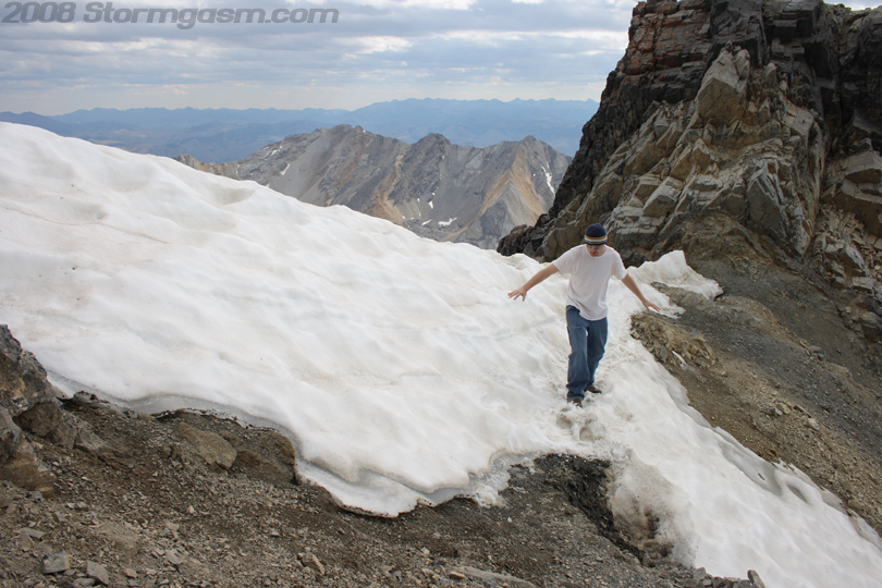
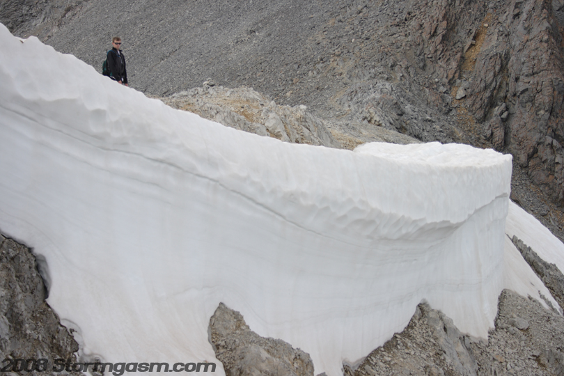
We encountered an exciting part of the climb that I had read about when doing research for Borah Peak; the snow crossing! The snow crossing is much more formidable earlier in the year, but this was mid August, so we only had to cross a tiny patch of crusty snow. Image on the right shows Brandon traversing the snow crossing. |
 |
|
Image on the right shows Brandon on the snow crossing with Borah's summit in the background. |
 |
|
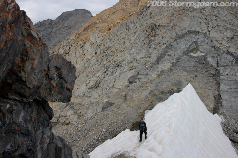
Image on the right shows Simon checking-out the view at the snow crossing. It was chilly on the ridge, so I pulled out the pants and long-sleeve shirt. |
 |
|
Image on the right shows Shawn messing around on the snow crossing... It's all fun and games until someone crosses some snow! |
 |
|
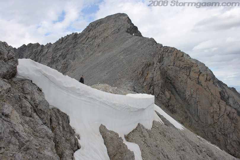
The image on the right shows the snow crossing and the end of 'Chicken Out Ridge'. |
 |
|
Image on the right shows Shawn at the snow crossing with the end of 'Chicken Out Ridge' behind him on the right of the pic. |
 |
|
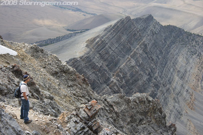
Image
on the right is looking at the massive gully/ravine and southwestern
ridge below our location.
|
 |
|
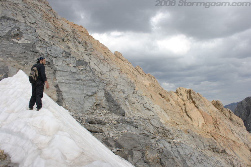
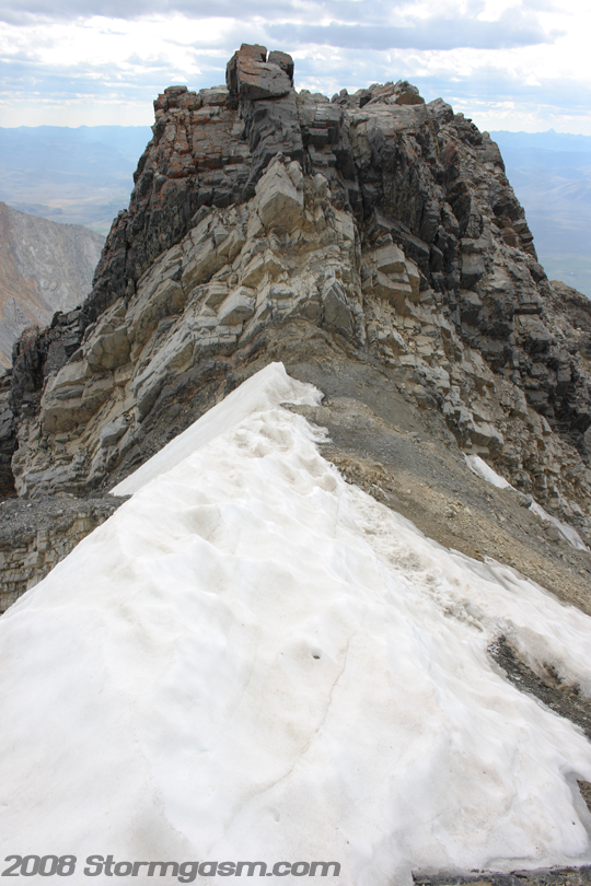
We came upon another larger patch of snow on the edge of the ridge before the final summit push. I climbed out onto a ledge to get some shots of this mass of hardened snow. The image on the right shows Brandon standing dangerously close to the edge of the snow shelf with the summit of Borah in the background. |
 |
|
Zoomed-in image of Brandon on the snow shelf. |
 |
|
Image on the right shows Shawn in the foreground and Borah's summit in the background. This was our final push to the summit: a scramble up loose rock called 'scree' and 'talus'. There appears to be a path or multiple paths up to the summit, but as we climbed we could not find a continuous path, so we just kept moving upward for what seemed like forever. |
 |
|
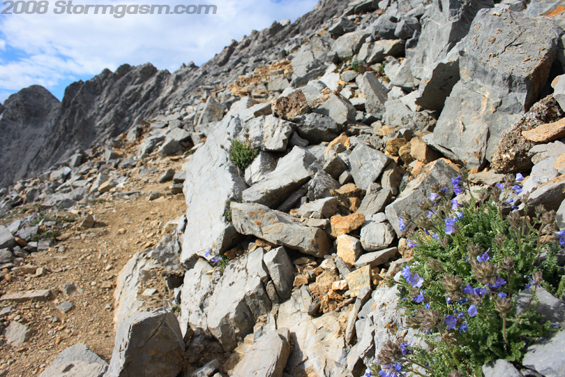
Image on the right shows a plant with flowers struggling to make a living near the top of Borah Peak. |
 |
|
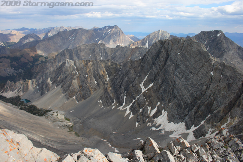
Image on the right is looking southeast at other peaks in the Lost River Range. A mountain pond/lake can be seen left-center of the picture. |
 |
|
Image on the right whos Brandon scrambling up the scree and talus trying to reach Borah's summit. |
 |
|
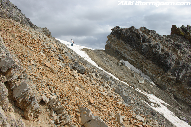
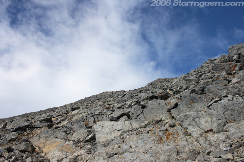
The final scramble to the summit was exhausting. I would get over a large section of rock and think I'm close to the end only to find I still have a ways to go; the final push from the ridge to the summit is about 700-800 feet. The image on the right is looking up towards the summit, which still shows a long way to go after some time scrambling. |
 |
|
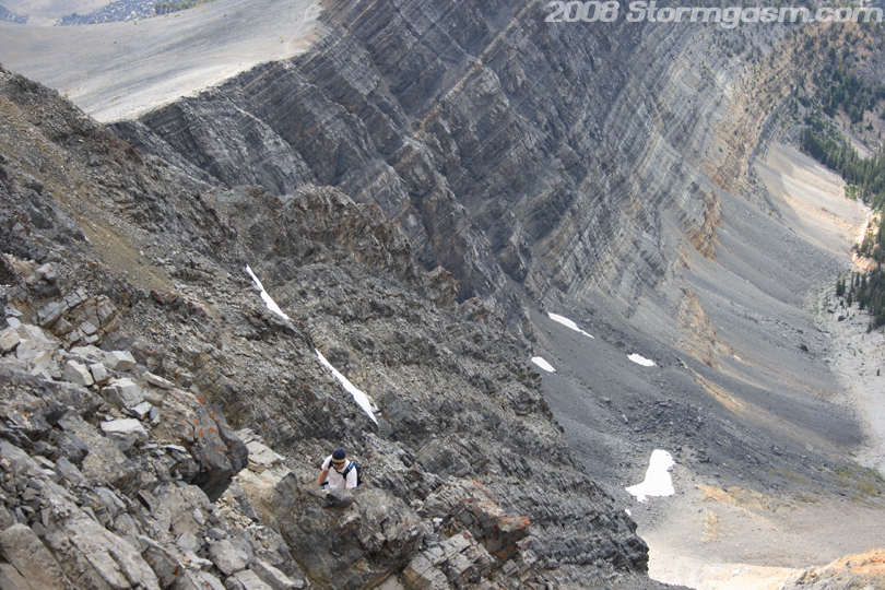
Image on the right shows the ridge below our location as we scramble to the summit. |
 |
|
Image on the right shows Brandon on the final ridge to the summit. The summit is 20-30 feet behind my location when I took this picture. Brandon is looking down at Shawn's location. |
 |
|
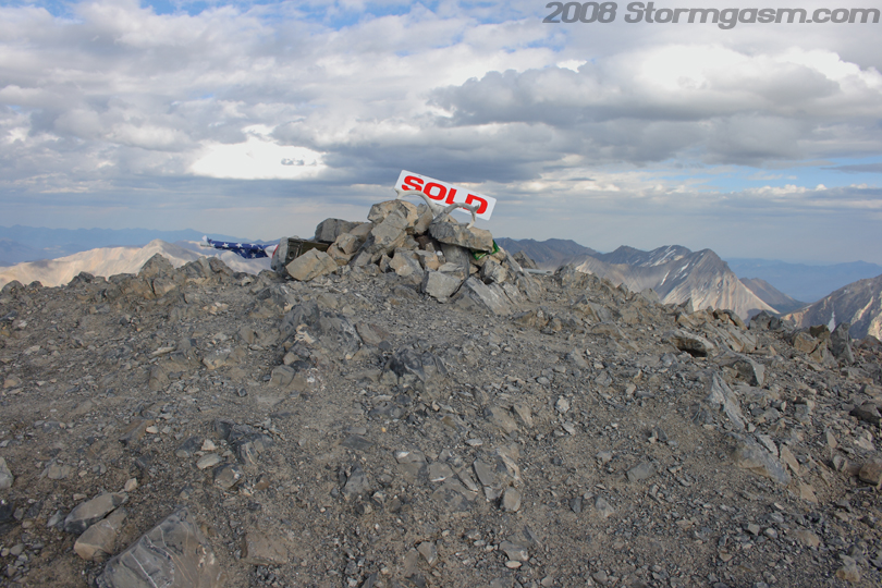
Image on the right shows the top of Borah Peak! We had made it to the summit! It was not till reaching the summit that I began to feel a horrible headache develop. I believe the headache was a combination of dehydration and elevation. I later felt a similiar headache on the summit of Humphrey's Peak in Arizona in late September. There was a great number of objects that people had brought and left on the summit. We took many pictures and signed the guest book/summit log. |
 |
|
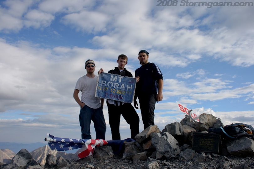
Image on the right shows (from left to right) Shawn, Brandon, and Simon on the summit of Borah Peak. Brandon is holding a hand made cloth sign someone had left on the summit. |
 |
|
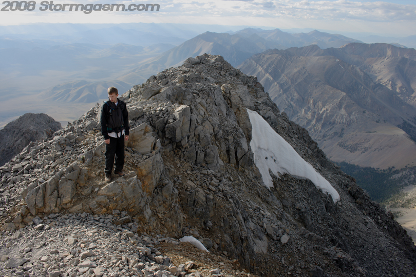
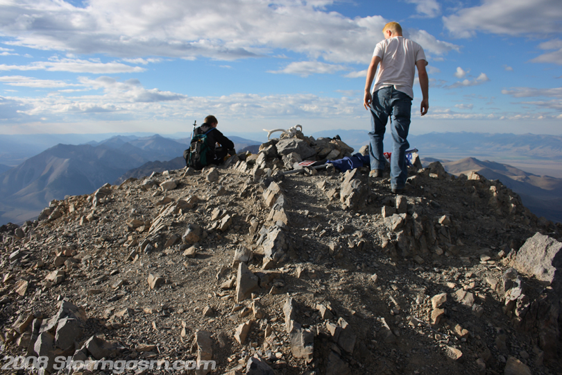
Image on the right shows Shawn and Brandon on the summit looking to the North. I think this is my favorite picture of the summit itself, because it shows a well defined rounded summit with Brandon and Shawn for depth. |
 |
|
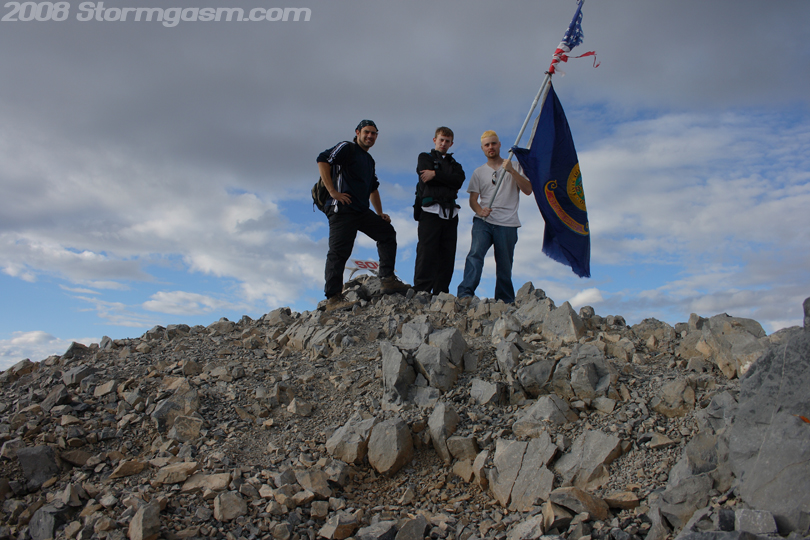
Image on the right shows another summit picture of our group, but this time Shawn is holding a flag he found on the summit; possibly the State flag of Idaho and 'Old Glory'. |
 |
|
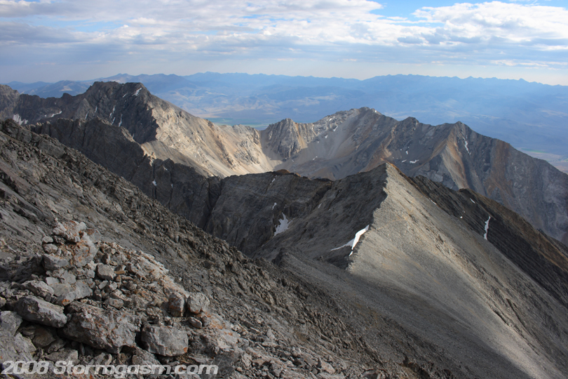
Image on the right shows one of many incredible views from the summit of Borah Peak; this image is looking southeast along the Lost River Range. |
 |
|
Image on the right shows another shot of the Lost River Range southeast of Borah, but this time I got part of Borah's summit in the foreground. |
 |
|
Image on the right shows my 'summit photo' on Borah Peak. I think the goofy smile is from the elevation sickness that was slowly killing me at the time. |
 |
|
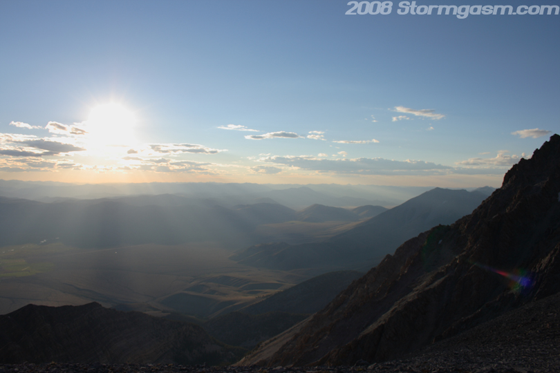
We spent maybe 30 minutes on the summit, but we should have only spent 10-15, because the sun was getting very low on the horizon. We had started the climb too late and wasted a bunch of time on 'Chicken Out Ridge', so now we were pushing our luck. Our main goal was to get over 'Chicken Out Ridge' before it got too dark. On the climb down from the summit I slid on some scree and dislodged a boulder the size of a basketball that began to tumble down a cliff to the right of the main path we had taken to the summit. The boulder caused a small rockfall to develop, which stirred up large amounts of dust and made a loud noise around the mountain. Anna heard the rockfall and thought we were hurt, so until we crossed 'Chicken Out Ridge' she was worried. Image on the right shows the valley and mountains to our west as the sun was low on the horizon. |
 |
|
Image on the right shows the sun setting, while we were still on 'Chicken Out Ridge'. |
 |
|
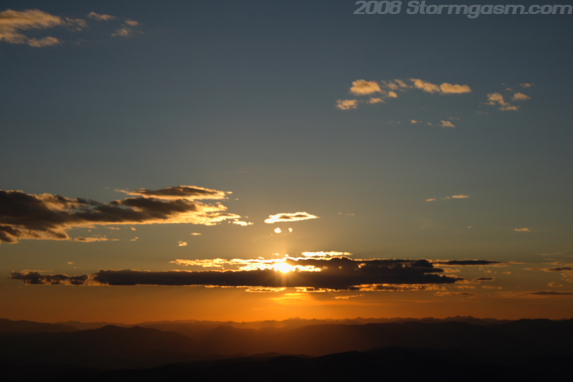
Image on the right shows the sunset over the valley and gully near Borah Peak. |
 |
|
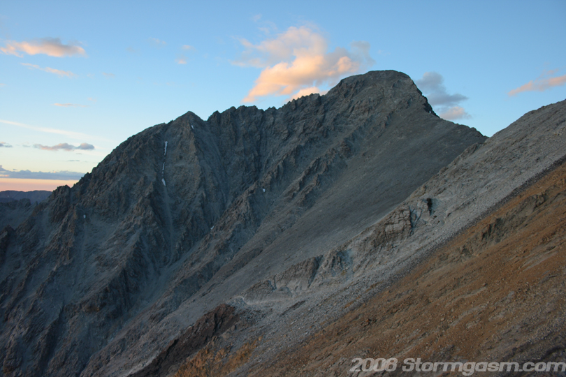
Image on the right shows Borah Peak at sunset. |
 |
|
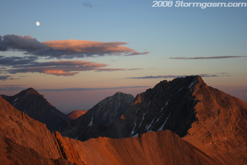
Image on the right shows other peaks to the southeast of Borah in the Lost River Range. The moon can be seen above the peaks. I didn't have a tripod, so I had to increase the shutter speed and increase the ISO on the camera. |
 |
|
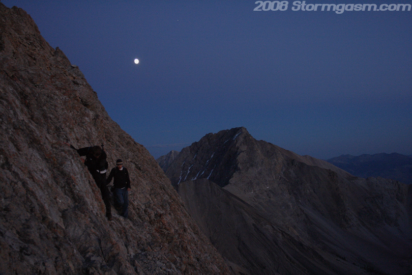
Image on the right shows Brandon and Shawn finishing 'Chicken Out Ridge' as night falls on Borah Peak. We barely got across the ridge before it got too dark. We had to climb down the remainder of Borah at night, which made for slow travel. We were somewhat prepared, but we only had one flashlight. We made some bad choices on this climb, but luck seemed to be on our side. We arrived at our camp near midnight! |
 |
|
We woke late the following morning, packed our gear, and got on the road. The image on the right shows Borah Peak the following day as we left the mountain. Borah Peak can be seen as the tallest point left of center in the photo. |
 |
|
Image on the right shows a zoomed-in version of Borah Peak. |
 |
|
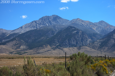
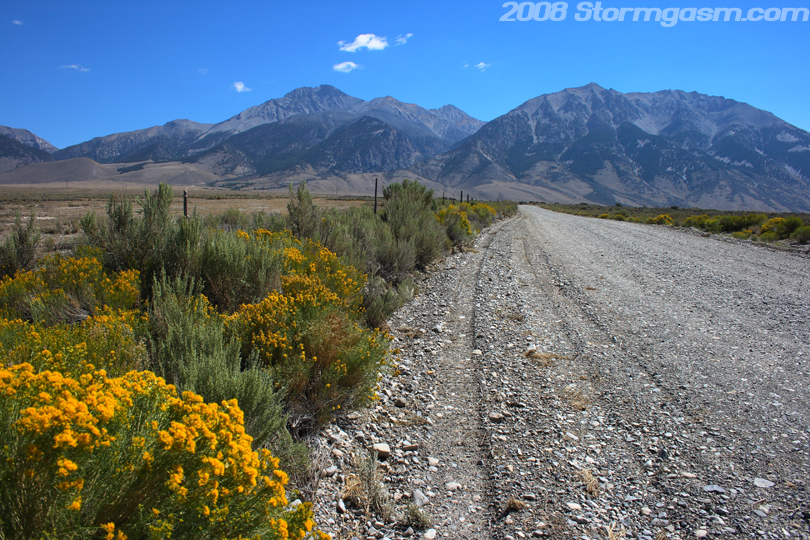
We left Borah Peak and drove to the town of Mackay and ate at a place called, "Burger Time", which had incredible burgers, but after climbing Mount Borah I think anything would have tasted like heaven. We drove by some other mountains in the Lost River Range that I would like to go back and climb some day. The image on the right shows one mountain I would definitely like to climb in the next couple years, Lost River Peak, which can be seen in the center of the pick. |
 |
|
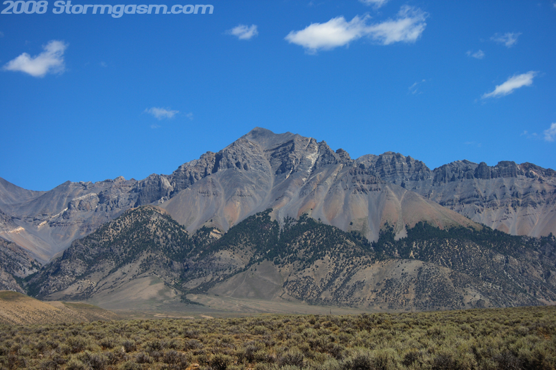
Image on the right is a zoomed-in pick of Lost River Peak. We left the Lost River Range after eating at 'Burger Time' in Mackay and hopped on S.R. 20 eastward through Idaho Falls. We passed some dormant/extinct volcanoes southeast of Arco, which were pretty cool. We took a smaller route 22 to Jackson Hole, WY. We then drove into Grand Tetons National Park and found a campsite for the night. |
 |
Home
| Storm Store | Photo
Gallery | Message
Board | Storm Chases | Latest
News
Stock Footage | About
| Contact | Editorial
| Weather Links
Copyright 2004 Stormgasm.com. All rights reserved.