July 10, 2008 North Dakota/South Dakota Supercells
|
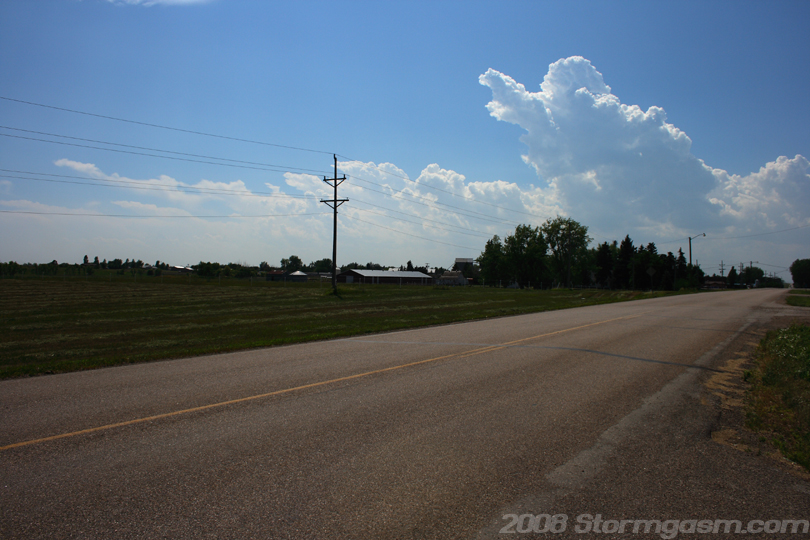
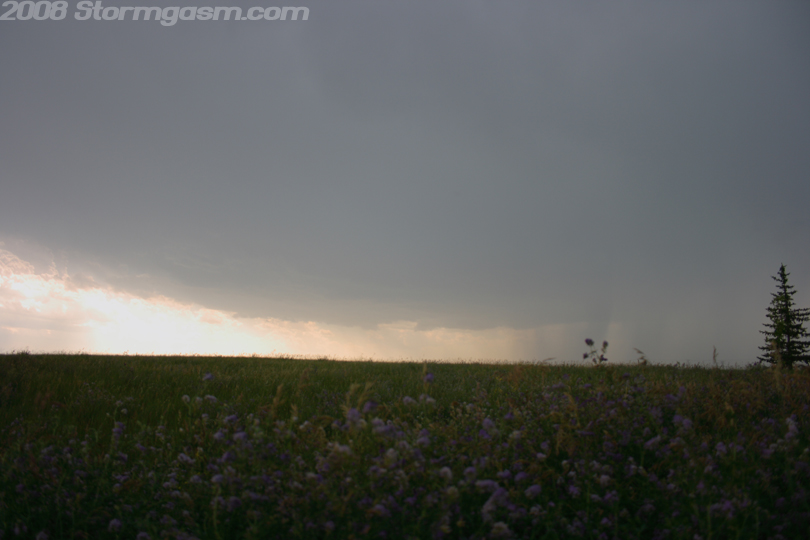
We arrived in Underwood, ND in the late afternoon, and topped-off our tank with over-priced gasoline mostly driven by futures trading on the stock market. We first saw convective towers develop along the dryline off to our west when we passed through Bismark. We orignally planned to stop in Minot to look at data, but discovered the nose of deepest moisture return was over our location, which could be seen by the northern end of convective towers to our west. Therefore, we decided to stay in Underwood, watch the convective towers develop, and wait for a storm to fire. The image on the right is looking WSW at the northern extent of the convective towers building along the dryline west of Underwood, ND. |
 |
| We sat in the parking lot of a gas station in the Underwood area watching towers develop, and then we noticed an altostratus cloud formation devlop near the convective towers. I'm not certain, but this mid-level cloud feature may have developed as the nose of a mid-level jet streak moved over the area. The picture on the right shows the mid-level cloud feature over and east of the cumulus towers. | 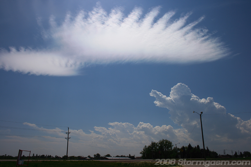 |
|
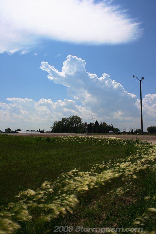
The image on the right shows the increasing size of the mid-level cloud feature and the convective towers as both cloud features approach our location. I was also interested in the fluffy grass. |
 |
|
The convective towers were increasing in size and numbers as they approached our locations. |
 |
|
A storm developed to our west and began to build southward, so we repositioned to the south and watched it organize. The image on the right shows this storm as it began to disorganize; outflow undercut the updraft and forced new development to the south and east. |
 |
|
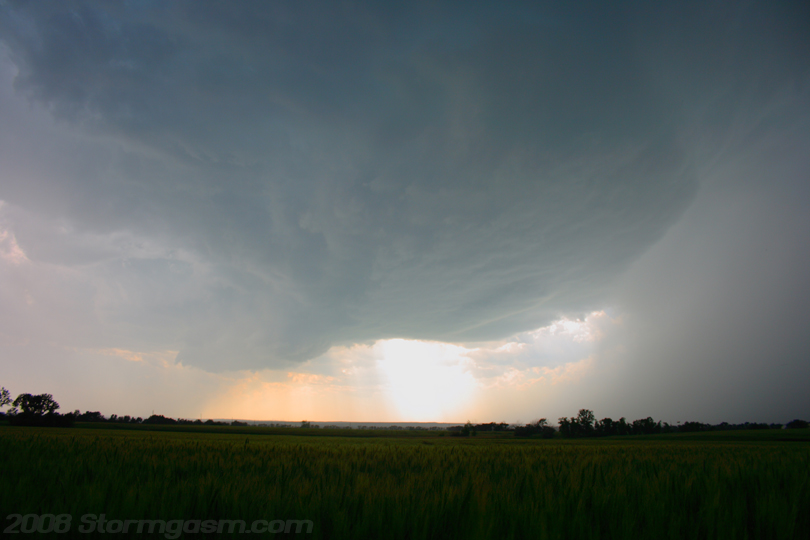
The image on the right shows a well developed updraft base as a supercell storm developed near Washburn, ND. There seemed to be a serious problem with outflow from the forward flank downdraft undercutting the updraft of all the supercells on this day. |
 |
|
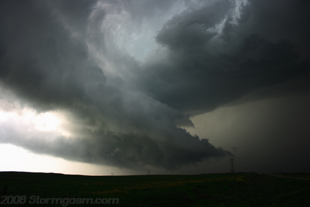
Our original storm was undercut, so we intercepted another storm, which rapidly organized near Wilton, ND, but it was moving SE, and our road options took us east into the FFD and then south. Apparently, during our time repositioning a tornado was reported to our west. We cut through the FFD and got a view incredible supercell structure. The pic on the right shows one of the many rotating wall clouds this storm produced. We never saw a tornado develop on this storm, but a few were reported. We followed this storm southeast of Bismark until the storm became completely outflow dominant. Then we dropped south after some supercells in South Dakota. |
 |
|
The cells in South Dakota conglomerated into elevated clusters and I fought the hoards of mosquitoes and biting flies to take the picture on the right. The image is soft due rain scattering the light, also, there might have been some precip on the camera lense. |
 |
|
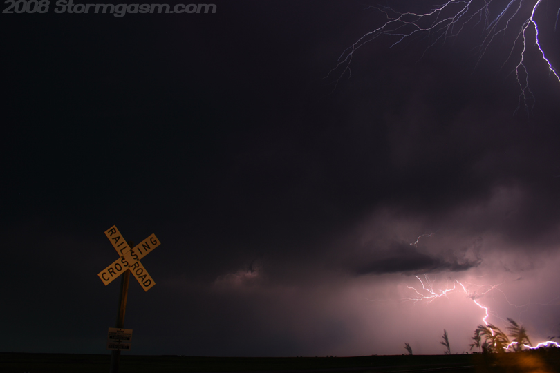
The backside of the thunderstorm clusters had incredible lightning! We drove east towards Aberdeen, SD watching incredible lightning and finally I had to pull over and risk another battle with flies and mosquitoes for some pics. The pic on the right shows two individual strikes to my east, but the camera was pointing northeast. |
 |
|
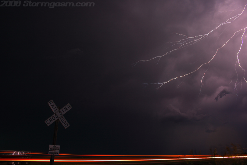
Cloud to cloud lightning over a busy state route shown in the image on the right. |
 |
|
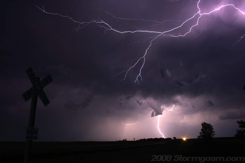
The image on the right was the last shot I could stand; the mosquitoes and biting flies were destroying me at this point, but it might be one of my best lightning shots of the year. We continued to Aberdeen after this shot was taken, and we slept in our car at a truck stop. We chased the following day in Minnesota and captured our first July tornadoes in central Minnesota. To see the next day go to this link: July Minnesota Tornadoes |
 |
Home
| Storm Store | Photo
Gallery | Message
Board | Storm Chases | Latest
News
Stock Footage | About
| Contact | Editorial
| Weather Links
Copyright 2004 Stormgasm.com. All rights reserved.