July 11, 2008
Minnesota Tornadoes
|
Juston
Drake and Simon Brewer documented two tornadoes and multiple supercells
in central Minnesota. We
started the day in Aberdeen, SD; a well developed shortwave trough was
propagating across the Northern Plains, deep moisture was in place,
a well developed dryline was mixing east, but a cold front was about
to overtake the dryline. We decided to drive northeast and position
ourselves in Fergus Falls, MN. Cells developed along the cold front
and we followed a robust tower northeast to Pelican Rapids, MN. The
updraft began to gain in organization north of Pelican Rapids and moved
northeast of town.
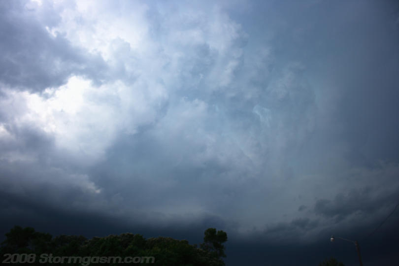
The
image on the right shows the developing storm north of Pelican Rapids,
MN.
|
 |
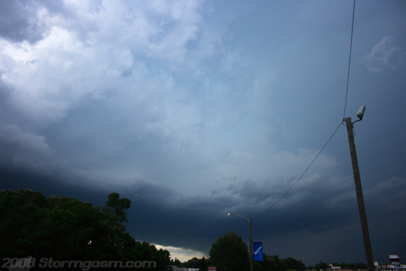
| The
image on the right shows the same storm north of Pelican Rapids, MN; notice
the developing beaver's tail feeding into the updraft. |
 |
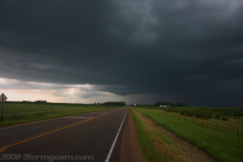
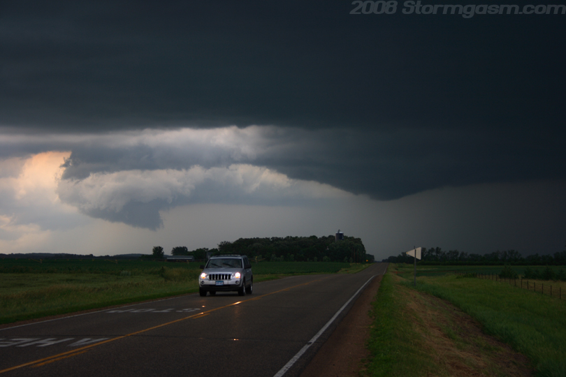
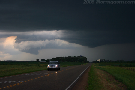
| We
drove east on 108 and documented our first tornado of the day, but did
not realize it at the time. The image to the right shows a supercell to
our north near Frazee, MN. There was a really nice occlusion and a lowering.
The lowering showed rapid rotation and a funnel rapidly developed and
appeared to get close to touching down at one point, but we couldn't tell
due to trees between us and the feature. Apparently, chasers or spotters
were closer to this feature and reported debris at ground level. |
 |
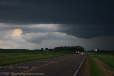
| Image
on the right shows the rotating wall cloud and occlusion on a tornadic
supercell near Frazee, MN. |
 |
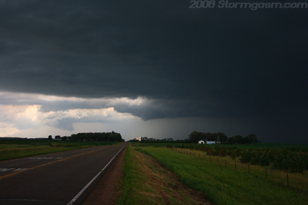
| Image
on the right shows the occlusion and rotation wall cloud near Frazee,
MN. |
|
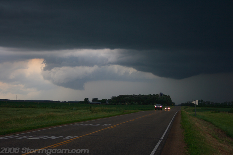
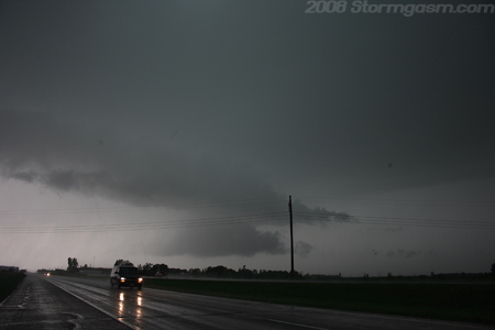
| Image
on the right shows the "nub" funnel cloud and occlusion to our
north near Frazee, MN. We decided to not pursue this storm, because a
storm to our south was about to cut-off the flow into the storm to our
north. |
 |
|
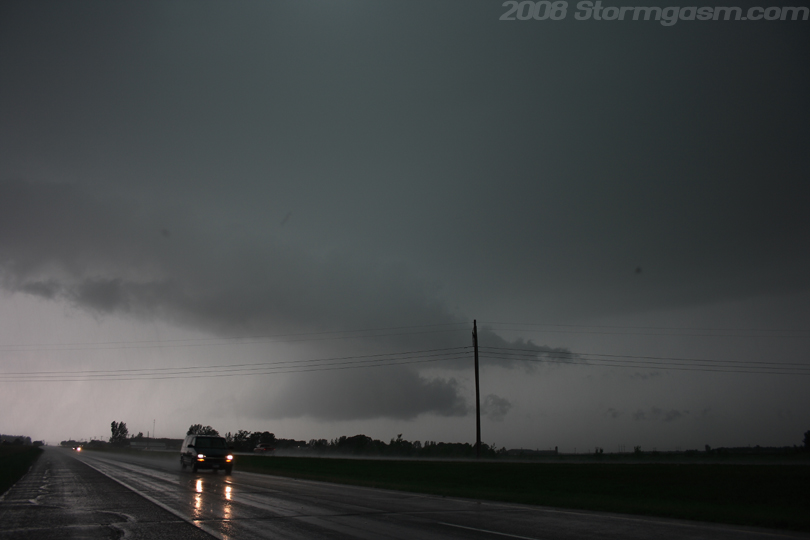
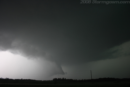
We
drove east-southeast and cut through the FFD of a storm to our south.
We found that a tornado warning was issued for this storm due to a tornado
being reported to our southwest. We stopped somewhere between Wadena
and Staples, MN on SR 10 and watched a rain-wrapped rotating wall cloud
cross the road behind our location. We let the RFD gust front pass over
us and we got slammed by high winds, rain, and small hail. We then were
able to witness a stovepipe tornado in the rain north of the road moving
northeast over a field. We captured only a few seconds of video and
I'll try to get that posted on the website someday.
Image
on the right is looking WNW at a tail cloud feeding into a rain-wrapped
wall cloud southeast of Wadena, MN.
|
 |
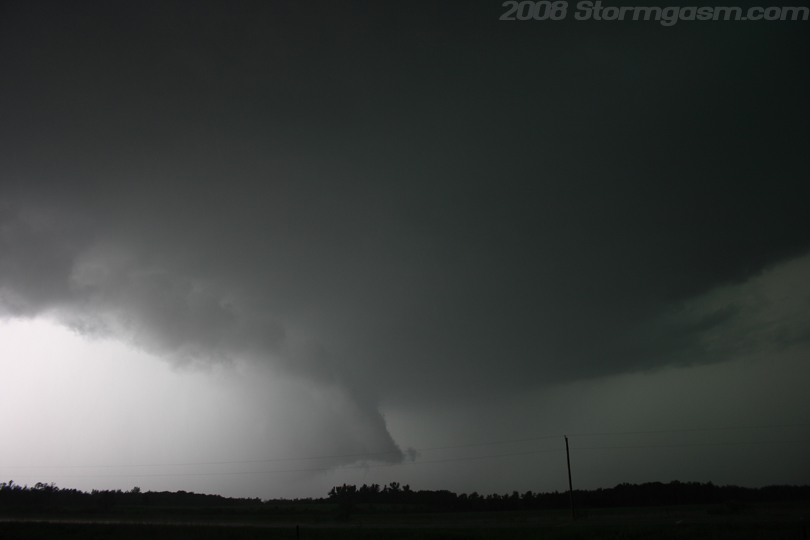
| Image
on the right shows the rain-wrapped wall-cloud NW of our location; this
picture was taken shortly after we witnessed a tornado back in the rain. |
 |
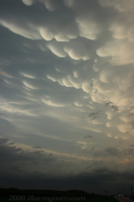
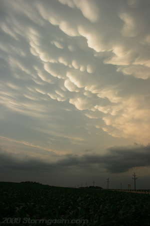
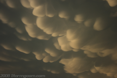
| We
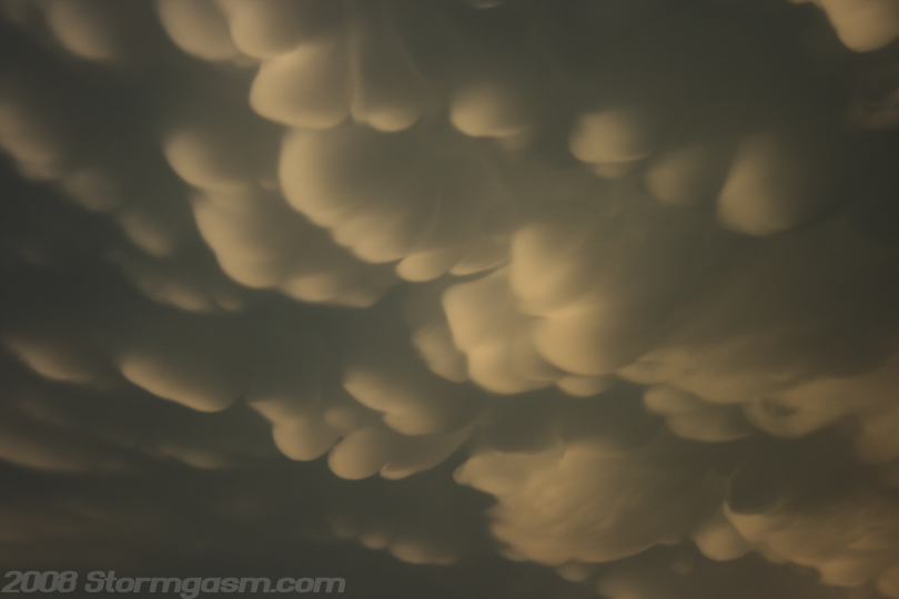
supercell hopped southward along a broken-line of cells in Minnesota.
Eventually, the line of cells became more solid and less broken, so we
let the line overtake our location. The image on the right shows beautiful
mammatus clouds on the backside of the squall-line; the pic was taken
near Kimball, MN. |
 |
| We
sat in the parking lot of a gas station in the Underwood area watching
towers develop, and then we noticed an altostratus cloud formation devlop
near the convective towers. I'm not certain, but this mid-level cloud
feature may have developed as the nose of a mid-level jet streak moved
over the area. The picture on the right shows the mid-level cloud feature
over and east of the cumulus towers. |
 |
| Image
on the right shows mammatus and sunset over a cornfield in central Minnesota. |
 |
| Image
on the right shows mammatus and sunset over a cornfield in central Minnesota. |
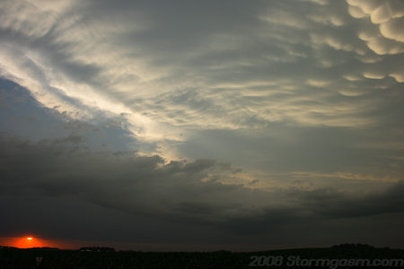 |
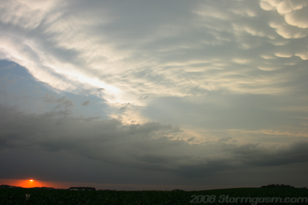
| Image
on the right shows mammatus over central Minnesota. I saw my first tornadoes
in July on this day, so Juston and I were pretty pumped. It was a good
two-day chase in the Northern Plains. |
 |
Home
| Storm Store | Photo
Gallery | Message
Board | Storm Chases | Latest
News
Stock Footage | About
| Contact | Editorial
| Weather Links
All
storm chasing (tornado, supercell, lightning, hail, sunset, ect.) photos and
videos are copyright property of Jim Bishop and Simon Brewer (Stormgasm),
unless otherwise specified. Any unauthorized reproductions are strictly prohibited
by law.
Copyright 2004 Stormgasm.com. All rights reserved.