![]()
Storm Chasing
June 24, 2003 South Dakota Tornadoes: Amazing Tornado Video of the Manchester, South Dakota Tornado!
June 24 promo 1:18 min 2mb |
 |
 sample clip 2 0:36 min 10.8mb |
| Buy
the DVD Today! Order Page |
|
Introduction Chase
account We
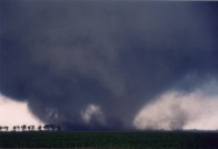
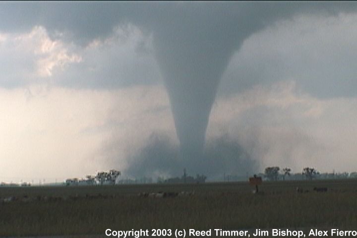
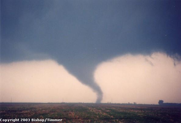
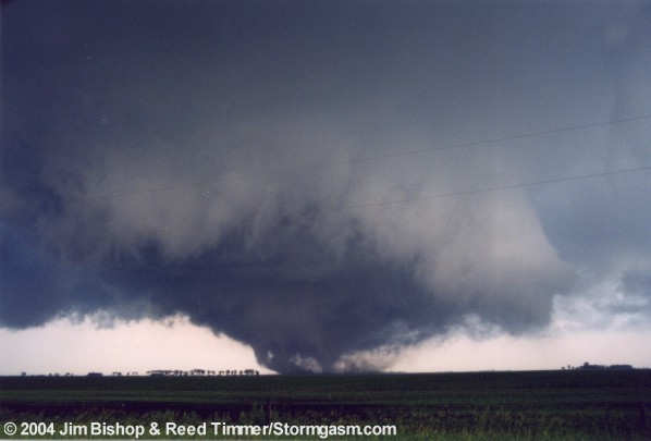
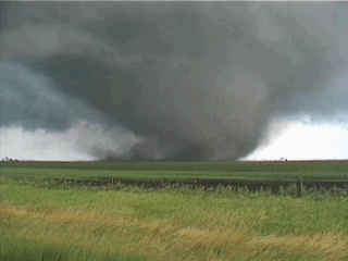
saw our first tornado touch down about ten miles to our west as we were
driving north on state highway 37. It was a beautiful cone tornado, with
a very impressive RFD occlusion going into the west side of the wall cloud.
37 turned west and we moved quickly, catching up to the tornado just north
of the intersection of highway 37 & 34 near Woonsocket, South Dakota.
We stopped about one mile north of the intersection. I shot some photos
of this very photogenic tornado as Reed captured amazing video. The tornado
roped out about five minutes later, owing to a ten to fifteen minute track
time. What a beautiful tornado! |
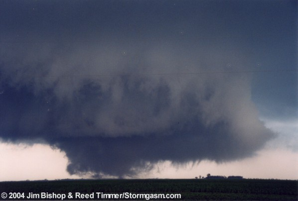
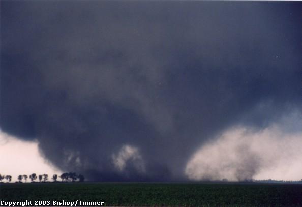
 F3 Tornado near Woonsocket,SD. |
|
 |
 |
|
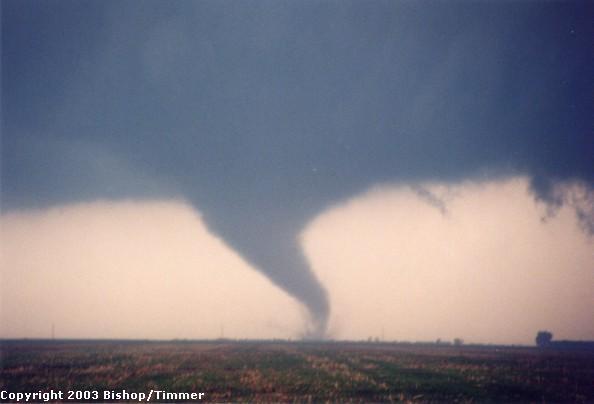
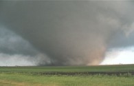
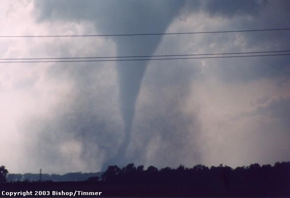
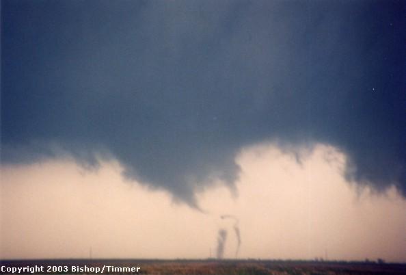
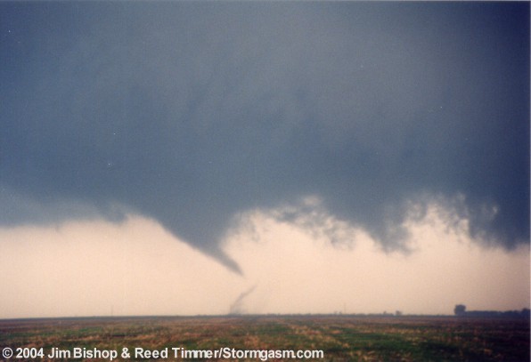
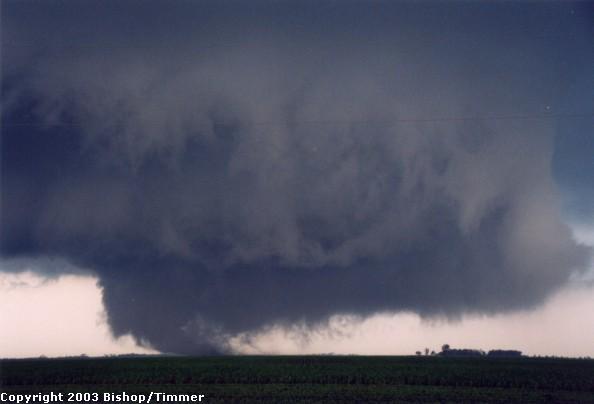
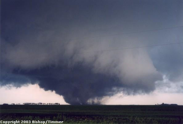
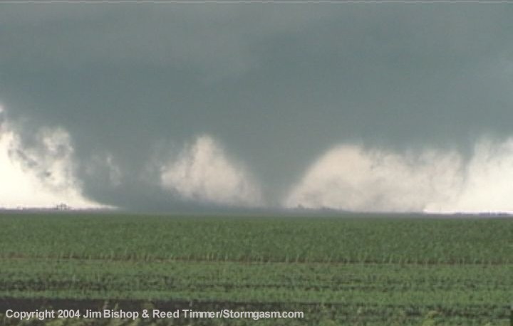
We continued north on 37 'till Huron, where we headed east. After being pounded by the heavy rain core of this incredible classic supercell, we emerged out of it about one or two miles west of Manchester. To our south was a very large wall cloud. At this point it only had broad, rather weak rotation. This storm was moving northeast at about 20 mph, so we simply "crawled" east, watching the enormous wall cloud intensify. Suddenly, the wall cloud rotation increased dramatically, and a small cone emerged from the base. Immediately I could see a debris cloud forming on the ground, as a cone funnel began extending halfway to the ground. A few seconds later I was staring at our second, photogenic, cone tornado about 3/4 to 1 mile to our south-south east! Multiple vorticies began forming at the bottom of the tornado, as it's shape was being distorted and stretched, looking a little like an elephant trunk, but not quite. It was very spectacular. At this point, I couldn't believe I was seeing my second spectacular tornado of the day. |
 Satellite tornado on the right |
 |
 |
 |
 Elephant trunk tornado 3/4 mile south |
 Multiple vorticies |
 |
 |
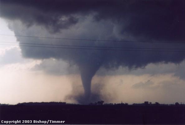
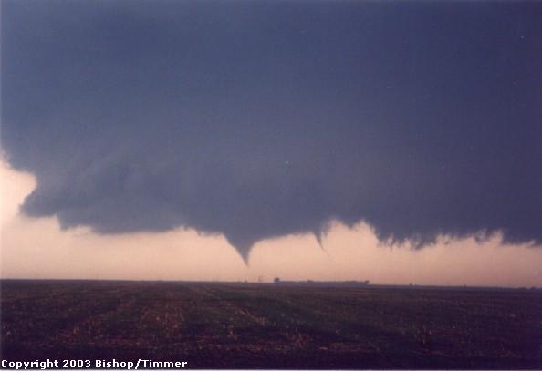
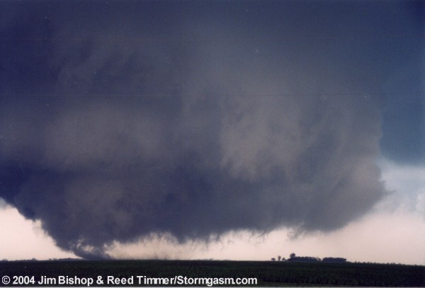
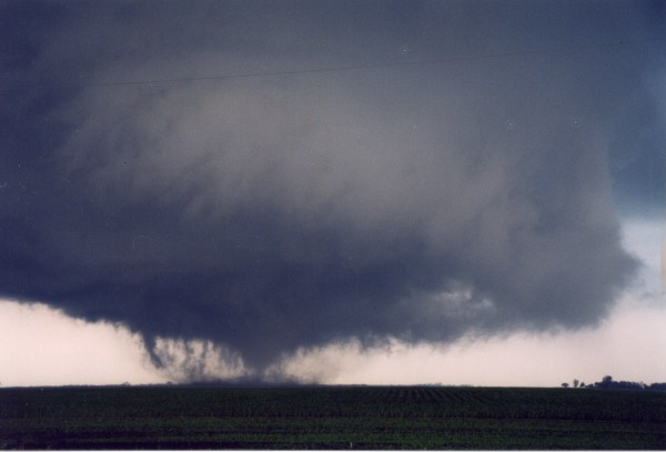
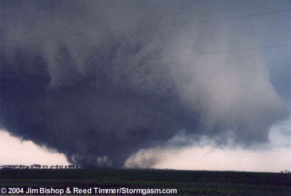
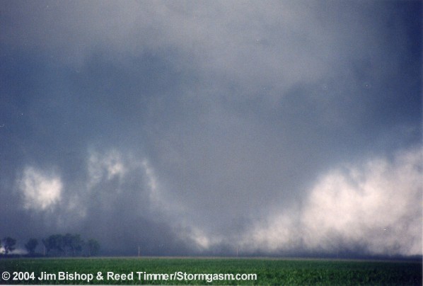
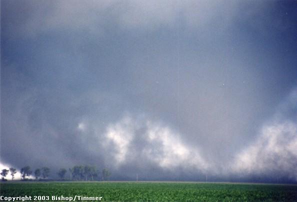
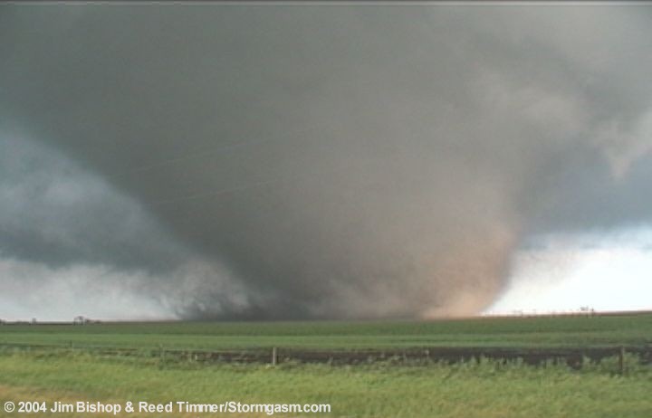
| A satellite tornado briefly formed to the west of the main tornado, but quickly dissipated. This is when a bowl funnel shape was beginning to take place. The once cone/elephant trunk tornado was quickly evolving into an incredible stovepipe to a wedge tornado. It was simply getting bigger, and moving north. By this time it was about 1/4 mile to our south. |
 |
 |
 Beginning to wedge formation |
 |
 |
 |
 |
 |
 |
 Takes the carousel look around a developing wedge |
 |
 |
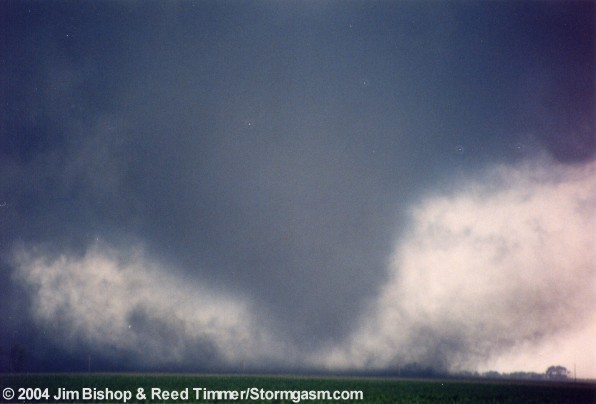 |
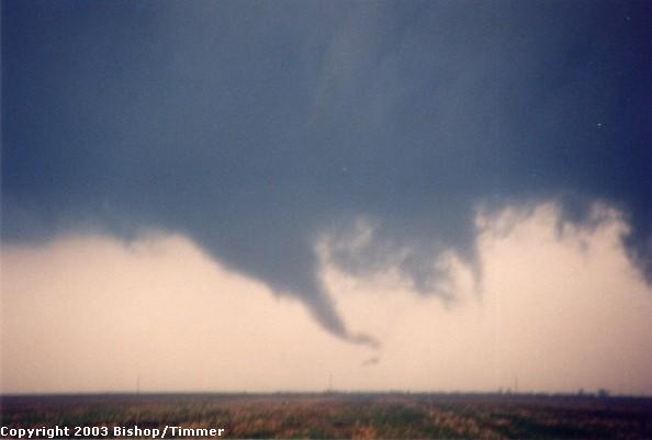
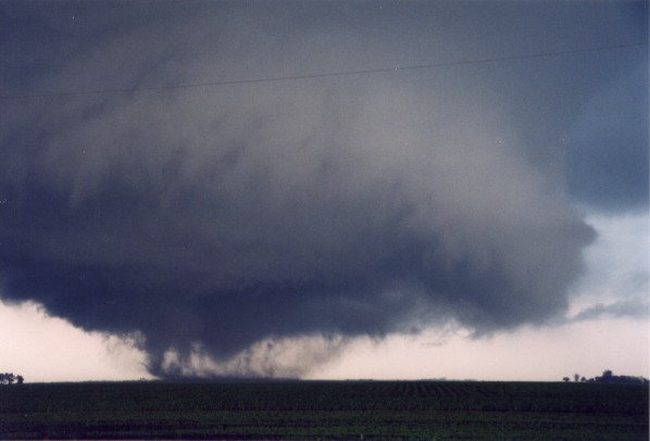
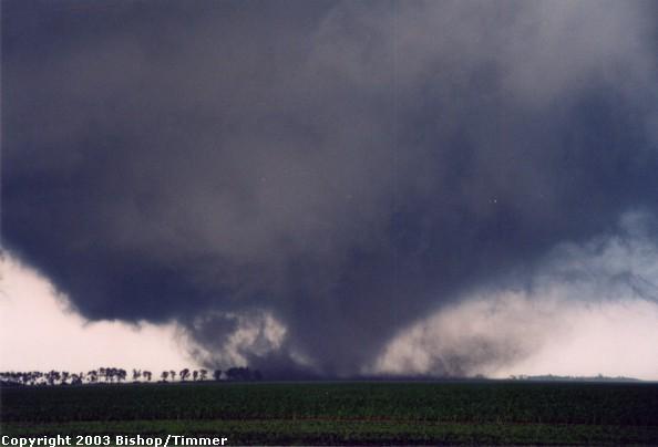
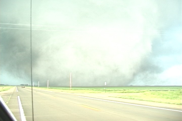
| The tornado was now an incredible wedge, about 1/4 mile wide. A field of green grass lay in our foreground as the now white and brown tornado sucked up brown and red dirt, ripping through an area of trees. The motion was getting stronger, and the tornado was getting closer. The adrenaline was pumping through my body. It was somewhat difficult to hold my camera steady to get good still photos since my hand was shaking! The tornado was now moving slightly west of due north, making a b-line for us! This was becoming a very intense situation. |
 |
 |
 |
 Looking SE 1/8 mile Tornado approaching Manchester |
 |
 |
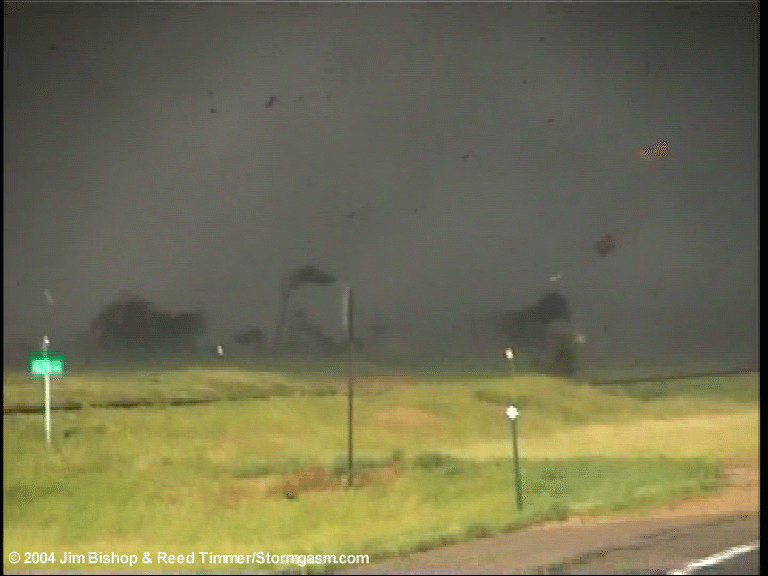
| The tornado was now a monster. I could hear it roar, lik a jet in the distance, or maybe a very loud waterfall from a short distance away. I put the car in reverse to prepare myself to go in reverse (west) if necessary. The tornado was now about 100 yards to our SSE and all of the sudden seemed to accelerate west. Keep in mind this tornado was only moving at about 15 mph. However, in the short period when it seemed to accelerate, it probably increased its speed by 5-10 mph briefly. As the northern edge of the tornado creeped next to the road, laying nearly 50 yards from us, Reed yells, "Back the **** up!", as I pushed the gas peddle. This began the most exciting moment of my life as I stared at a monster tornado heading towards us, 50-100 yards to our ESE, almost close enough to reach out and touch it. |
 |
This video still, sent by Tim Samaras, provides a unique and very convincing perspective on just how close we really were to this tornado! My car can be seen on the road (seemingly just a speck) about 100 (give or take) yards from the edge of the tornado! It looks like it was taken right after we began backing up, so I don't think this was the closest we were to it (but almost). However, I cannot be certain. |
|
I backed up until I was sure we were safe (~ 300 yards from tornado). Had I not moved we WOULD have been hit, but we did have a window of about 15 seconds to move, of which I acted immediately. We were not in immediate danger provided the car would go in reverse when I wanted. After a close study of the video, I recently discovered we would not have been hit by the tornado had we not backed up at all. However, it would have been very close. I got out of the car in complete awe as the tornado was crossing the road. The roar was absolutely incredible. It was so loud, there was no mistaking it. A dark grey, partially brown wedge tornado violently rotated in front of me. This was the single most amazing thing I have ever seen in four years of storm chasing. As I watched in complete shock, one house was completely swept away by the far western edge of the tornado. I watched as first the roof was blown off, and then the walls followed, disintegrating into small pieces of debris. As always, camera equipment doesn't cooperate during intense moments. Just as the tornado was crossing the road both cameras ate the new rolls of film; thus we have no stills of the tornado at that time. Below are a few video stills from when the house was being destroyed by the tornado. |
 A nice two story, well built house sits just feet away from the tornado's western edge |
|
 The house is now a pile of rubble |
|
It's very difficult to describe what I felt inside as I watched this unfortunate event unfold. That was someone's home, and it was now gone, completely destroyed. Was anybody in the house? If so, were they underground? I sincerely hope so. This moment was a mixture of excitement, awe, and sadness. (I recently discovered nobody was in the house at that time) We
followed the tornado north on a small gravel road looking to our east.
It turned into an incredible white stovepipe with brown dirt at its base.
It was contrasted with a beautiful South Dakota green field. The tornado's
circumference was shrinking, but it was intensifying. I couldn't believe
how fast its rotation was right at the ground as pieces of someone's house
were flying through the air. Debris was raining all over the area. I wasn't
able to drive more than 20 mph due to a wet, slightly muddy road. I actually
had some trouble controlling the car a few times, but managed to keep
in control. |
| Next Page |
