Next Page 1 2 3

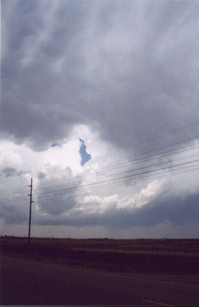
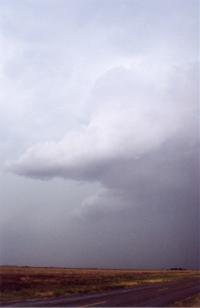
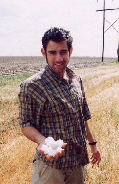
Me (Simon), Jim and Tom forecasted a big severe weather event on this day. We thought the best supercells would develop between Plainview and Lubbock, TX. We arrived in the town of Floydada, TX (just SE of Plainview) in time to see large towers exploding to the northwest. We picked a spot in between the two best looking towers on the north side of Plainview.

The tower to the south developed more rapidly, so we went south to get under the updraft. As we approached the updraft from the north we heard reports 
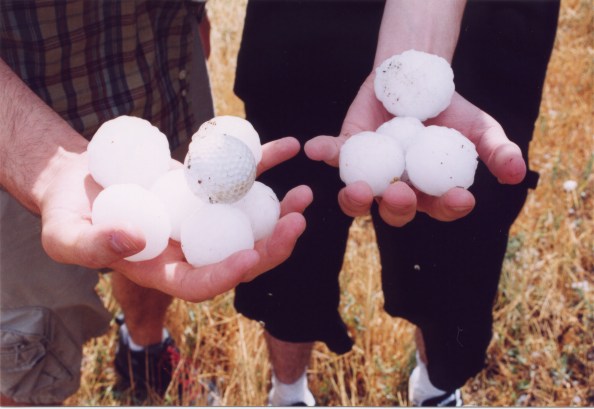
of softball-sized hail being produced very near our
location. The storm then dumped its cargo and we got slammed by blinding rain and powerful winds from the south side of the FFD. There seemed to be a lake on the wind shield, which made it impossible for me to see, but my good friend Jim stuck his head out his window and told me what not to hit as I blindingly drove forward. We were then blocked by cars crammed under an overpass, but I couldn't back up, because a car had inched itself up to my back bumper! So I went up the slanted base of the overpass up and around the cars! Luckily the momentum the our car received on the way down the slant plowed us through a large mud hole! Unfortunately some chasers and people got stuck in that very same mud hole, but it serves them right to block me in and cause a dangerous situation to get worse.


We caught the updraft east of Hale Center, TX. The storm had strong rotation, but began to weaken, so we went north after another supercell west of Plainview. We stopped on the north side of Plainview and
watched the LP supercell. It had a tornado warning, but there was not a tornado on it, and it was beginning to weaken. So we drove south again after a new supercell near the Junction of highway 54 and I-27.


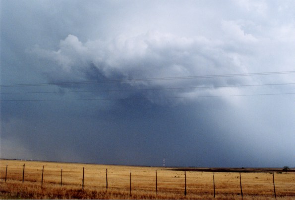
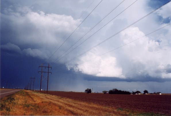
Several Storms Fire Up B/W Lubbock and Plainview, TX
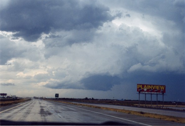
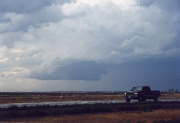
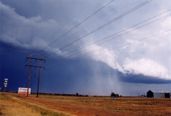
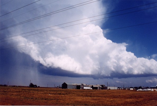
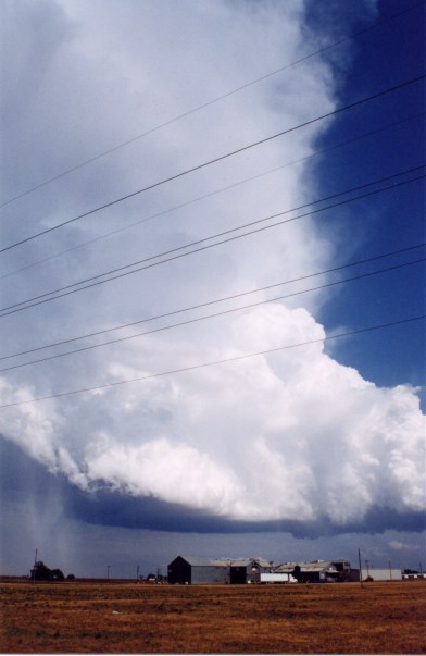

First Cell we saw,
looking NW near Plainview.


Same updraft as
seen from NW


Hail Shaft to Our SSE
from Crosbyton Cell


Simon & Tom Holding
golfball and racket
ball sized hail.


Jim pointing and laughing
in disbelief at the hail.


Updraft to our ENE


LP with tornado warning?


Crosbyton Cell


This supercell had awesome structure and a very large flanking line. A new meso was trying to form along the flanking line, but a new LP supercell developed to its southeast. So we began chasing the new LP. As we drove 
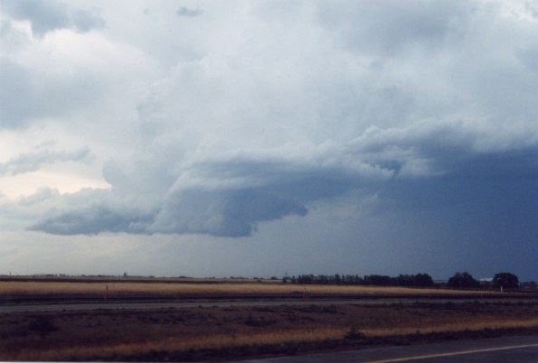
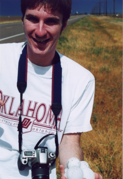
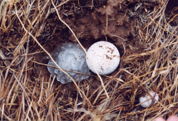
east on 54 the LP turned into a classic supercell, dropping baseball-sized hail. We continually had to stop to check out the hail on the ground. 
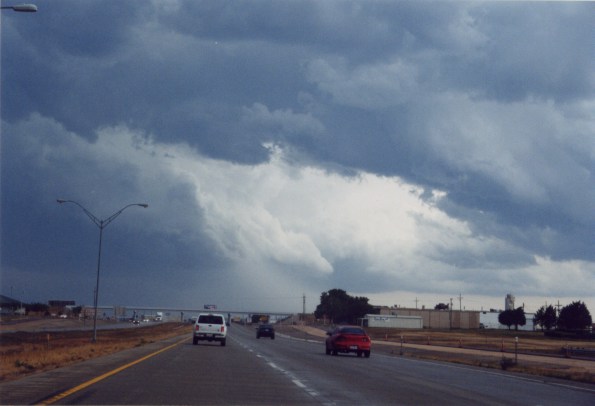
The supercell had the most picturesque flanking line I have ever seen (not the best, but the most picturesque). While looking at hail we heard a tornado sighting for our supercell from the weather radio. So we hauled ass to Crosbyton, TX to get under the updraft. We were next to the updraft the entire life of this supercell, but there was one area of the updraft just behind the hailshaft in which we could not see, and that must have been where the tornado was reported.


Large Hail and Beautiful Flanking Line


Golfball next to a hail
stone which dug its own hole.


Flanking Line to Crosbyton Cell


Hail shaft becoming more defined.


Cell to our north west

Next Page 1 2 3


Home | Storm Store | Photo Gallery | Message Board | Storm Chases | Latest News
Stock Footage | About | Contact | Editorial | Weather Links


All storm chasing (tornado, supercell, lightning, hail, sunset, ect.) photos and videos are copyright property of Jim Bishop and Simon Brewer (Stormgasm), unless otherwise specified. Any unauthorized reproductions are strictly prohibited by law.
Copyright 2004 Stormgasm.com. All rights reserved.