Grand Teton National Park , Wyoming
August 14, 2008
|
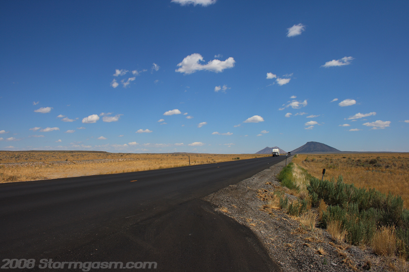
August 14, 2008: Simon Brewer, Anna Morrell, Shawn Maroney, and Brandon Nelson left the Lost River Mountains and headed east toward the craggy Teton Mountains of Wyoming. This was an part of the 'August 2008 Borah Peak, Grand Teton National Park, and Yellowstone National Park Trip'. We drove across a dormant volcanic plain dotted with ancient lava flows and isolated volcanoes. It reminded me of the lava flows and volcanoes across northeast New Mexico. We passed through Idaho Falls, which happens to be a beautiful town/city, and then we were able to see the jagged peaks of the Tetons like a great wall to the east. We followed the fertile Snake River Valley along SR 26 before taking a short cut on SR 31 and SR 33. The scenery became more beautiful as we approached the Tetons; picturesque views of winding river valleys and farms framed by large evergreen forests along steep hill sides, and towering snow-covered peaks in the distance. The image on the right shows 'Twin Buttes', which are dormant/extinct volcanoes, northeast of Atomic City, ID on SR 20. Not far too the west of this area is 'Craters of the Moon National Monument', which I'll have to visit one day in the future. |
 |
|
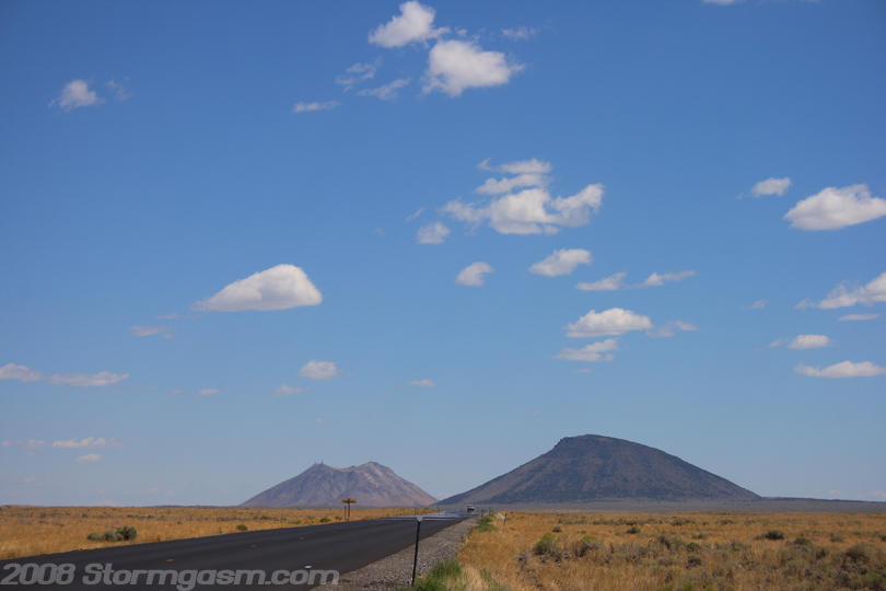
The image on the right shows a close-up of 'Twin Buttes' northeast of Atomic City, ID. The butte on the left is 'East Butte' and the right one is 'Middle Butte': these are actually dormant/extinct volcanoes.
|
 |
|
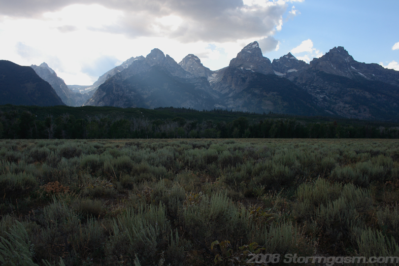
SR 33 changes its name in Wyoming to SR 22, which is a spectacular drive! We passed along the south side of the Teton Range. We reached a town called 'Wilson' and turned north on SR 390. A massive Bald Eagle nest was awkwardly perched on a large telephone pole at the intersection of SR 22 and SR 390. The a large bald eagle was standing in the nest watching the heavy traffic below. I would have taken a picture, but the traffic was heavy and there was no place safe to park in the vicinity of the nest. We continued north on 390 and entered Grand Teton National Park from the south. The image on the right shows our first good view of the Teton Range. The large peak in the middle is Grand Teton (13,770 ft).
|
 |
|
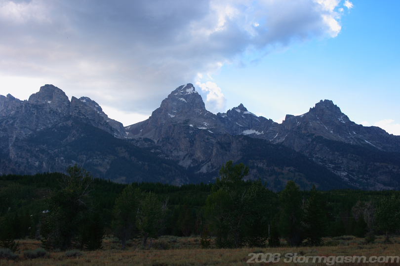
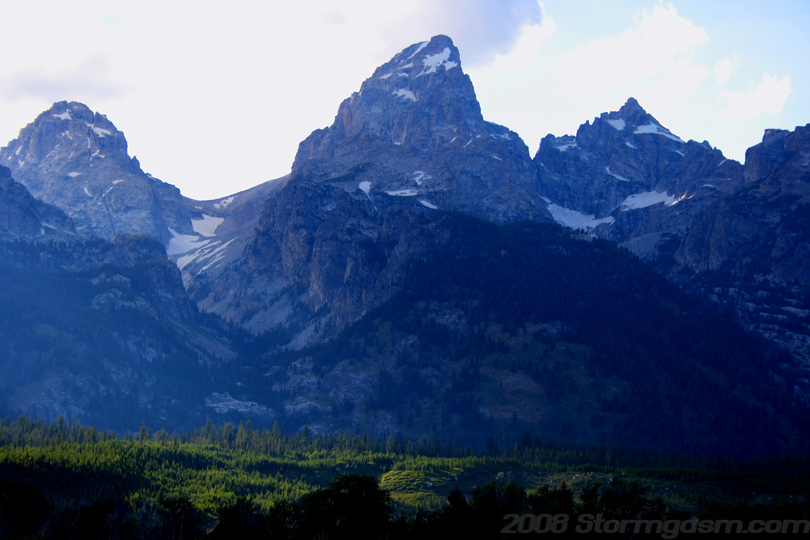
The Tetons seemed magical; jagged and defiant of gravity. Image on the right shows the main core of the Tetons at Grand Teton National Park; from right to left is Teewinot Mountain, Mt. Owen, Grand Teton, Middle Teton (barely visible), Nez Perce, and South Teton might be visible on the far left. There was a $25 fee for a week pass to Grand Teton National Park, which can also be used for Yellowstone National Park. If you plan to visit multiple National Parks in a 12 month period then I recommend buying a National Park Pass, which will last 12 months from the date of purchase. The Park Pass will work for any federal park, which includes: National Parks, National Recreation Areas, National Monuments, etc...
|
 |
|
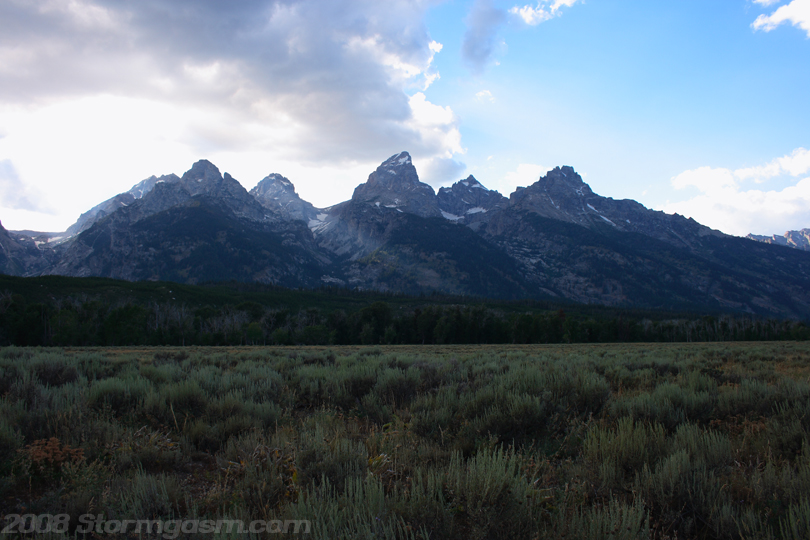
Image on the right shows the main core of the Teton Range in Grand Teton National Park.
|
 |
|
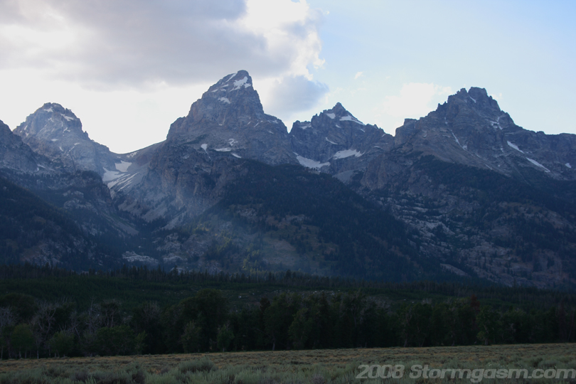
Image on the right shows the core of the Teton Range at Grand Teton National Park.
|
 |
|
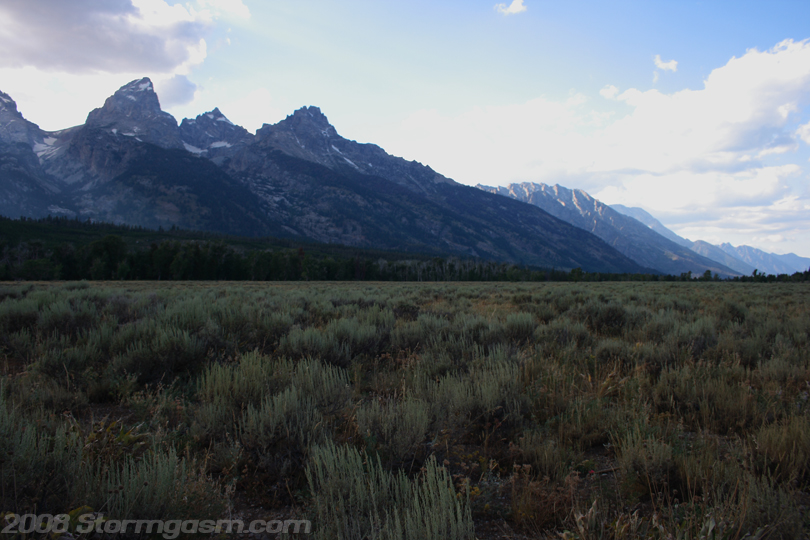
Image on the right shows Grand Teton and the remainder of the Teton Range trailing to the north.
|
 |
|
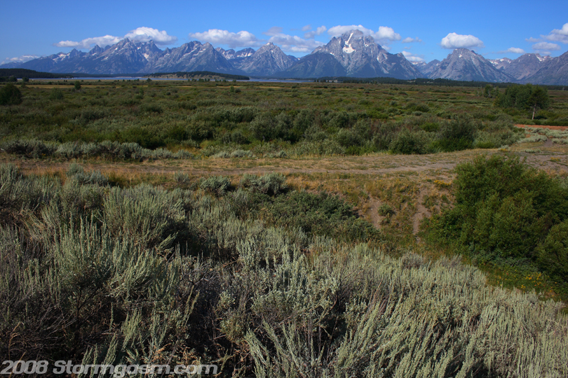
Image on the right shows the sage and other plants on the plains east of the Teton Range.
|
 |
|
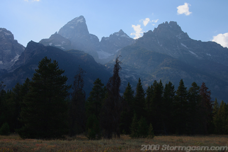
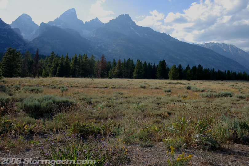
There were some clouds developed over the Teton Range and provided me with poor light for pictures most of the time, but every once in a while a break in the clouds would develop. The image on the right shows a sun-lit, tree-covered hill in the foreground with Grand Teton towering in the background.
|
 |
|
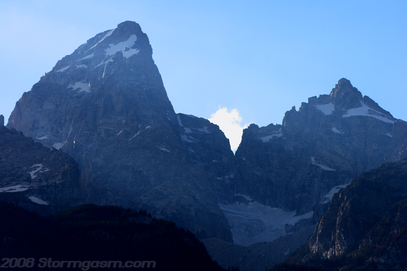
Image on the right shows a close-up of Grand Teton and Mt. Owen at Grand Teton National Park. |
 |
|
Image on the right shows the core of the Teton Range at Grand Teton National Park.
|
 |
|
Image on the right shows Grand Teton on the left, Mt. Owen in middle, and Teewinot Mountain on the right. |
 |
|
I loved the incredible views of the Teton Range, but there were few areas to park along the main road passing through the park. I guess I'll have to do some serious hiking to get the angles I would have liked for these mountains. Image on the right is looking further north along the Teton Range with Grand Teton still in view.
|
 |
|
The image on the right shows Jackson Lake in the foreground and Mt. Moran in the background at Grand Teton National Park. Brandon says this is his favorite image from Grand Teton National Park. This image was taken near the Jackson Lake Dam. |
 |
|
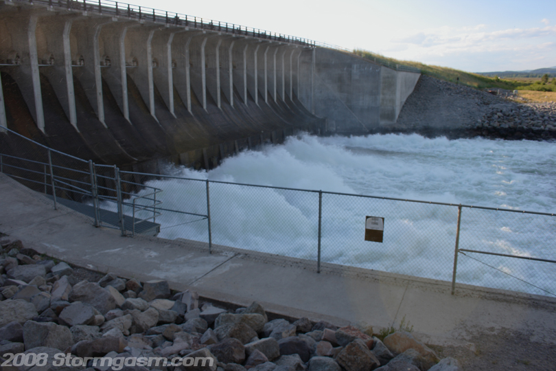
The image on the right shows the 'Jackson Lake Dam' at Grand Teton National Park. The image shows violent rapids emitted by the dam. This relatively small dam holds back Jackson Lake.
|
 |
|
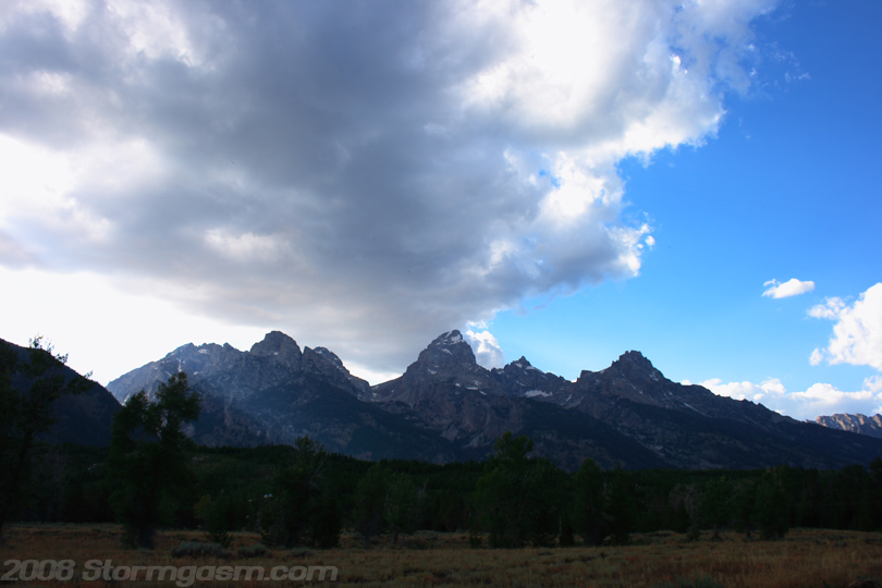
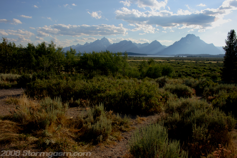
We continued northward into the park seeking a campground. We eventually purchased a campsite at "Colter Bay Village" next to Jackson Lake. The image on the right shows the Teton Range in the late evening at Grand Teton National Park.
|
 |
|
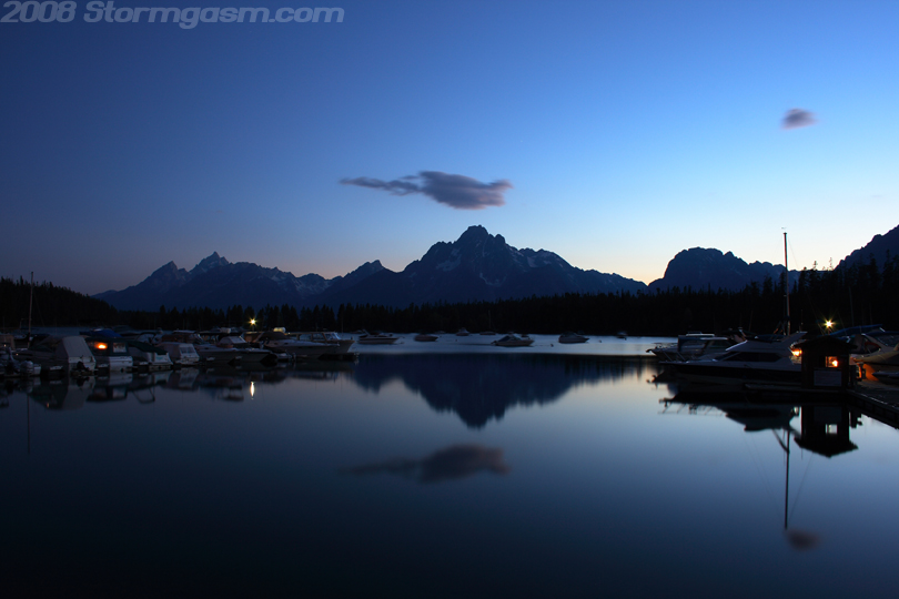
We went to the lodge/resturant at Colter Bay Village and got an incredible dinner: a pound of BBQ Buffalo Brisket! I daydream from time to time about that dinner. It was one of the best meals of my life. I will go back to Grand Teton National Park just to eat that brisket again, and do some climbing/hiking, but mostly to eat that brisket. Image on the right shows darkness decending on Jackson Lake and the Tetons at a marina near the resturant at Colter Bay Village.
|
 |
|
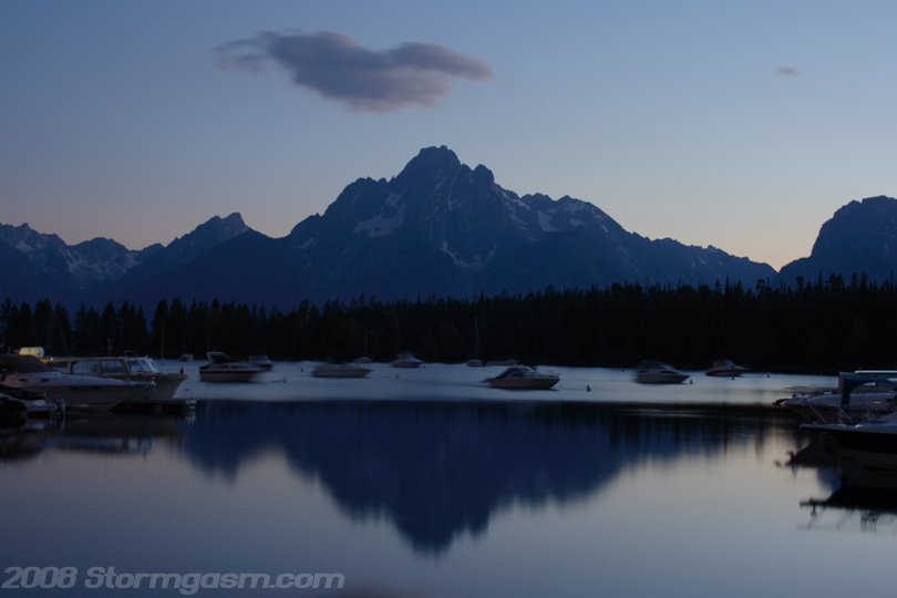
Image on the right shows twilight over Jackson Lake with Mt. Moran in the background.
|
 |
|
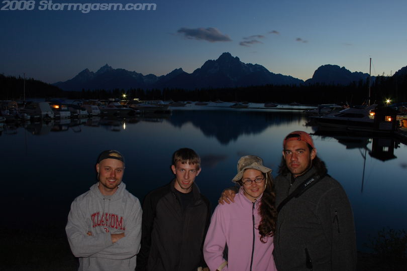
Image on the right shows some full and happy campers, from left to right; Shawn, Brandon, Anna, and Simon with Jackson Lake and the Teton Range in the background.
|
 |
|
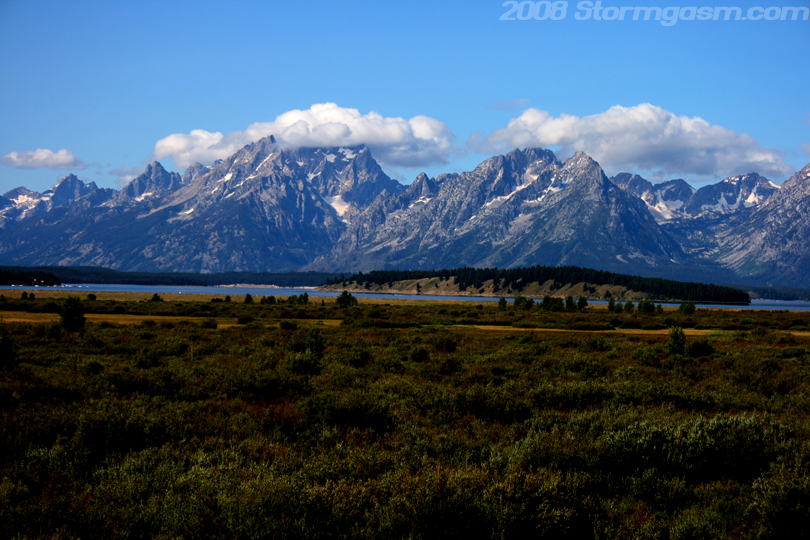
We went to sleep that night not really knowing what we were going to do the following day. We thought maybe do some hiking in Grand Teton National Park, or possibly leave Wyoming and try to climb some mountain in Colorado. We woke the following morning (August 15th) and decided to go check out Yellowstone National Park since we were so close, but before leaving the Grand Teton National Park I had to get some more shots with the mountains front lit in the late morning light. Image on the right shows the Tetons in the late morning light on August 15th.
|
 |
|
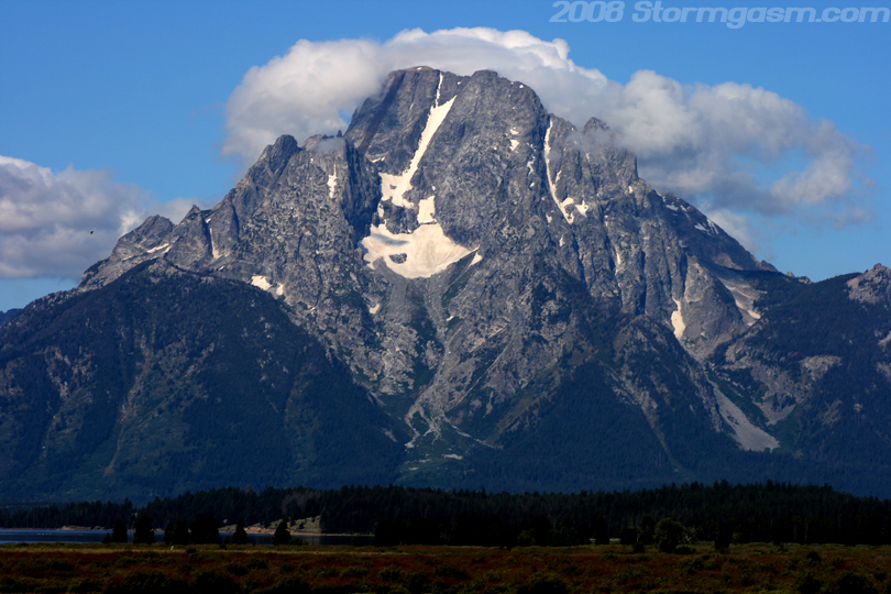
Image on the right shows Mt. Moran in the late morning light on August 15th.
|
 |
|
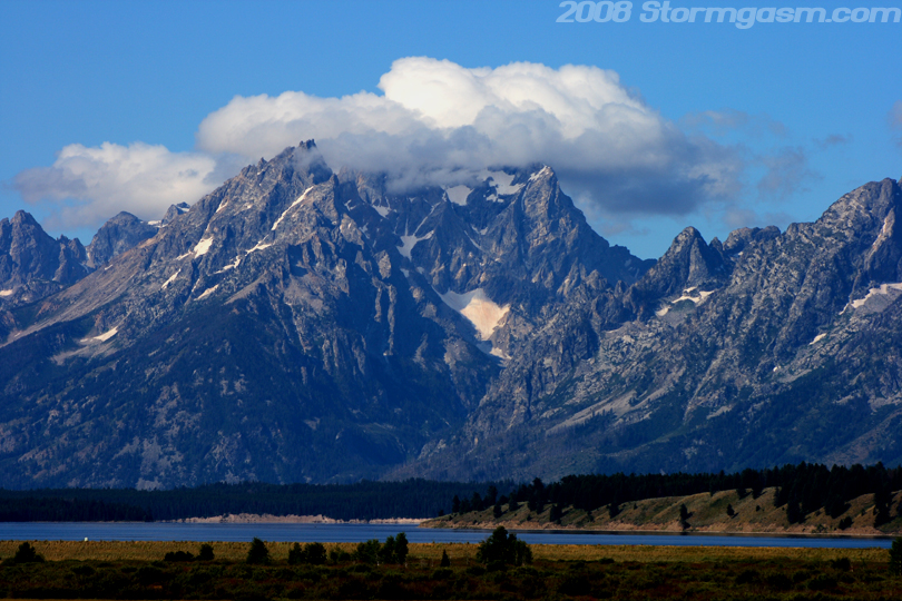
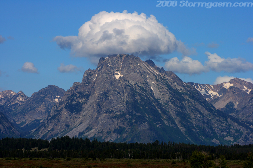
Image on the right shows Grand Teton with the top shrouded in clouds.
|
 |
|
Image on the right shows one of the Tetons, not sure which one it was, with a cloud over the peak.
|
 |
|
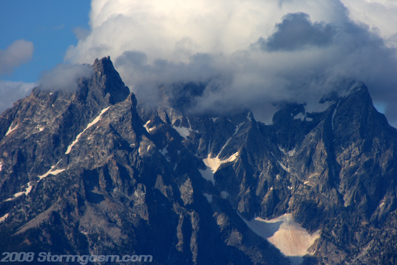
Image on the right shows a close-up of the cloud-shrouded Grand Teton.
|
 |
|
Image on the right shows a close-up of Mt. Moran with clouds increasing around the summit. |
 |
|
Image on the right shows the bulk of the Teton Range with Jackson Lake visible in front of the mountains.
|
 |
|
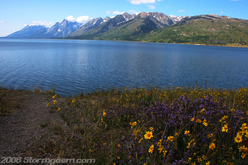
Image on the right is looking southwest at the Tetons and the north side of Jackson Lake at Grand Teton National Park.
|
 |
|
Image on the right shows the Tetons towering above Jackson Lake at Grand Teton National Park. We had no intention to visit Yellowstone National Park on this trip, but sometimes you just 'go with the flow' and we felt compelled to discover what the 'hype' was all about concerning Yellowstone. Check out the "Yellowstone Page/Pages" when I get them up on the site. |
 |
Home
| Storm Store | Photo
Gallery | Message
Board | Storm Chases | Latest
News
Stock Footage | About
| Contact | Editorial
| Weather Links
Copyright 2004 Stormgasm.com. All rights reserved.