Hurricane Dolly
July 23, 2008
|
23 July 2008: Catagory 2 Hurricane Dolly made landfall on South Padre Island, TX with max sustained winds of 100mph and a central low pressure of 964mb. Simon Brewer, Juston Drake, and Shawn Maroney intercepted the most intense portion with the highest winds in the southwestern eyewall of Hurricane Dolly on South Padre Island, TX. The chasers measured a low pressure of 977mb in the SW portion of the eyewall of Dolly. A 3-4 foot storm surge was also documented on the west side of South Padre Island as the bay was forced inland by 100mph winds. |
 |
 |
|
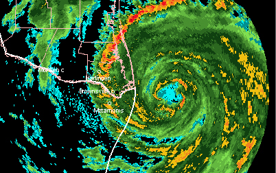
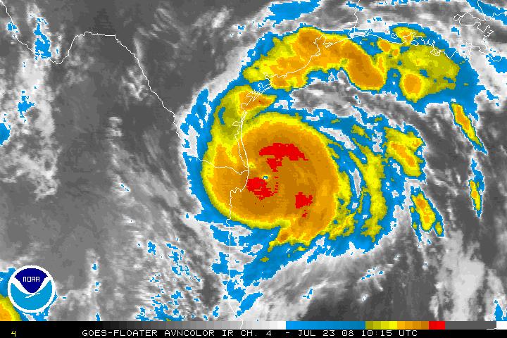
The two pics on the upper right are INF Sat images before Dolly made landfall. The two pics on the right are RAD Images before dolly made landfall. |
 |
 |
|
4PM CDT 21 July 2008: Loading vehicle and ready to make way for South Padre Island, TX. We are optimistic about Dolly's track and we are confident Dolly will be at least a CAT2 if not a CAT3 hurricane by landfall. The models are now aligning and we are pretty sure Dolly will make landfall around noon on Wednesday the 23 July 2008. Deep convection is firing in all quadrants around the center of Dolly's circulation and once a central dense over cast can develop then we should be in for a wild ride. |
 |
 |
|
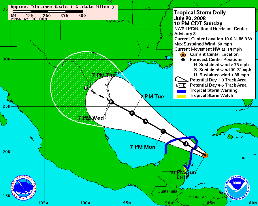
1AM CDT 21 July 2008: Tropical Storm Dolly was located over the northeastern tip of the Yucatan Peninsula with maximum sustained winds of 50 mph. Left image shows NHC forecast track for Dolly at 11PM CDT, which would put Dolly making landfall very near to the Texas/Mexico border. The image on the left is a watervapor image composite: the red circle indicates Tropical Storm Dolly, the yellow lines indicate its general and forecasted direction, and the pink oval indicates Stormgasms current target location for interception of future Hurricane Dolly. |
 |
 |
|
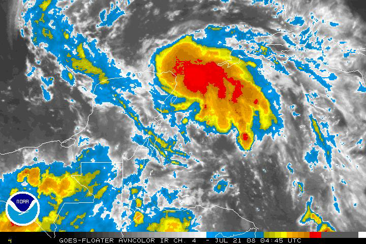
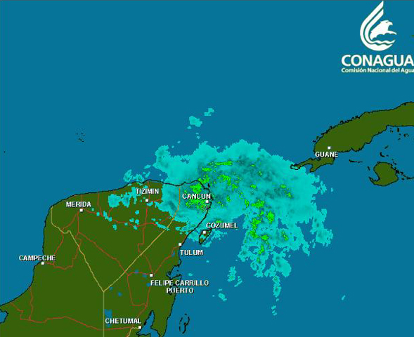
Intense convection developed around the northeastern side of Dolly's circulation on Sunday shown in the infrared satellite image on the left. The image on the right is a radar image of Dolly from a Mexican radar station. |
 |
 |
|
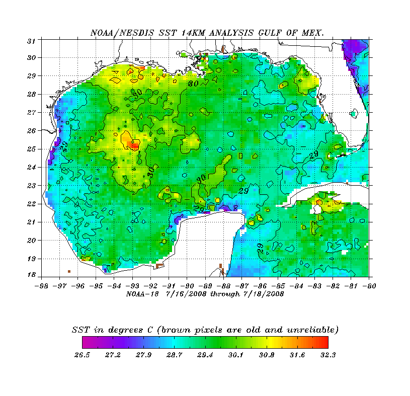
Stormgasm forecasters expect Dolly's circulation to emerge over the Gulf of Mexico Monday in an environment favorable for rapid strengthening. Weakening environmental shear and warm SSTs should cause Dolly to strengthen into a CAT 2 or possibly CAT 3 Hurricane before making landfall near the Texas/Mexico border on Wednesday. The image on the left shows SSTs over the Gulf of Mexico. The image on the right is from the CPC and shows Velocity Potential for the MJO Index; an MJO wave approaching the Atlantic Basin could be partially responsible for the sudden increase in tropical convection over the Atlantic region. |
 |
 |
Home
| Storm Store | Photo
Gallery | Message
Board | Storm Chases | Latest
News
Stock Footage | About
| Contact | Editorial
| Weather Links
Copyright 2004 Stormgasm.com. All rights reserved.