June 7, 2009 Oregon, MO Supercell with Massive Hail
|
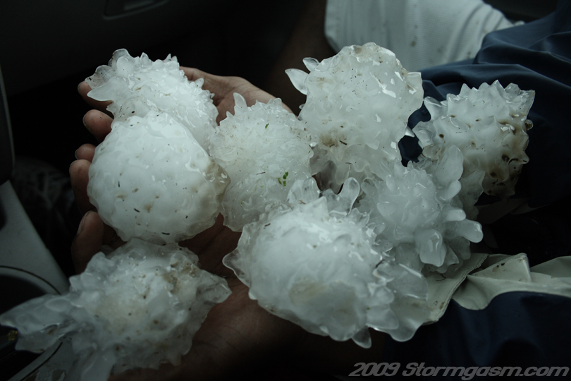
June 7, 2009: Simon and Juston Drake intercepted a supercell thunderstorm near the Missouri/Kansas border and documented a 5.25 inch diameter hailstone in the town of Oregon, MO. The supercell never produced a tornado, but had great mid-level structure and produced large quantities of massive hailstones. We targeted the NE/KS border along a warmfront/stationary front. High instability and good shear along with a nice shortwave trough made this region look best in our eyes. We intercepted a developing supercell west of Pawnee City, NE, but it seemed to always have issues with outflow. We decided to drop the cell and catch a developing cell in northeastern KS, which was moving into southeastern NE. The move was a good call, because our first cell began to slowly die and the newer cell became a 'beast'! The supercell moved into northeastern MO and we punched the core in Oregon, MO. We noticed massive hailstones in the fields west of Oregon, MO and stopped and picked up several dodging (by chance only) softball hail. Image on the right shows multiple softball and larger-sized hailstones held by Juston. Some of the stones were relatively spherical, but most large hail stones were very spikey and aspherical. |
 |
|
We kept driving east into Oregon, MO and noticed a few larger hail stones in the yards of houses in town. We stopped in the midst of a barrage of massive hail stones and Juston dashed into a yard and grabbed a whopper of a stone! I grabbed the ruler and it measured 5.25 inches in diameter! The largest hail stone either of us had physically measured! A few monster stones shook the car upon impact on the roof and hood. We then proceeded to evacuate the town. By chance alone we avoided the loss of our car windows! Other chasers were not so lucky. Later that night we discovered the windshield took glance hits on two edges invisible from inside the car and small cracks have since grown.
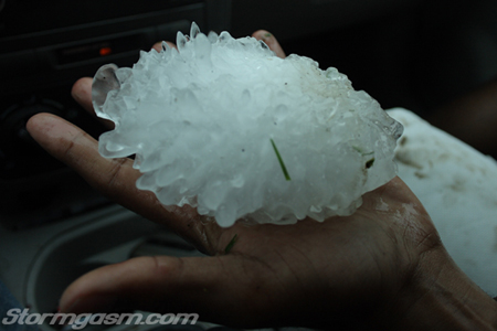
The image on the right shows the massive 5.25 inch diameter hail stone. We triple checked the measurment of the hail stone to verify its size. |
 |
|
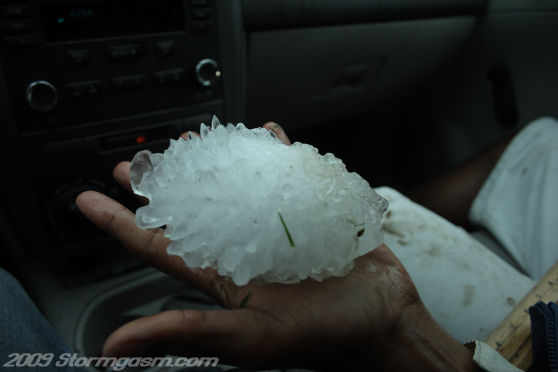
Image on the right shows the monster 5.25 inch diameter hailstone in Juston's hand! |
 |
|
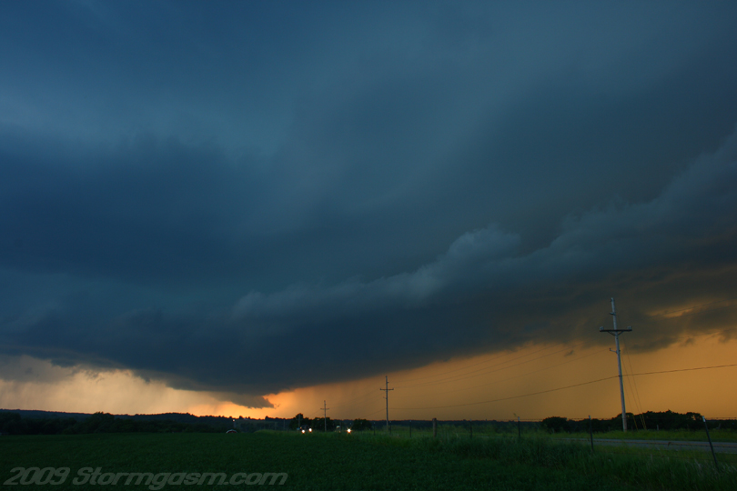
We quickly gained and advanced ahead of the supercell east of Oregon, MO only to discover the supercell was outflow dominant. We would have probably stayed in Oregon and searched for larger hail stones if we knew the storm was outflow dominant! Anyways, the structure was nice and we advanced a reasonable distance ahead of the storm to get structure shots as the sunset to its west. The image on the right shows the supercell and mesocyclone to our west near the town of Weatherby (fitting name for the day). |
 |
|
The supercell never seemed to become fully 'surface-based'; at least it never seemed not be outflow dominant.
|
 |
|
Portions of this chase appeared in the Speed Channel show "Dangerous Drives: Storm Chasers".
|
 |
Home
| Storm Store | Photo
Gallery | Message
Board | Storm Chases | Latest
News
Stock Footage | About
| Contact | Editorial
| Weather Links
Copyright 2004 Stormgasm.com. All rights reserved.