June 27th, 2008 North Central Oklahoma
|
June 27th, 2008: Simon intercepted a supercell along the Kansas/Oklahoma border near Waldron, KS. The supercell developed along an outflow boundary from an MCS the previous night. I (Simon) was on my way back to Norman, OK from Topeka, KS and was hoping to get lucky and catch a supercell along the way. There was incredible instability and a very weak short wave moving into Western Kansas, but the CAP was strong and it was iffy if anything could develop. Well, towers were developing south of Emporia, KS, but as I was driving through Emporia all the towers died and evoporated. It was near peak heating and all the towers were gone, so I thought it wouldn't happen, but as I approached Wichita the outline of a huge convective tower was had become visible! I checked the radar and nothing was detected in that region on base reflectivity or echo tops. I checked a few minutes later and 'boom' a 35k top was showing on echo tops! I got incredibly excited and prepared for an intecept. The storm fired east of Kiowa, KS or southwest of Anthony, KS. I intercepte the storm near Waldron, KS. The mid-level winds were weak, but the shear was supportive of supercells, and the storm drifted south and I along with it. The pics to the right are looking west as I approached the storm. |
|
|

|
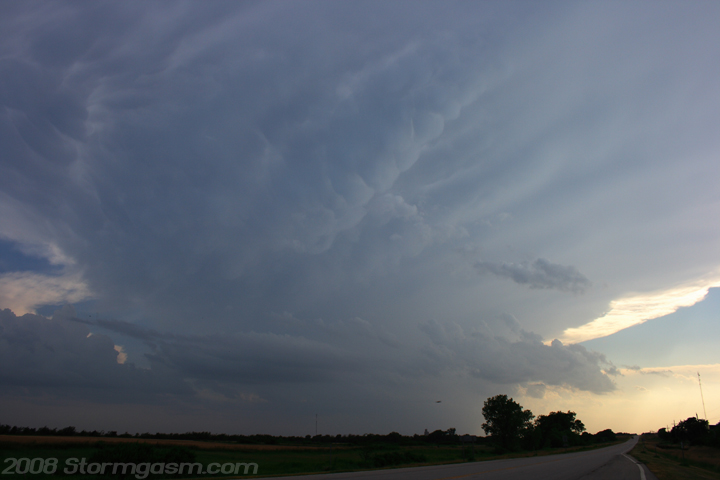
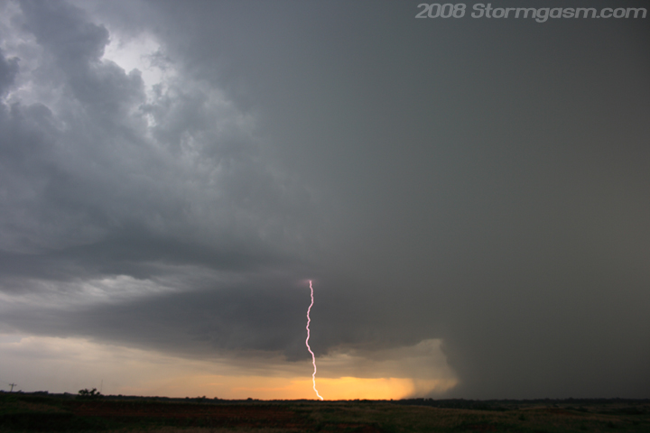
It took a while before I could see the base of the storm, but I got in great position and it had nice structure with a wall cloud. There was a lot of lightning with this storm and I was able to get a few bolts with the still camera despite the daylight. I don't know what is going on with this year, but I've been able to get a bunch of daytime lightning photos on many chases. Before this year I got maybe a handfull of crappy daytime lightning shots over the past 10 years, but this year just produced. The pic to the left it looking NW at the supercell. The pic on the right is looking NW with lightning bolt in the vault portion of the storm. |
 |
 |
|
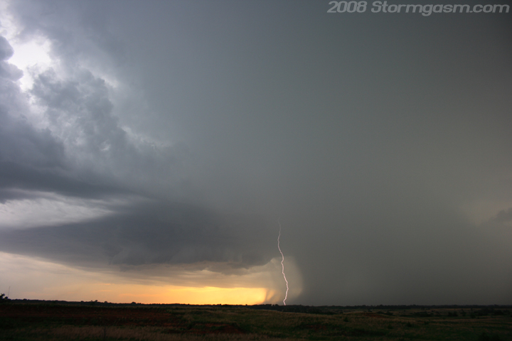
The storm just kept producing nice daytime bolts; I took a lot of shots to get these few pics of daytime lightning. |
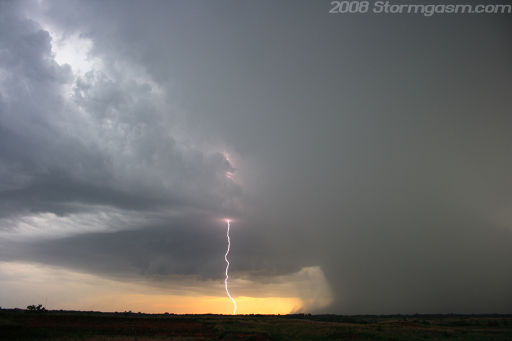 |
 |
|
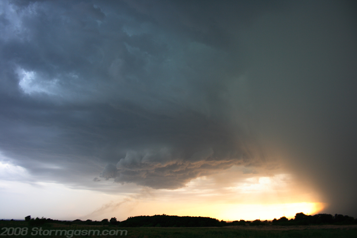
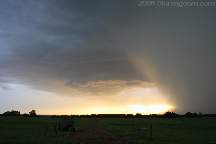
I followed the storm south and got some nice shots with a field in the foreground. Outflow kept undercutting the wallcloud despite nice rotation, but I didn't care if this cell produced a tornado. It was a very beautiful storm. |
 |
 |
|
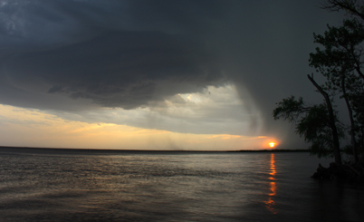
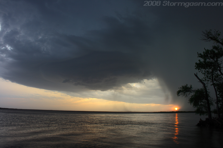
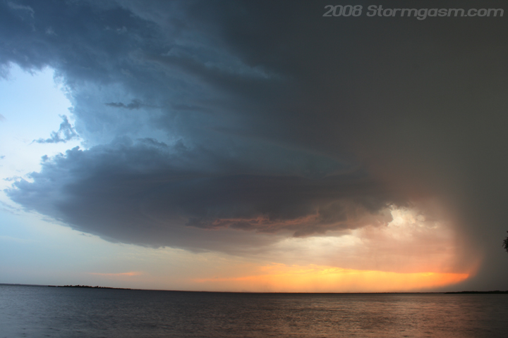
Eventually I arrived at Great Salt Plains State Park and I was about to do what I normally do; drive all the way around the park and wait for the supercell on the other side. This time, because the sun was setting and the cell was moving so slow, I drove around and found the perfect spot on the Great Salt Plains Lake and took some gorgeous shots of the supercell over the lake with the sun setting in the background. |
 |
 |
|
These last few shots are probably some of my favorite shots of the year. I never got any solid tornado shots, so beauty shots like these don't have much competition. |
 |
Home
| Storm Store | Photo
Gallery | Message
Board | Storm Chases | Latest
News
Stock Footage | About
| Contact | Editorial
| Weather Links
Copyright 2004 Stormgasm.com. All rights reserved.