June 16, 2008 Western Oklahoma HP Supercell
|
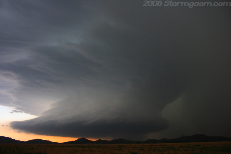
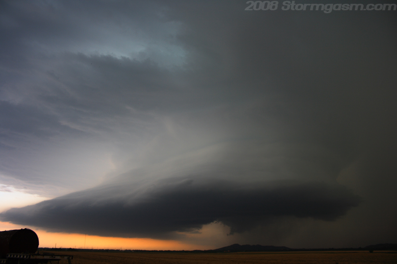
June 16, 2008: Simon Brewer, Tom Santillo, and Anna Morrell documented a high-precipitation (HP) supercell near the Wichita Mountains in southwest Oklahoma. We (Tom, Anna, and I) weren't really planning on chasing this day, but conditions looked marginally favorable for supercell development in western Oklahoma. We left Norman after a cell began to show supercellular characteristics on radar imagery. We took S.R. 9 and intercepted the cell near Hobart, OK. The image on the right shows one of our early views of the monster HP beast near Hobart, OK. |
 |
|
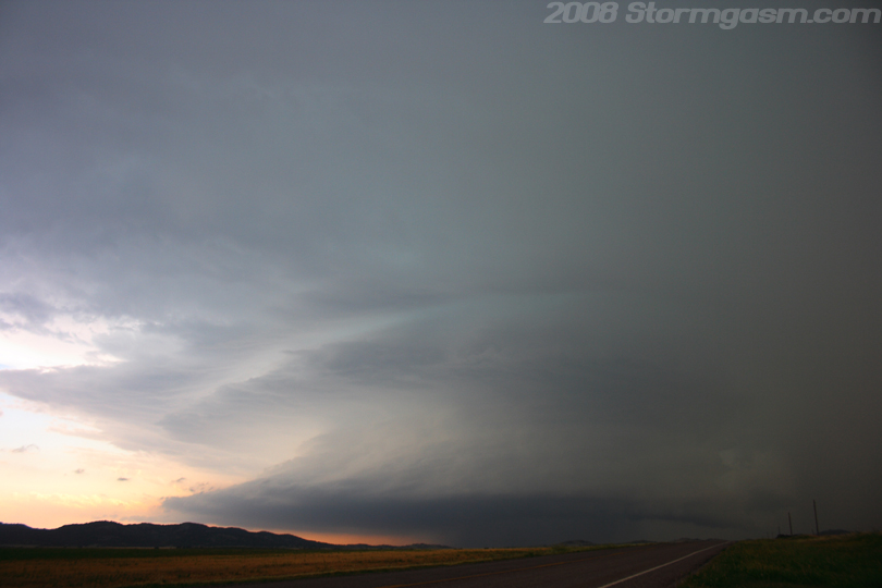
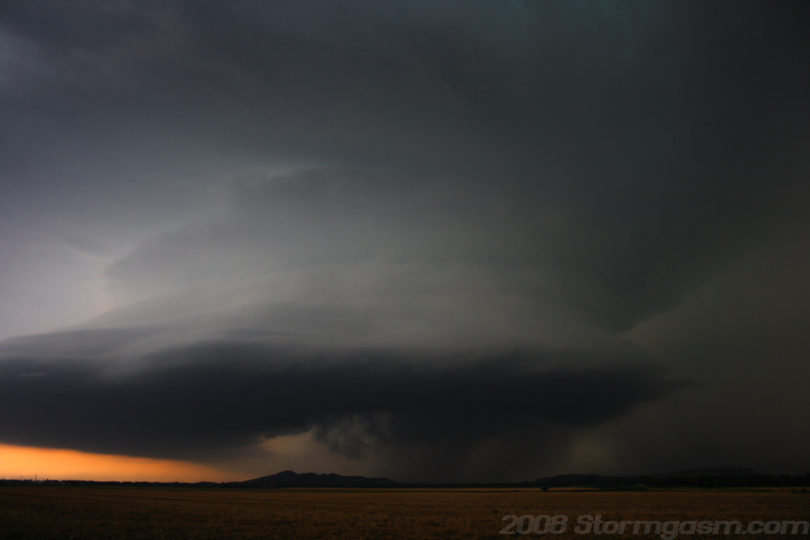
The storm was slowly propagating to the south-southeast; this was a 'Northwesterly Flow' setup, so the mid-level winds had a large northerly component. The image on the right is looking west at the monster HP supercell near Hobart, OK. |
 |
|
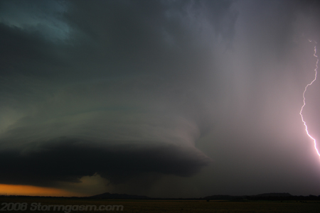
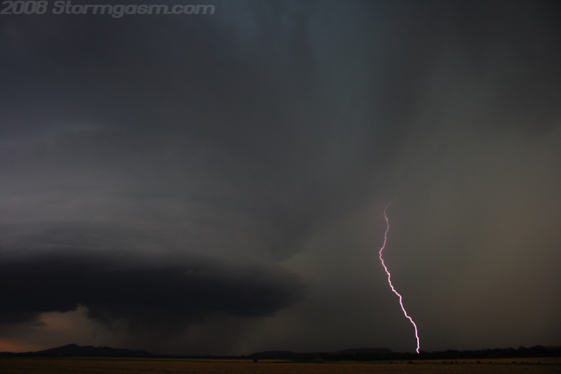
We decided to get closer to the updraft base, which was a bad decision. We quickly were hit by heavy rain and hail and lost view of the incredible structure. This storm produced some large, hail, high winds, and lots of spectacular cloud-to-ground lightning strikes. The image on the right shows a cloud-to-ground (CG) lightning strike in the wet vault region of the supercell. I took many successive pictures to get this bolt in a shot. |
 |
|
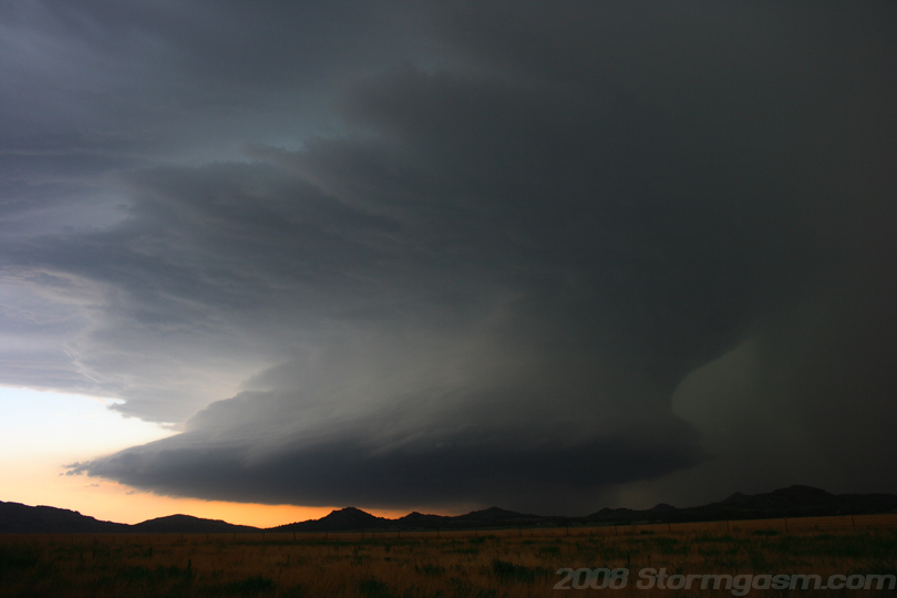
We decided it was best to hang back from the updraft and enjoy the structure, because it was too wet near the updraft base, also, it appeared outflow would never allow tornado development to occur. Image on the right is near Roosevelt, OK looking southwest at unbelievable structure! What a beast! |
 |
|
Another image of the supercell near Roosevelt, OK. |
 |
|
I just couldn't get enough pictures of this monster supercell. It may not have produced any tornadoes, but it was still a beautiful storm.
|
 |
|
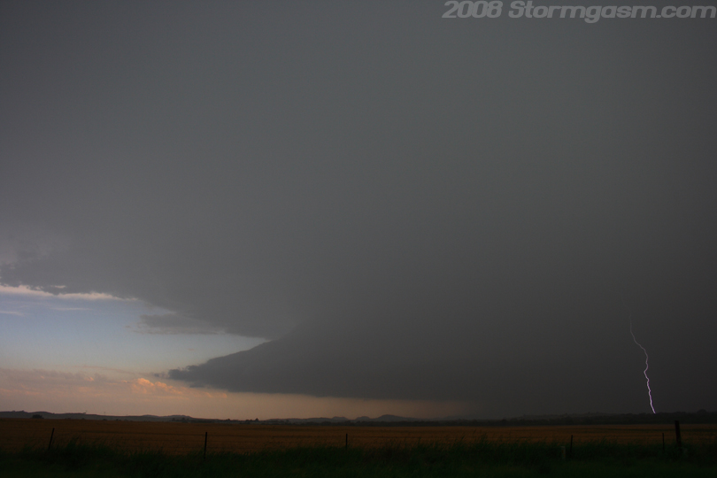
The supercell continued to drift in a southerly direction. The image on the right shows a nice RFD clear-slot develop with a wall cloud in the rain under the main updraft. This occlusion seemed to be its best chance to produce a tornado, but outflow under cut the storm and it was downhill from that point. |
 |
|
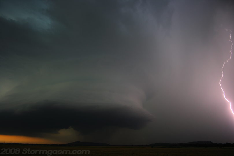
I got lucky and nabbed a couple images of the frequent lightning associated with this supercell. The image on the right is a lucky picture I got of a bolt in the vault of the storm. A rain-wrapped wall cloud can be seen in the rain on the left side of the image. |
 |
|
I really need to get a wider lense, like a 10mm or something. The image on the right shows a portion of a lightning bolt next to the HP supercell near Roosevelt, OK. |
 |
|
The image on the right shows the supercell before it got ripped appart by its own outflow. The large item in the foreground on the lower left side of the pic is an old train car.
|
 |
|
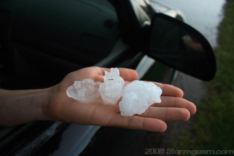
We messed around on some gravel roads west of Snyder, OK trying to find some big hail, but only got dime and nickel-size hail. We dropped south to S.R. 62, drove west and found some golfball-size hail on the side of the highway in the grass. The image on the right shows golfball-size hail on Tom's hand. |
 |
|
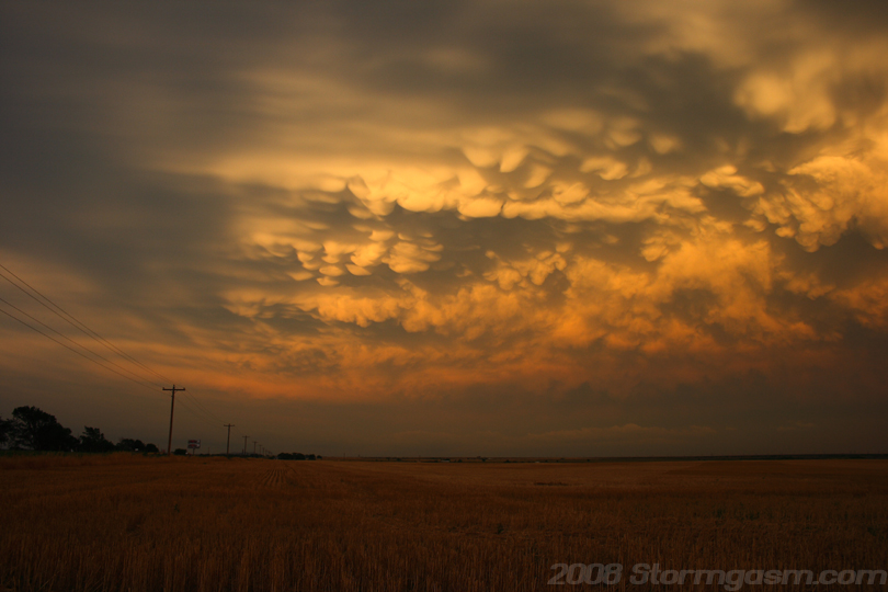
We tried to avoid Altus, OK by taking gravel roads, but they eventually turned to mud. We almost got stuck a few hundred meters from a paved road. The supercell had become outflow dominant and merged with other cells by that point, so we just waited for some sunset pics. The image on the right shows mammatus hanging in the evening sky east of Altus, OK. |
 |
|
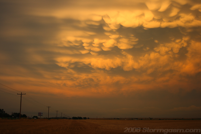
Image on the right shows another shot of evening mammatus east of Altus, OK. |
 |
Home
| Storm Store | Photo
Gallery | Message
Board | Storm Chases | Latest
News
Stock Footage | About
| Contact | Editorial
| Weather Links
Copyright 2004 Stormgasm.com. All rights reserved.