|
June 12th, 2004
Jim
and I (Simon) were very poor at this point in the spring. High
gas prices and long, frequent trips to Iowa, Nebraska, and South
Dakota gobbled our chase money. By June 12th we were forced to
eat bagels and resort to cannibalism to live, so that we could
scrounge a few more gas dollars for one more chase. We were glad
to find out our efforts paid off, because on this day we witnessed
3 tornadoes and a gorgeous supercell.
We
(Jim, Simon, Mark, and our good friend Kyle Mozley) left Kansas
City, MO heading for Salina, KS. The setup was near perfect, great
shear for slow-moving supercells, very high CAPE, and a good dryline
to fire convection. We thought Salina or just west of Salina looked
a little better than anywhere, because that area was on the north
side of a bulge in the dryline, so we had much better convergence
in our area along the dryline. We thought things were going well
when storms began to explode just west of I-35 along the dryline
in the late afternoon, but the CAP was still strong and the updrafts
could not sustain themselves.
By
early evening we were becoming very frustrated, because the CAP
was still keeping storms from firing in Kansas, but then we received
a call from Tom, he was back in Norman; he said convection in
SE Kansas generated an outflow boundary that moved west and fired
strong convection near Wichita. We decided to stay put until the
convection near Wichita showed signs of sustaining itself, which
did eventually occur, so we took off south on I-35 to Wichita.
As
we approached Wichita the FFD of the storm was over the city and
the updraft was continuously back building. The hail shaft was
sitting over I-35 on the south side of Wichita, so we cut around
the FFD and intercepted the updraft from the east, which was unfortunate
for us, because we missed the Mulvane tornado. We got in great
position, but only after the Mulvane tornado had lifted, but that
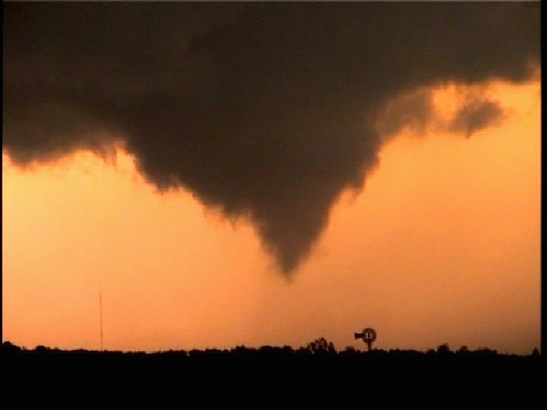
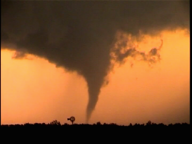
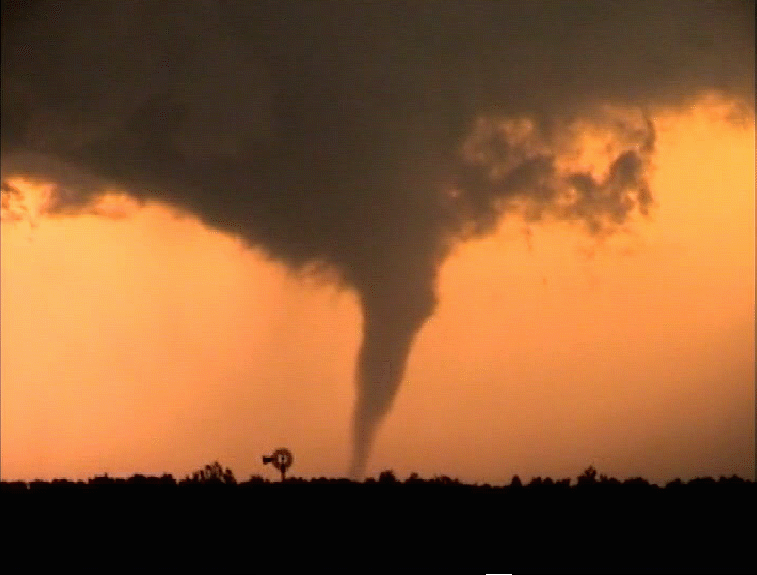
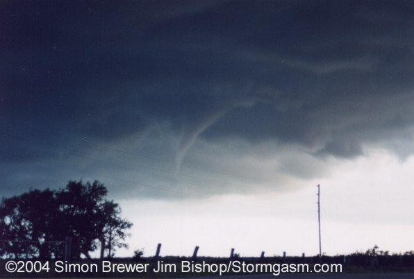
was okay, because we had a great spot to view the "Rock"
tornado. An awesome site greeted us as we approached our eventual
viewing location for the "Rock" tornado; there were
3 mesocyclones lined up from east to west. The first meso was
completely cut off from inflow and was furthest west, which I
suppose was the same meso that had created the Mulvane tornado,
the middle meso had just been occluded and was about to produce
the Rock tornado, and the third (furthest east) meso was just
tightening up and eventually produced 2 tornadoes.
We
found a spot west of Rock and watched that tornado form and dissipate,
which was awesome, because there was a windmill in the foreground
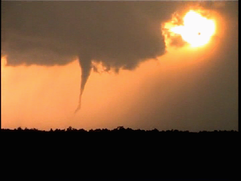
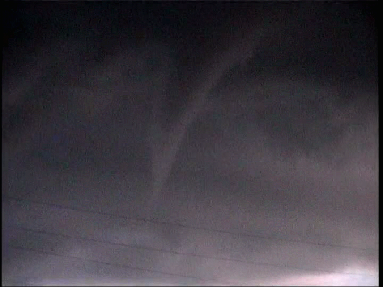
and the sun was set behind the tornado. Then we watched a brief
tornado develop under the youngest of the 3 mesocyclones; this
tornado was very brief with no condensation funnel connecting
the cloud base to the ground, but it was definitely a tornado
and not a gustnado. This updraft didn't occlude as quickly as
its predecessors, but instead another tornadic circulation developed,
which touched down periodically. The cloud to ground lightning
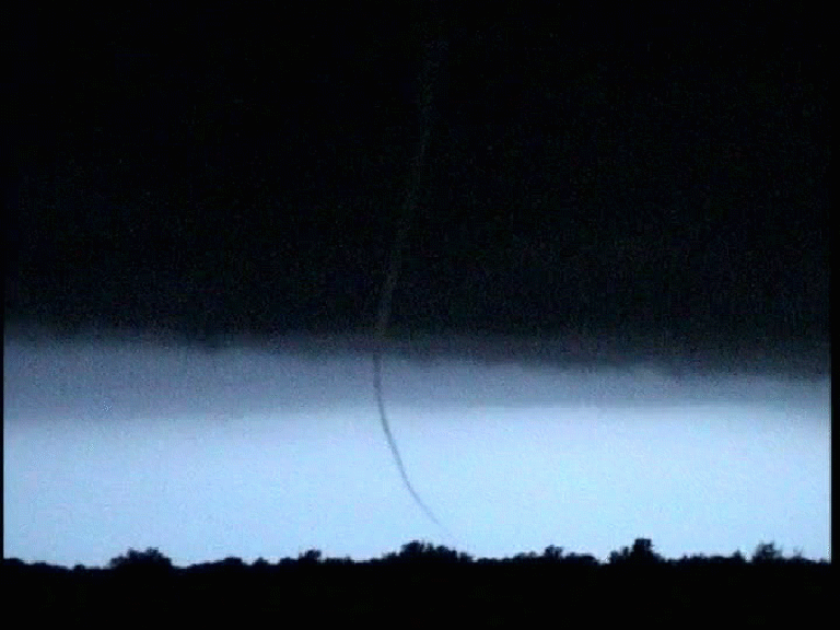
was insane with this particular updraft. The last tornado was
very interesting, because it had a continuous condensation funnel,
which only once or twice completely connected from cloud base
to ground, and the tornadic circulation had a very long duration
while only periodically touching down. After complete darkness
overtook us we called it a night and headed back to Kansas City.
This was a great chase, because the supercell was absolutely gorgeous
and very easy to chase.
|