![]()
|
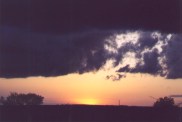
Saturday, May 5, 2001, the weekend before finals week at OU, what a great day to go chasing. On Friday, May 4, conditions looked really good for tornadic supercells somewhere in central or western OK the next day. They looked so good in fact that friends of mine who never go chasing, were planning on going chasing. I believe Simon, Tom and I left at around 11:30 a.m. or so. Our destination, the only good exit north of Wichita Falls Texas, north of the Red River in southwestern OK. Well, just like any other good chase day, conditions looked better elsewhere as we got closer. We arrived at the exit, and called our other friend Tom, who was bringing others. We told them there was way too much cloud cover where we were, plus the dew points were way up here, and that front must have retreated much further west than we originally had thought. So, we ended up at the Altus public library, once again, to look at the weather info online. The cold front/dry line was nearing the Oklahoma/Texas panhandle border. So, we headed towards Duke, Oklahoma. The skies were mostly sunny with lots of puffy cumulus trying to climb high in the sky. We headed further west to Hollis, Ok. It was 4:30pm, and still nothing had gone up. We decided to go east, just outside of the town for a good vantage point. For the next hour, it seemed that the best towers were building mostly to our north and northwest. I never saw anything worth mentioning to the south. |
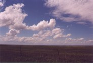 |
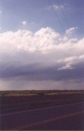
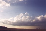
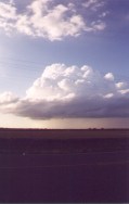
I didn't take any pictures of the towers, but this is what the sky looked like at 3pm, east of Hollis, looking NNW. |
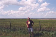 |
Here's Simon, Posing to the camera, in front of a field standing below many growing cumulus. |
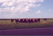 |
As we waited for towers to take off, we had time to make a few new friends. Man, they were frisky! |
|
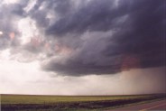
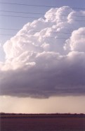
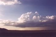
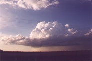
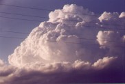
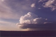
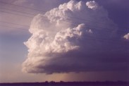
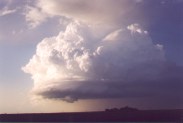
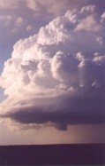
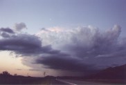
By about 5:30, anything that had tried to go up had failed. We saw that most of the towers that were trying were off a little to the north. We headed that way, then east some on some small, bumpy gravel road. Then finally, at about 6pm, a cumulus cloud right over us suddenly took off! Six o'clock magic baby! What's so amazing about this supercell is how small it was, and how small it's top was. It really wasn't a tall storm, that's for sure, and it sure as hell didn't look very impressive at first. Take a look! |
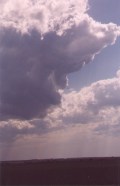 |
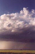
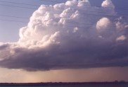
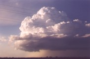
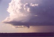
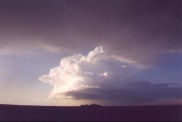
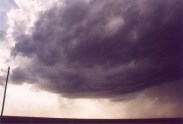 Dark base, yeah, but doesn't look very impressive. |
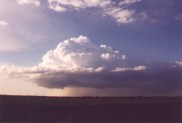
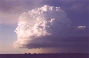
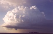
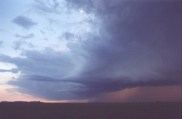
 OK, very dark base, but what's going on here? |
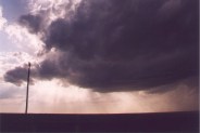
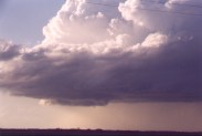
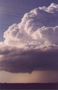
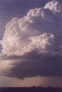
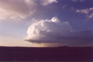
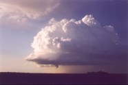
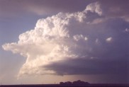
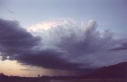
 OK, looking a little more defined, we'll stick with it. |
 |
 |
 |
 |
 |
 |
 |
 |
 |
 |
 |
 |
 |
 |
 |
 |
 |
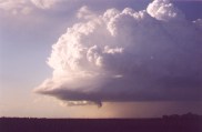
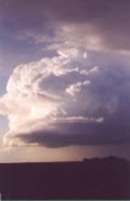
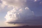
 Forming Wall Cloud |
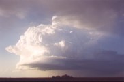
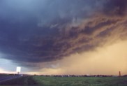
 Beautiful Storm |
 Sweet, it's a funnel! |
 |
 |
 |
|
 |
 |
 |
 |
 |
 |
 |
 |
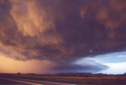
| After that, the storm continued off to the NE, but it completely fell apart, or so it looked that way. So, we decided to go with the newer storm off to the sw, which was actually very close by. Here are the pictures of the gust front of this newer storm, looking mainly west. |
 |
 |
 |
 |
 |
 |
Home | Storm Store | Photo Gallery | Message Board | Storm Chases | Latest News
Stock Footage | About | Contact | Editorial | Weather Links
Copyright 2001 Stormgasm.com. All rights reserved.