![]()
storm chasing: 5-16-03 Prague, Oklahoma tornado
|
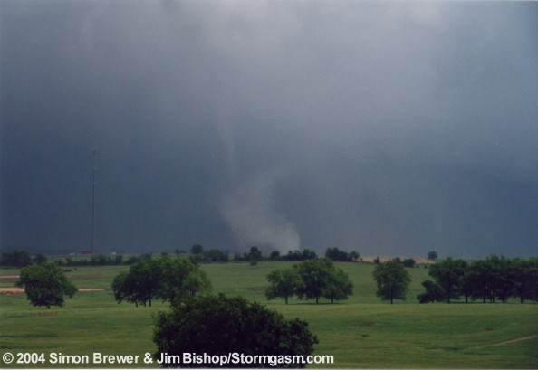
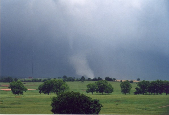
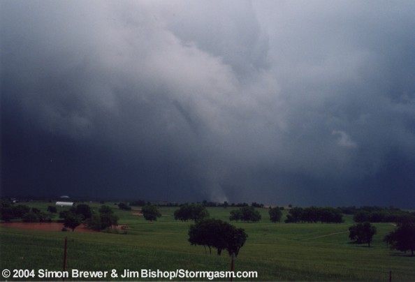
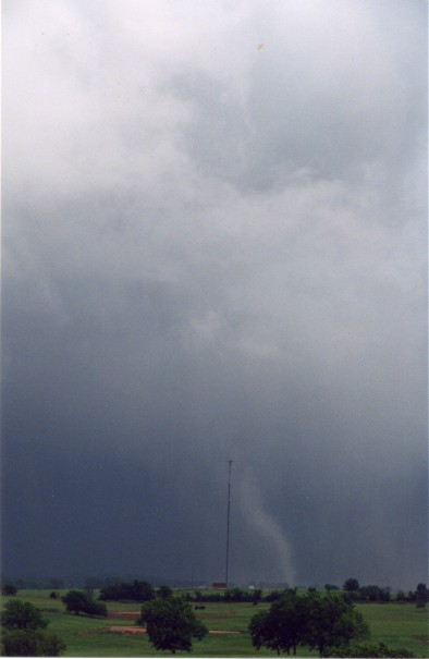
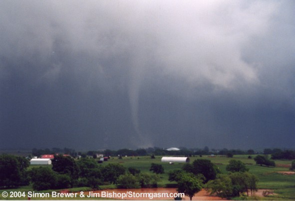
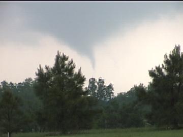
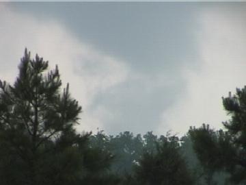
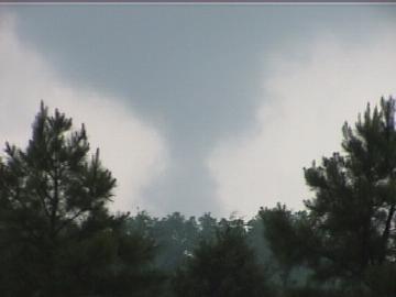
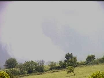
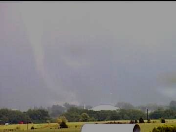
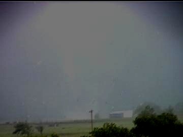
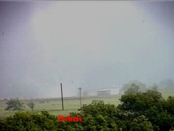
5/16/03 Prague, OK Tornado Chase Summary This chase day began with the Mark knocking on my front door. I let him in and hopped on the computer to make a quick forecast. Luckily the triple point was situated directly over Norman at the time, so it made getting in position easy. I checked out the shear/CAPE/forcing situation and decided that we needed to head just east of Norman. We left my house to pick up Jim, but Jim was still asleep, so I pounded on his apartment window to wake him. He was groggy, but I grabbed his stuff and told him to get to the car a.s.a.p. We left Norman driving east on Highway 9. Towers were already exploding in front of us. We took S.R.102 north to I-40, drove east and got off the interstate at exit 200. On exit 200 we washed the car windows and watched a nice cell form to our southwest. We headed north through Prague following this rapidly developing cell. This particular cell developed some nice structure northwest of Prague, and we heard reports on the car radio of another cell with a wall cloud and some funnels over Edmond. We knew the Edmond storm would soon die, because it was moving in areas of less instability. Our storm looked good, but a brand new storm had just developed to our south, which was going to cut off the good inflow of our storm to the west. The choice was easy, we headed south to the new storm. As we entered the north side of Prague on 377 we saw what appeared to be a cone funnel on the southwestern side of town on the western side of our new storm’s meso. It appeared to briefly touchdown, but we did not have a great view, so we didn’t want to be too hasty in declaring it a tornado. But as we drove deeper into Prague we could clearly see it was a tornado. I found a great place to view the tornado on the eastern side of Prague off SR 82. I drove us up onto a hill, which looked to be the best vantage point to view the tornado. This tornado was a small, but intense multi-vortex for most of its duration, but the tornado transitioned from cone to individual vorticies, to stovepipe, to elephant trunk, back to a cone, to rope, back to multiple vorticies. This particular tornado was on the ground for 20 to 30 minutes. When we first positioned ourselves on the hill the tornado was in a multiple vortex phase, and a short-lived rope tornado touched down nearly a mile to the west of the original tornado, but that tornado was brief. When we first spotted the tornado no warning had been issued to our knowledge for this particular storm. We tried to call in the tornado, but we did not have a cell phone signal. We positioned ourselves on a hill on the east side of town and watched helplessly as the tornado ripped though buildings on the south side of Prague. Nearly 10 minutes after the tornado had first touched down we received a cell phone signal. We called KOCO Channel 5 in OKC and Jim told Rick Mitchell on the air that a tornado was ripping through houses in Prague. We continued watching the tornado as it pasted to the southeast, east, and then northeast of Prague. The tornado looked to be pretty intense and contrary to what some have said about this day, this tornado was not a cold core tornado, this storm was rooted along the warmfront during the time of the tornado. This storm had very impressive structure. We witnessed three more brief tornadoes before the storm crossed the warmfront and became elevated. We had witnessed 5 tornadoes before 2:30 pm and were already heading home. On the drive home we witnessed some true cold core thunderstorms, which developed in association with the strong lift from the vorticity advection. I guess there were some reports of funnels or even tornadoes from some of these cold core supercells. |
Photos taken by Simon
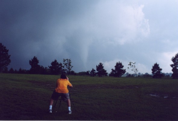 Jim video taping tornado looking south |
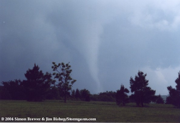 Classic tornado |
 |
 |
 |
 |
 |
Digital Video Stills
 |
 |
 |
 |
 |
 |
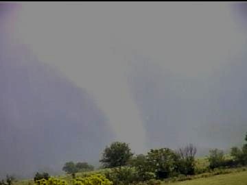 |
 Tornado ripping through houses |
 |
 |
Home | Storm Store | Photo Gallery | Message Board | Storm Chases | Latest News
Stock Footage | About | Contact | Editorial | Weather Links
Copyright 2004 Stormgasm.com. All rights reserved.