Sample Clip: 0:47 min 1.3mb
storm chasing: May 15, 2003 Stratford Texas Tornadoes

I don't recall the exact time, but I believe Simon, Mark and I left Norman around 7:30am or 8:00am. Our initiation target was an area in extreme easter New Mexico west-south-west of Amarillo, TX. We had called a few people along the way for weather information, but came up short. We stopped at a welcome center a couple miles into New Mexico on I-40. A couple storms had already fired in northeastern New Mexico off of upslope, and it appeared the dryline was beginning to move out of central New Mexico. We decided we needed to head north, and took the only state highway that goes northeast in the area, 54, so we hit that route in Logan, NM. Funny enough, to get there we had to drive west a bit, which actually worried us at first, but it seemed like the best way to go.

Not long after we turned on state highway 54, a cell was forming just to our southwest. At the same time, we could also see one of the cells in the northeast part of the state, the cell furthest south, and it looked really good. So, we continued heading northeast and were able to stay ahead of the newly-developing cell as well as gaining on the older cell to our northeast. The cell to our southwest had a nice inflow band the entire time, but still seemed to be having problems intensifying.

We arrived in Dalhart, TX around or just after 4:00 pm. After receiving some nowcasting information, we decided to stick with the still intensifying storm which was now bearing down on Dalhart. The inflow winds going into this storm were incredible. They were probably sustained at nearly 35 mph, but gusting to 50 or 60 at times! Very incredible situation.

We proceeded northeast on 54. The storm had yet to produce a well defined wall cloud. It seemed like it was still trying to get its act together.

Once we were headed north on state highway 807, the storm began to rapidly intensify. The inflow increased even more, and a wall cloud rapidly developed. By the time I actually noticed the wall cloud, a large bowl funnel was in the process of touching down. This wall cloud was enormous, probably 7-10 miles to our west, and rapidly rotating.


Large wall cloud

Multiple vortex tornado

Two tornadoes!


The larege bowl funnel briefly touched down as a wedge, then quickly became a multiple vortex tornado! Even though it was a couple miles away, I could clearly see multiple vorticies touching the ground. At this time, the tornado was moving east, however, I believe the storm itself was still moving northeast. The tornado continued on a nearly due east path, while the wall cloud continued to grow in size. (At this point I am not certain as to whether the next tornado touched down under the same wall cloud, or whether a second mesocylone formed on the north side of the original wall cloud. But it seemed from our frame of reference that the wall cloud grew to a very large size and a second tornado touched down on its north side).

Suddenly, out of the blew, Simon yells, "Oh my gosh, is that a wedge?.....It is! Jim, there's a wedge on the ground!" I looked to the northwest (north of the tornado) and to my comlete amazment there layed a large, dark wedge tornado! How amazing is that? Never in my wildest dreams did I ever think I'd witness two photogenic tornadoes at the same time. From what I could tell, this tornado had either formed on the northern side of the same wall cloud as the first tornado, or it was another mesocyclone entirely. I don't think I'll ever know which case is correct. However, I am 100% sure the first tornado (smaller one) was NOT a satellite tornado like some other chasers claim. These were clearly two seperate tornadic circulations, clearly not rotating around one another and both were cyclonic.


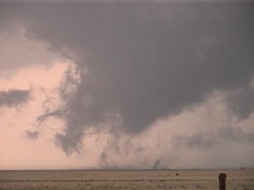
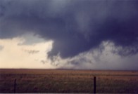
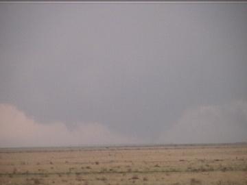
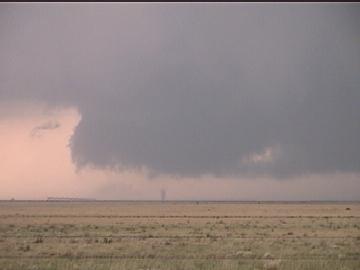
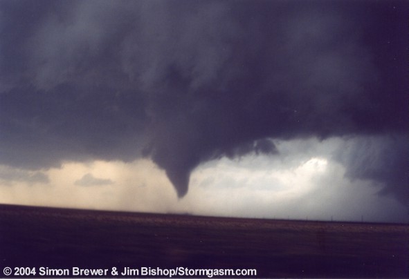
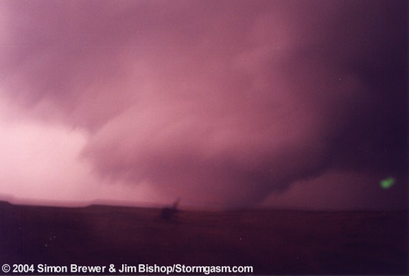
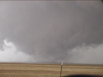
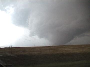
As the first tornado was getting closer, I prepared myself to grab the camera and tripod and jump in the car. The tornado was forming a large bowl funnel with multiple vorticies rotating within it. It was certainly one of the best chase moments of my life. Once it got about 1/4 mile from the road, we jumped in the car and started heading north.

As the large wedge raged on, it was beginning to dominate it's local environment. The large wedge actually caused the first tornado to become occluded. Thus, the first tornado began it's dissipating stage, and what an amazing dissipating stage it was. It turned into a beautiful cone/stove pipe just a couple hundred yards west of us. That lifted and a rope quickly touched down, and evolved into an elephant trunk in a matter of seconds, and then began to dissipate. By this time we were now just to the northeast of the tornado, but southeast of the large wedge! A "chaser frenzy", as Simon put it, passed us heading southbound on the road. We counted 14 cars, all of which probably thought the elephant trunk was a satellite tornado and just freaked out! We knew what was going on, and were apparently the only ones who can claim that, so were the only chasers inbetween these two maginficent tornadoes!

Shortly after passing the "chaser frenzy", the circulation from the now roping out tornado was still on the ground noted by the dist whirl, but condensation had lifted for good, and the tornado was decaying. The attention was now diverted back to the wedge, which was now more of a large, bowl funnel with multiple vorticies. How incredible!


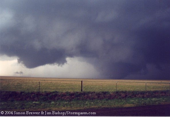
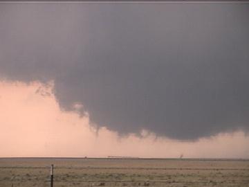
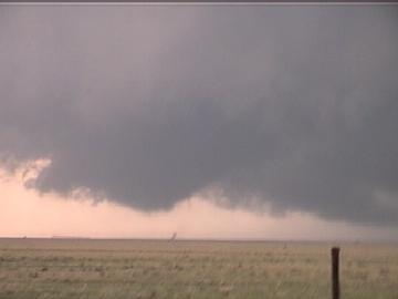
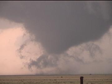
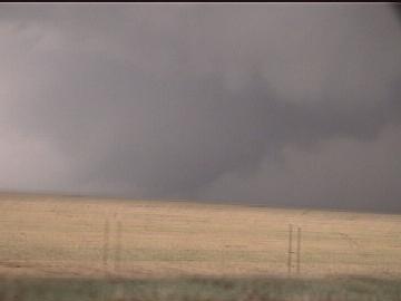
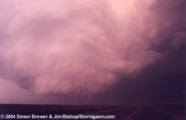
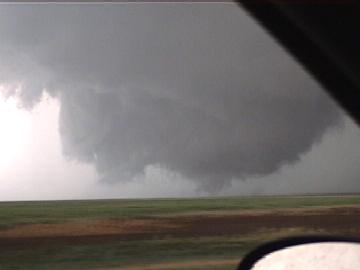
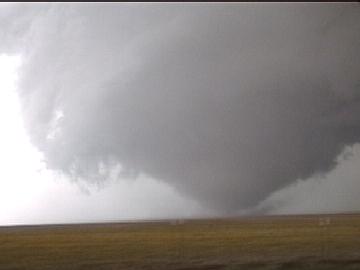
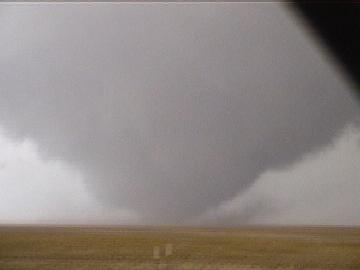
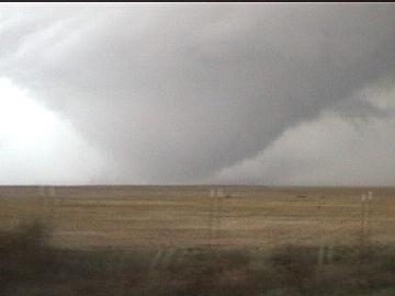
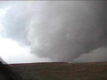
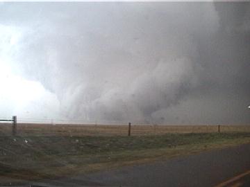
While the elephant trunk was raging on, Simon's camera ran out of film. I quickly tossed him mine, which strangely would not work. I had to mess with it while I video taped the wedge, which of course effected the quality of the video. The tornado was nothing short from absolutely amazing! It was very photogenic and beautiful. It did not cause any structural damage other than to some unfortunate power lines.

Gene Rhoden and a couple other cars passed us as the tornado was about to cross the road. Simon and I were very upset about that since they slowed down after passing us; meaning they just wanted to be in front. The way I see it we were there first, so I was pissed off. Had they not slowed down in front of us there would be no hard feelings.

The tornado became rain wrapped as it crossed the road. There was no east-west road nearby other than a muddy one to our south. We did try this road, but discovered the mud and got out of that horrible situation! We tried heading north again into Oklahoma for a major east-west state highway, but couldn't proceeed north due to a down powerline. We were forced to dive south and then east.


Wedge tornado approaching the road to our N

Tornado crossing the road

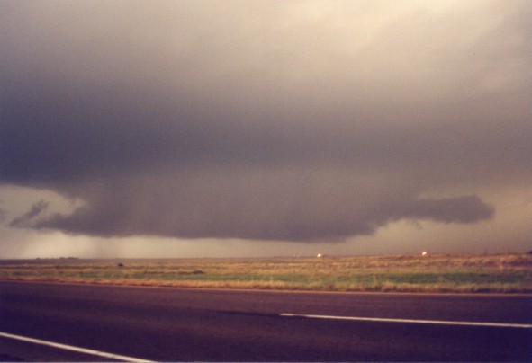
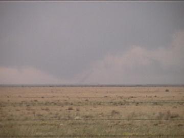
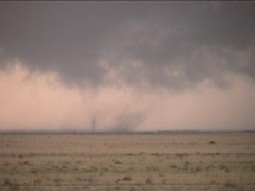
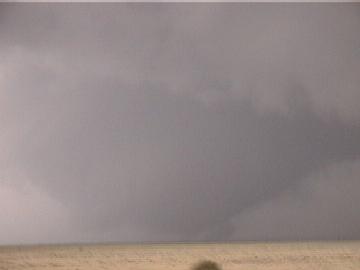
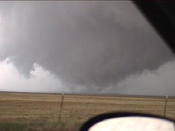
Later that evening we saw this massive wall cloud just northwest of Guyman, OK. It had broad rotation, but nothing compared to the motion we saw west of Stratford, TX. It apparently produced a tornado after dark in Liberal, KS. We decided to head home before dark since the wall cloud had no signs of producing a tornado for over an hour, and since other cells to our southeast were threatening to cut off our route home.


Home | Storm Store | Photo Gallery | Message Board | Storm Chases | Latest News
Stock Footage | About | Contact | Editorial | Weather Links


All storm chasing (tornado, supercell, lightning, hail, sunset, ect.) photos and videos are copyright property of Jim Bishop and Simon Brewer (Stormgasm), unless otherwise specified. Any unauthorized reproductions are strictly prohibited by law.
Copyright 2004 Stormgasm.com. All rights reserved.