April 7th, 2008 Electra, TX Tornado
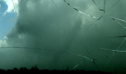
Click on Pic Above to View Short Video Clip
|
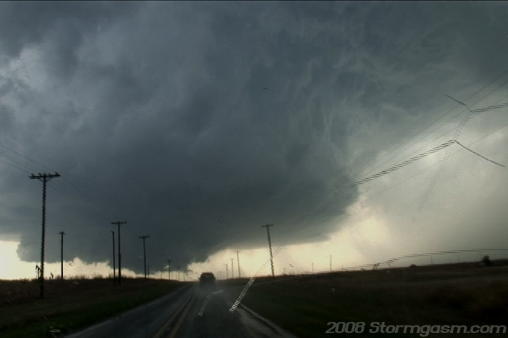
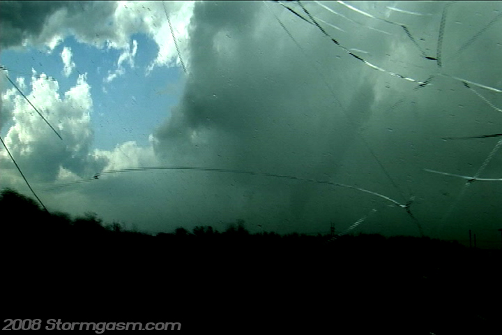
April 7th, 2008 Simon Brewer, Jim Bishop, Tom Santillo, and Cory Rundquist documented a tornado northwest of Electra, TX. We targeted the 'deep moisture nose' near the Red River in NW TX and intercepted an incredible supercell near Electra, TX. The pic on the left is a video still looking west showing the amazing structure of a supercell WNW of Electra, TX (incredible vault)! The pic on the right is a video still looking WNW at the occluding tornado cyclone (notice the RFD clear slot on the left and the developing tail cloud on the right). The wall cloud was showing very impressive rotation. |
 |
 |
|
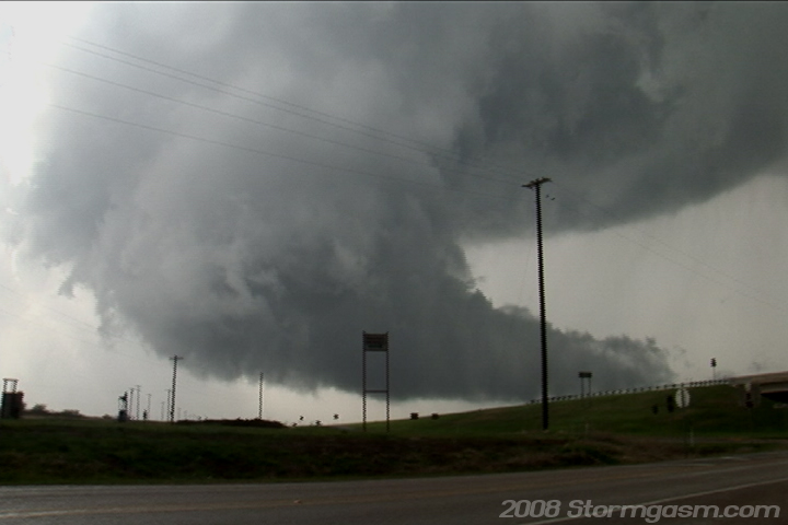
We pulled onto a small farm road NW of Electra, TX and filmed a rapidly rotating wall cloud about a mile to the NW of our location. The wall cloud was moving SE toward our location and then quickly changed direction and began moving due north paralleling our road to the west. Both pics to the right are video stills looking WNW at the rapidly rotating wall cloud. Hate to use a double negative, but I have never not seen a tornado produced by a wall cloud with such incredible rotation. A cone/bowl funnel could periodically be seen on the southeastern side of the wall cloud and light debris was periodically seen under the wall cloud at this point. |
 |
 |
|
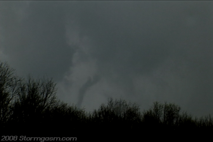
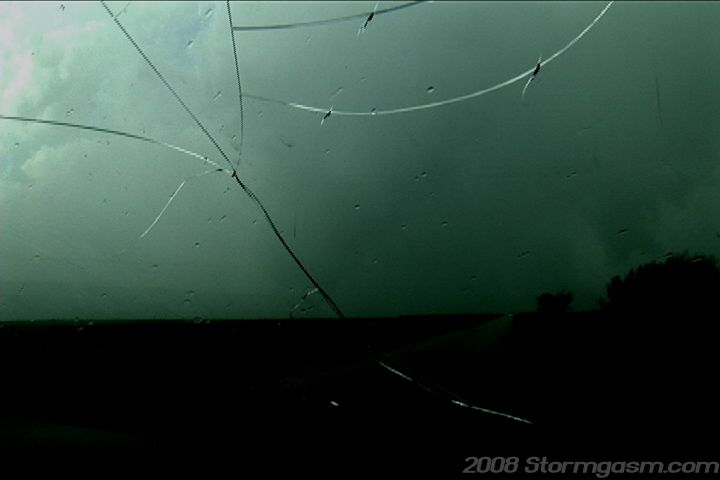
We drove north to follow the wall cloud and had some small trees to the west of our N-S orientated road, which semi-blocked our view. We pulled into a small driveway and filmed a condensation vortex from a now multi-vortex tornado briefly connected to the ground. The pic on the left is a video still looking WNW at the tornado in its multi-vortex stage. The vid still on the right is lookin NNW at the rain-wrapped tornado in its 'stout cone' phase (had to really adjust the contrast on this image to bring out the tornado on the video). |
 |
 |
|
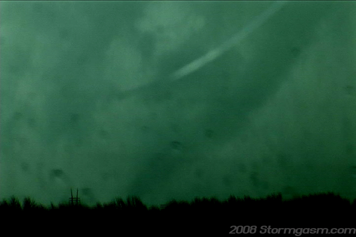
We kept driving north watched (when we could see through the rain) the tornado rope-out. We also saw a very impressive mid-level funnel along the flanking line updraft to our east in the RFD clear slot (I believe the mid-level funnel was rotating anticyclonically). The video still on the left (had to increase the contrast to see the vortex) is looking NNW and zoomed-in at the rope tornado condensation and some debris on the ground. The video still on the right is looking NNW at the rope-out stage of the tornado (once again, sorry, I had to increase the contrast to see the tornado on video). |
 |
 |
|
We were pretty sure we could see the tornado at times in the rain, but were not certain with the exception of the brief multi-vortex stage and the rope stage, but by increasing the contrast on the video we were able to actually see the shape of the tornado many times during its life cycle. The tornado could have been on the ground for several minutes, but we could not tell due to the rain continuously wrapping around the tornado and blocking it from our view. The tornado likely did little to no damage, because it was over open country the whole time of its life cycle. The supercell quickly became high based and slowly tracked ENE and died in southern OK. The environment in NW TX and SW OK was becoming less suitable for tornadic supercells as the day continued; most likely due to dry air mixed well east ahead of the dryline. We watched the cell cross I-44 and then we started back to Norman, OK despite the sun still being high in the sky. |
Home
| Storm Store | Photo
Gallery | Message
Board | Storm Chases | Latest
News
Stock Footage | About
| Contact | Editorial
| Weather Links
Copyright 2004 Stormgasm.com. All rights reserved.