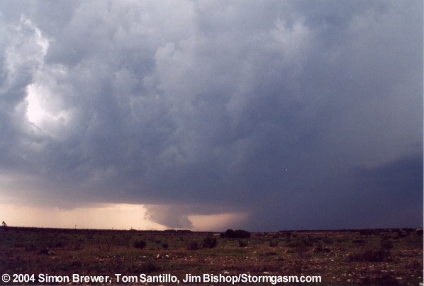
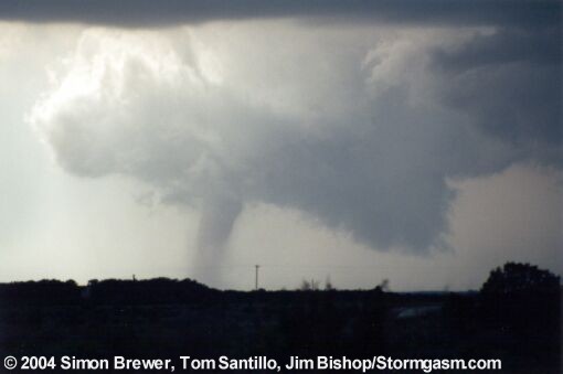
The
tornado was on the ground between 2:58 pm and 3:06 pm in the vicinity
of about 8 miles southwest of Aspermont, TX.
Chase
Summary:
Jim,
Tom, and I (Simon) left Norman, OK at 7:30 am and headed to Weatherford,
TX to pinpoint our forecast. We had to leave very early, because
we knew the cap was weak and convection would fire early. The severe
weather setup for northern Texas looked very good for the formation
of supercells and possibly some tornadoes. Our hope was to catch
a supercell that would fire off the triple point and root itself
along the warm front.
After arriving in Weatherford we saw the warm front had not yet
reached I-20, so we continued on to Abilene. In Abilene we saw some
cells begin to fire at the dryline/warm front intersection. We did
not spend enough time to look in detail as to whether the storms
fired off the dryline or upslope along the caprock since we were
storm chasing and all. Once convection began to fire we raced northwest
towards Aspermont, TX to intercept a northeastward moving cell.
We called a friend (Chris Walsh) as we drove northwest and he told
us the cell was still moving northeast, which worried us, because
the storm might cross the warm front. On arrival in Hamlin, TX we
could see the updraft to our west, so we setup position on Route
83 on the north side of the Double Mountain Fork Brazos River.
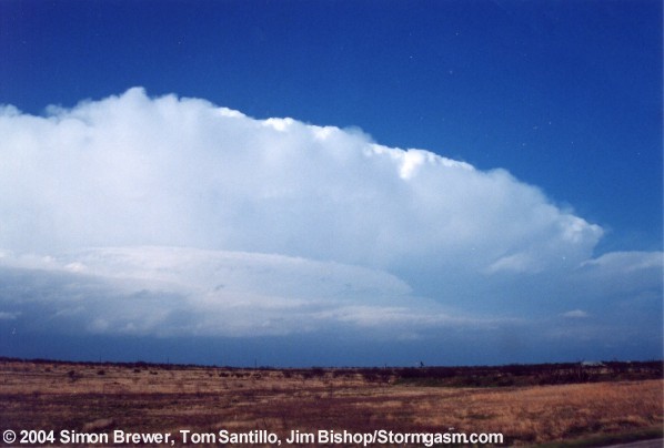
We watched a nice rain-free base off to the west. The storm structure
was nice, but it was just getting started. The storm then veered
to the east, which told us it had become rooted along the warm front.
We watched what appeared to be a land spout form along the RFD gustfront.
Because we were not right next to the circulation I can not confirm
whether or not it was a land spout or an intense gustnado.
At the time of the land spout the RFD was beginning to push out
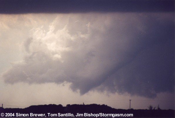
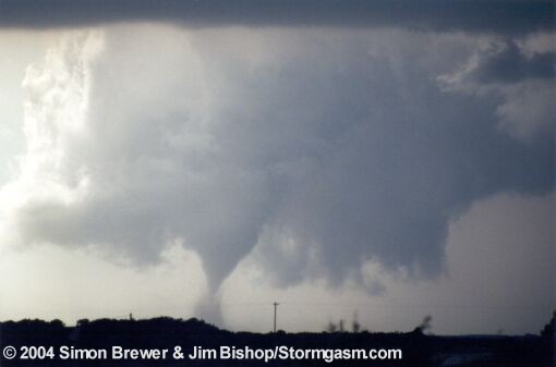
ahead of the meso. Soon after, a wall cloud developed and a mult-vortex
circulation briefly formed. The wall cloud was then becoming occluded
and a cone tornado touched down and evolved into a stovepipe tornado
(~3 pm). The tornado had a very brief rope-stage and the wall cloud
became completely cut-off by the RFD. The tornado's life cycle lasted
about 7 minutes.
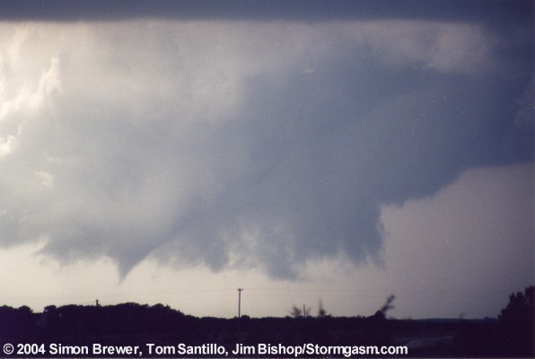
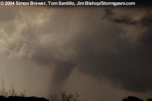
A new wall cloud then rapidly developed over our location forcing
us southward. We watched as brief funnels flirted with touching
down dangerously close to our location. We followed the rapidly
rotating and very low wall cloud eastward. A brief but pronounced
tornado touched down near road 2834 near the tiny town of Pastura.
That was the last tornado we witnessed of the day. Any other possible
tornado look-a-likes were merely dust plumes kicked up by inflow
or outflow or gustnadoes.
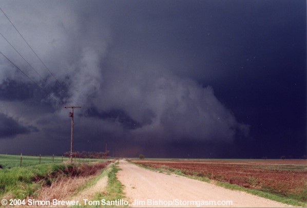
We followed the wall cloud east to extreme eastern Haskell county
and witnessed a very intense gustnado develop near the edge of the
wall cloud. Soon after witnessing the gustnado the wall cloud was
under cut by a cold RFD and the storm briefly became outflow dominant.
At that time our roads ended, and we opted to go south instead going
north and eventually cutting through the RFD or FFD and losing our
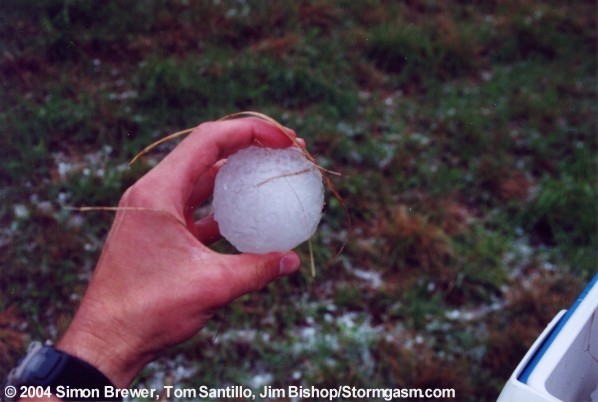
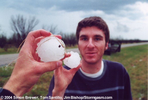
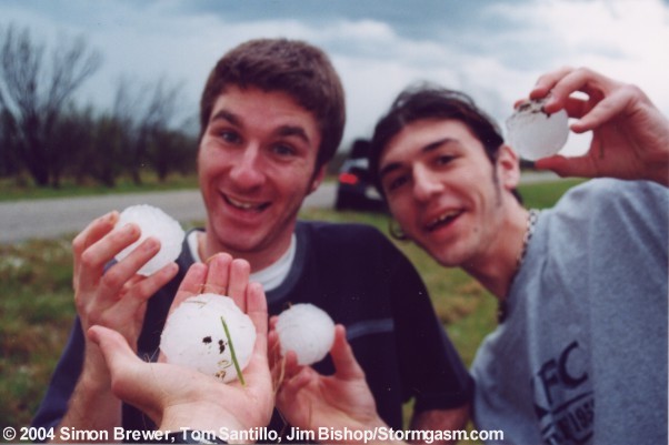
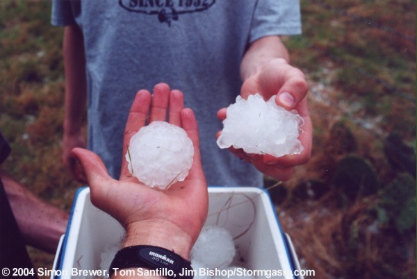
windows to the monster hail.
We caught the storm again near Fort Griffin, but let it get ahead
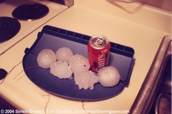
of us, because we wanted to check out the huge hail on the ground.
We continued east after the storm, but stopped again on 209 to look
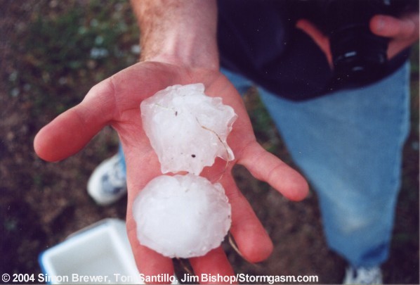
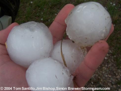
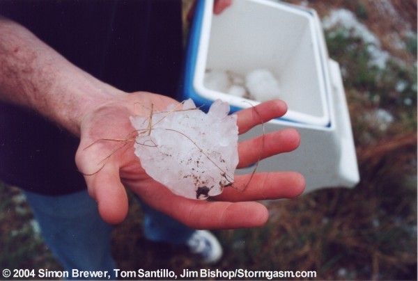
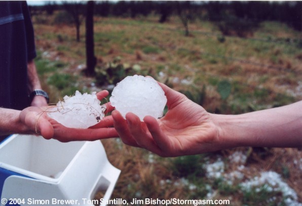
at 3 and 4-inch diameter hailstones that had fallen in the area.
We were not in an absolute hurry to catch back up to the supercell,
because the massive hail shaft stood between us and the meso and
we really did not have any other road options.
We witnessed intense hail damage in the town of Woodson and we saw
many chasers on the sides of the road with all their windows gone.
We even passed over a dead bird, which was most likely killed by
the hail, which lay in the middle of the road.
As we tailed the hail shaft of the supercell we moved over its path
once again and witnessed a very wide and impressive hail swath.
The hail on the road was quite a few inches deep and the hill sides
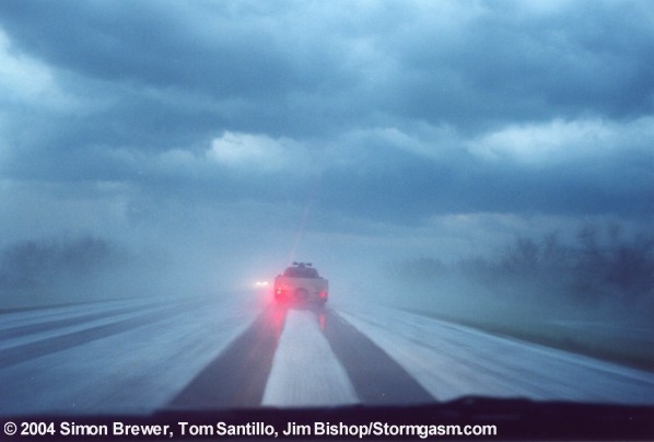
were white. The entire area was shrouded in very dense fog and the
strong odor of shredded evergreen plant-life.
We did not have any outside information on the locations or intensity
of the supercells in the area, but we did know our supercell and
some newly developed supercells were approaching the northern side
of the Dallas Ft. Worth Metroplex. We knew the nature of these particular
supercells and did not want to risk the possible road and visibility
problems associated with chasing an HP Supercell through city streets
at night, so we decided to try intercepting one of the supercells
on I-35. The visibility was bad, but we still managed to get next
to a rain-wrapped meso as it crossed I-35 near Denton. After it
crossed the interstate we decided to go home.
As we plowed north through the FFD of one of the supercells traffic
came to a halt in to the south of an overpass. Despite the efforts
of the NWS to keep people from seeking the shelter of an overpass
there are still many people who risk their lives and the lives of
others by blocking the interstate with their cars under the overpasses.
Eventually traffic began to slug its way between parked cars under
the overpass. As our chance came to slowly pass between the parked
cars I laid down on the horn for a few minutes.
This was a great chase; two tornadoes, possible land spout, intense
gustnado, hail larger than baseballs, gorgeous violently rotating
wall clouds, and a massive hail swath in the hills of north Texas.
|