April 26, 2009 Northwest Oklahoma Tornado Outbreak
|
April 26, 2009: Simon Brewer, Juston Drake, and Nate Miller documented 3 tornadoes in Northwest Oklahoma. A large shortwave trough located over the Rockies Saturday night moved eastward over the Great Plains Sunday. A small jet max/associated wave ejected northeastward over the southern and central Plains in the late morning, which initiated a large cluster of surface-based and elevated showers and storms over the Texas Panhandle and Western Oklahoma. We left Norman early (~10 am) hoping to intercept any organized cells in West-central Oklahoma from early convection and then possibly catching more intense storms later in the afternoon/evening. This plan of action proved to be somewhat successful.
|
 |
|
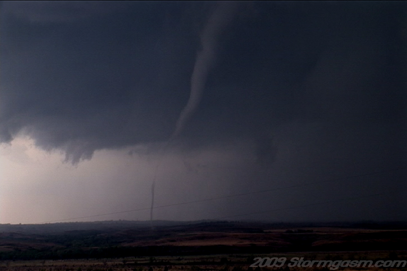
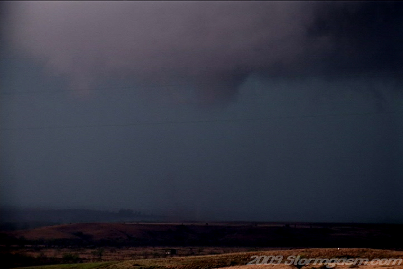
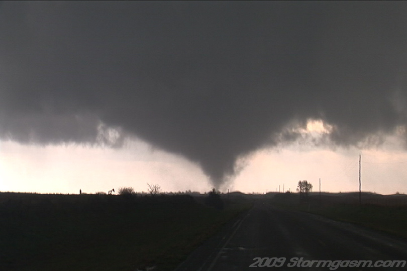
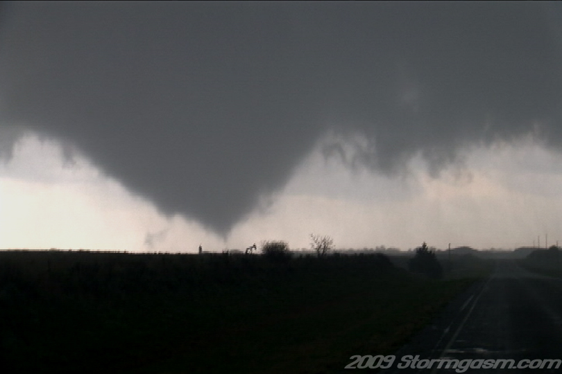
The cluster of cells finally began to merge and a supercell organized along the TX Panhandle/OK border as we approached. We could see great mid-level structure as we approached the storm and then we discovered a tornado warning had been issued for the supercell. We drove north of Roll and Nate spotted a cone tornado along the RFD gust front. We stopped and documented the tornado, while a well-developed wall cloud became more organized. The image on the right shows the cone/elephant trunk tornado west of SR 283 and south of the Canadian River.
|
 |
|
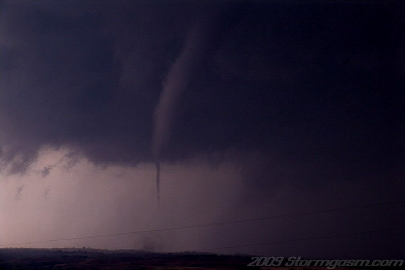
The image on the right shows the rope tornado west of SR 283 and south of the Canadian River.
|
 |
|
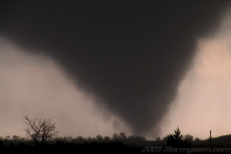
The image on the right shows the cone/rope tornado west of SR 283 and south of the Canadian River.
|
 |
|
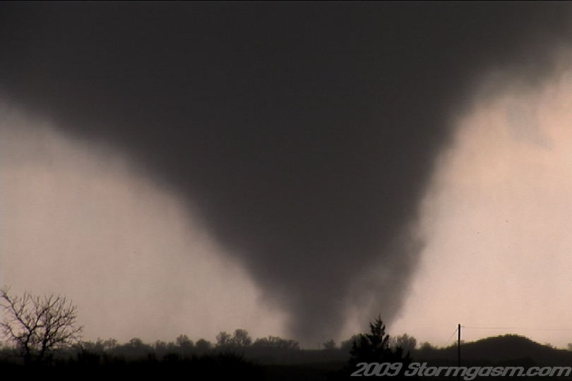
The image on the right shows the cone/elephant trunk tornado and rapidly rotating wall cloud west of SR 283 and south of the Canadian River. The wall cloud began to take on a 'barrel' shape and a cone funnel cloud appeared after this image.
|
 |
|
The image on the right shows the rope tornado west of SR 283 and south of the Canadian River.
|
 |
|
The image on the right shows the rope tornado west of SR 283 and south of the Canadian River.
|
 |
|
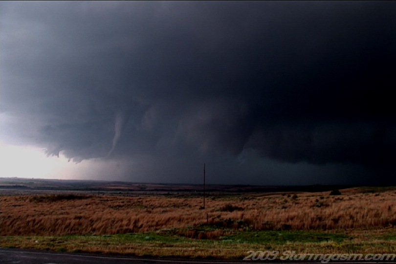
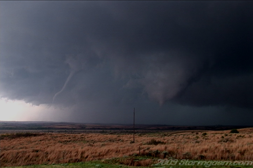
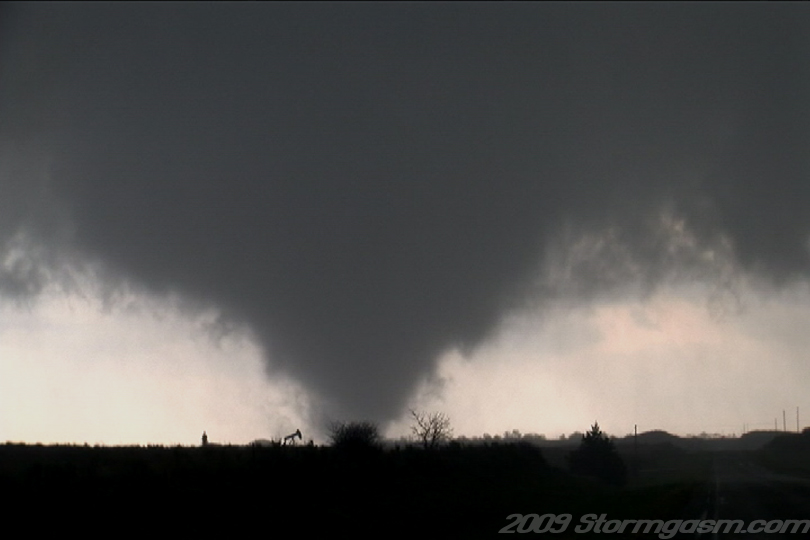
The image on the right shows the rope tornado and cone tornado west of SR 283 and south of the Canadian River. The new cone tornado can be seen to the north of the rope tornado. The condensation had not reached the ground at the time of this image, but debris was visible under the funnel. This is a great image of two tornadoes simultaneously 'on the ground'. |
 |
|
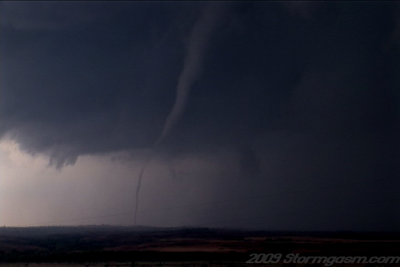
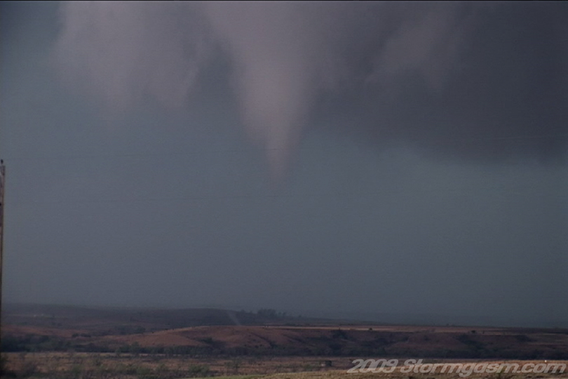
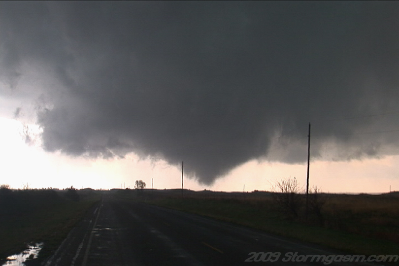
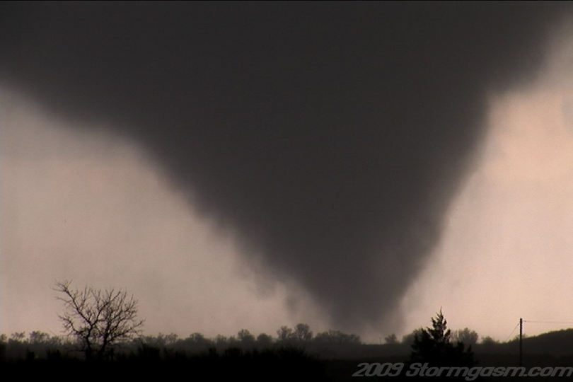
The image on the right shows the cone tornado west of SR 283 and south of the Canadian River. A small 'suction spot' or vortex can be seen at the ground level (small slanted condensation tube on the ground) under the cone funnel cloud in the image on the right. Tornadoes that have this appearence early tend to become strong to violent later in their lifecycle.
|
 |
|
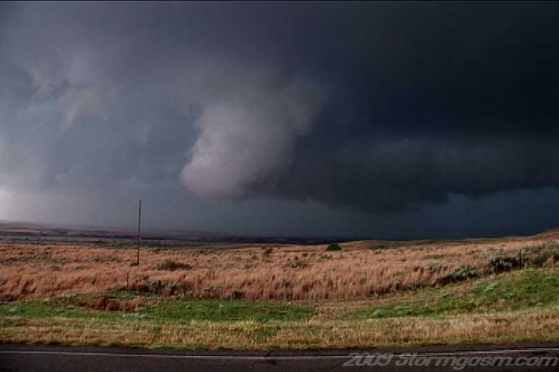
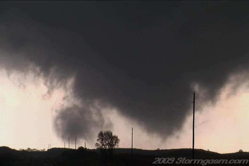
The image on the right shows the cone tornado and wall cloud west of SR 283 and south of the Canadian River. The remains of the earlier rope tornado can still be seen on the left side of the image, but the new developing cone tornado dominates the image in the middle of a rapidly rotating 'barrel' wall cloud, and the thick tail cloud.
|
 |
|
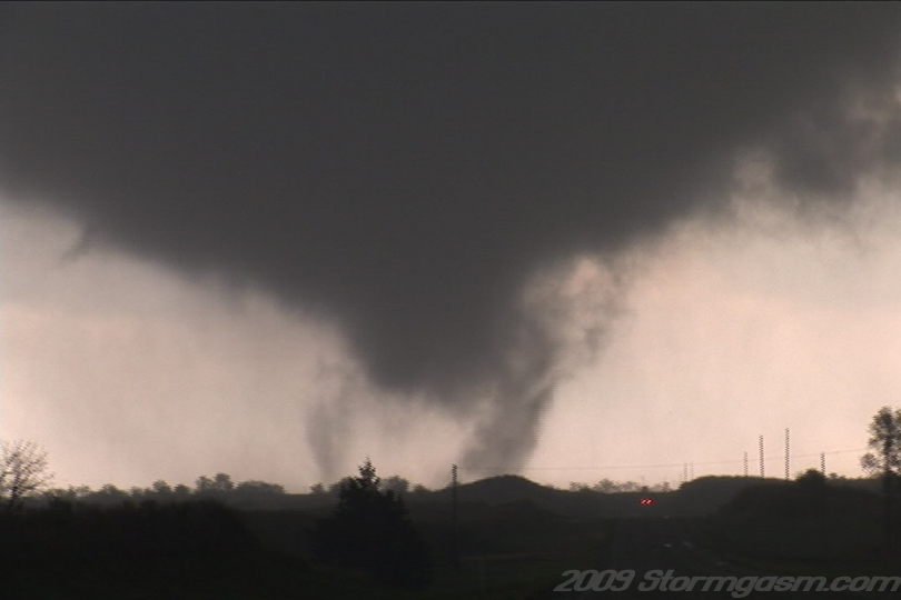
The image on the right shows the multi-vortex tornado and associated debris cloud west of SR 283 and south of the Canadian River.
|
 |
|
We were located on the edge of the Canadian River Valley wall and it appeared the new strengthening tornado was tracking to our location, so we repositioned about a half mile north. This gave us a great back lit view of the tornado during the development stage, but eventually hurt our visual for the mature phase of the tornadoes life cycle.
The image on the right shows the multi-vortex tornado and associated debris cloud west of SR 283 and north of the Canadian River.
|
|
|
The image on the right shows the multi-vortex tornado west of SR 283 and north of the Canadian River.
|
 |
|
The image on the right shows the multi-vortex tornado west of SR 283 and north of the Canadian River.
|
 |
|
The image on the right shows the multi-vortex tornado east of SR 283 and north of the Canadian River.
|
 |
|
The image on the right shows the multi-vortex tornado east of SR 283 and north of the Canadian River.
|
 |
|
The image on the right shows the multi-vortex tornado east of SR 283 and north of the Canadian River.
|
 |
|
The image on the right shows the multi-vortex tornado east of SR 283 and north of the Canadian River.
|
|
|
The image on the right shows the multi-vortex tornado east of SR 283 and north of the Canadian River.
|
 |
|
The image on the right shows the multi-vortex tornado east of SR 283 and north of the Canadian River.
|
 |
|
The image on the right shows the multi-vortex tornado east of SR 283 and north of the Canadian River.
|
 |
|
The image on the right shows the multi-vortex tornado east of SR 283 and north of the Canadian River. At the time of this image we were getting plowed by heavy rain from the FFD. We looked at our road options and decided it might be best to drive north to SR 60 and then east towards Vici to reintercept the tornado assuming it would still be tracking northeast. We did not know if we drove a mile south that we would have good visuals from the RFD, so we missed watching the tornado turn into a stovepipe shape. |
 |
|
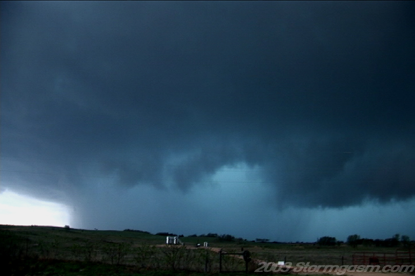
We drove north to SR 60 and the plowed east back through the FFD to cut in front of the mesocyclone. The original tornado appeared to be gone, but a new wall cloud had developed and began to occlude to our south. Rain band began to wrap around the wall cloud and a brief cone developed in the rain and debris was visible under the funnel. This feature was not visible for long as a very wet RFD completely wrapped around the meso. We drove east to avoid be mowed by this rain-wrapped circulation, but had trouble thanks to some traffic and very slow chasers. We drove east of Vici and didn't like the environment ahead of this storm, so we dropped south on SR 34 to get a view of the cells to the southwest of this cell. We followed one of the cells to Vici, but it appeared to be outflow dominant or elevated, so we began our drive back to Norman with hopes of catching an interesting cell after dark. All of the convection congealed into elevated clusters after dark, but we got great rainbow and sunset pics south of Watonga, while being slammed with southeast surface winds sustained at 40mph with a gust of 50 measured by the local mesonet station close to our location. We, also, got some great lightning video after dark from the backside of the MCS. Image on the right shows a rain-wrapped tornado and parent occluding mesocyclone/tornado cyclone west-southwest of Vici, OK. |
 |
Home
| Storm Store | Photo
Gallery | Message
Board | Storm Chases | Latest
News
Stock Footage | About
| Contact | Editorial
| Weather Links
Copyright 2004 Stormgasm.com. All rights reserved.