![]()
|
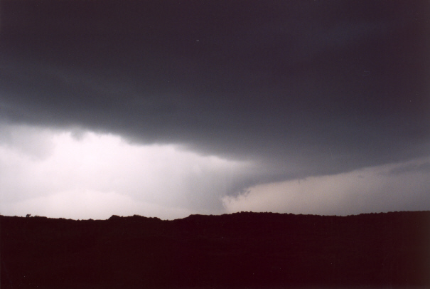
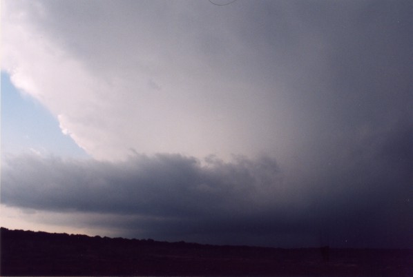
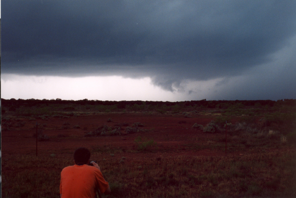
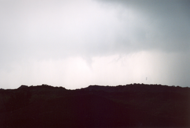
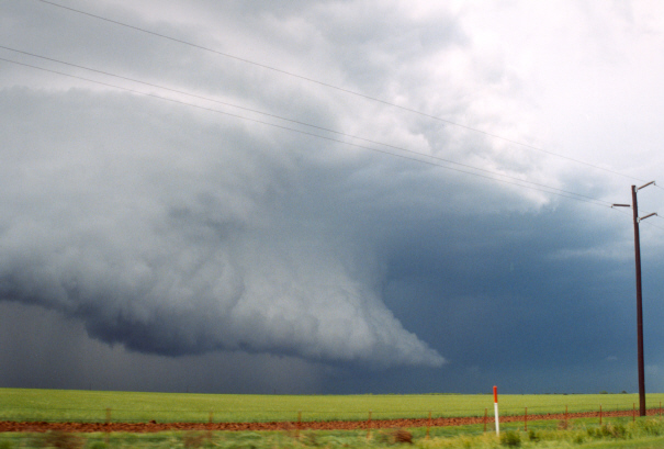
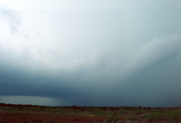
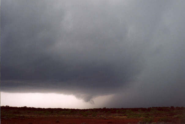
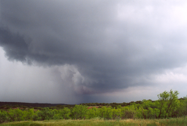
Simon and I (Jim) left Norman and headed SW on 44. After calling a few people for some weather information, we intercepted a nice hp supercell (the Benjamin storm I believe) on state highway 1919. Looking west around 3:10pm a wall cloud developed. The RFD really started advancing NE, but then the wall cloud was quickly undercut by outflow. However, scud began rising rapidly into the updraft, and a new wall cloud rapidly developed as a gray cone funnel formed. The condensation funnel reached about 2/3 to the ground, but cannot confirm any rotation on the ground. The funnel then became rain wrapped. About 3:20pm, we moved further SE on 1919 to about 12 miles NW of Seymour. The wall cloud was now visible, although rain was falling in the area. It quickly intensified, and another funnel formed just to our NW (less than 100 yards ahead). Rotation on the ground became evident when we saw a debris cloud of dirt just off the road. With rapid rotation on the ground, we drove further down the road for a safer position, but the tornado became obscured by rain and was not clearly visible, though I think it lifted after 30 or 45 seconds. The wall cloud was still rotating, and it appeared the RFD was occluding it one final time as a broad circulation of rain bands came charging from the SW. Within the circulation was a (new?) condensation funnel, and rapid rotation on the ground. At this point I wasn't sure if the broad circulation on the ground was the low-level mesocyclone with the tornado in the middle, or if this was a very weak and short lived multiple vortex tornado with one of the vortices being the tornado. I ponder because the outer circulation was not extremely intense. Whatever the case, rotation was on the ground for 30 seconds to 1 minute. After all the excitement, we took 277 NE of Seymour and watched a new storm, which I think was forming along the other's flanking line possibly (?), form, look impressive, then dissipate. We saw many other chasers on this highway at this time. |
HP Supercell 10 miles NW Seymour, TX |
||||
|
|
|
||||
|
The rest of the day was filled with confusion and frustration. After much of that, we caught up to a newly developing storm just SW of Holiday, TX. Witnessed a microburst as the storm died, and watched another display a horrible attempt to get organized. By then it was around 8pm, and we headed back to Norman. Since we may be chasing tomorrow, photos from today's chase won't be up 'till probably late Friday. Special thanks to Kyle Mozley for the nowcasting which guided us in the right direction. |
Home | Storm Store | Photo Gallery | Message Board | Storm Chases | Latest News
Stock Footage | About | Contact | Editorial | Weather Links
All storm chasing (tornado, supercell, lightning, hail, sunset, ect.) photos and videos are copyright property of Jim Bishop and Simon Brewer (Stormgasm), unless otherwise specified. Any unauthorized reproductions are strictly prohibited by law.
Copyright 2004 Stormgasm.com. All rights reserved.