March 31st, 2008 Southeastern Oklahoma Supercells
|
March 31, 2008 Simon Brewer, Shawn Maroney, and Cory Rundquist documented 3 supercells in SE OK. The storm chasers documented golfball and baseball-size hailstones; one hailstone was measured at 3.25 inches in diameter. The low-level shear was poor for tornadoes, but the midlevel shear was adequate for supercells, which produced large hail and high winds. The capping inversion over OK was weak with moderate instability, so multiple storms were developing across OK and North TX all day. We left Norman in the afternoon and documented a short-lived cell south of Purcell, OK, which produced some pea-sized hail at our location. The pic on the right is looking west at the updraft base of the cell south of Purcell, OK. |
 |
|
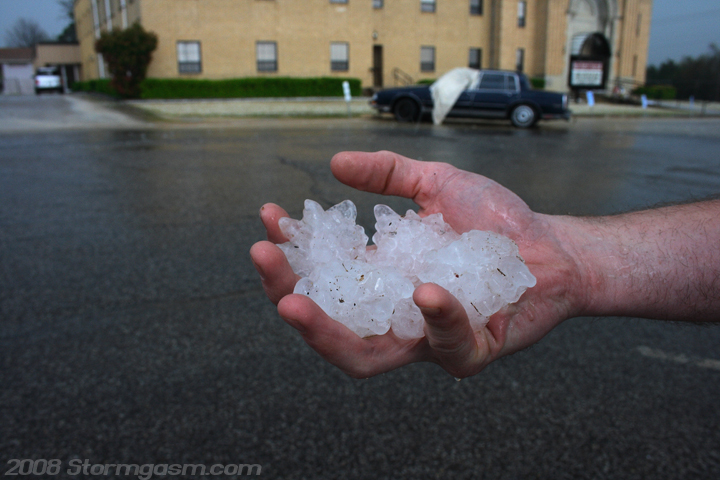
We didn't like the storm near Purcell and decided to drive south for another storm heading towards Sulphur,OK, which was isolated and had a good shape with a high dBz core on radar. We got stuck behind a minivan going 35mph in a 65mph zone, which we couldn't safely pass north of Sulphur, so we watched the updraft base pass south of Sulfphur and we got pounded by the FFD. The pic on the left is looking southeast as wind-driven hail hits a parking lot in Sulphur. The pic on the right is looking at Cory's hand, which is holding multiple golfball-sized hailstones in Sulphur. |
 |
 |
|
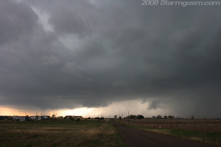
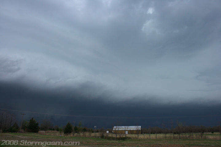
The Sulphur storm raced east into a very bad road network, and there was a good environment for supercells to the south near the Red River that was virtually untapped, so we decided to drive south to Madill, OK. Towers and storms developed along I-35 to our west as we drove to Madill, and lucky for us the best storm of the day formed due west of Madill. We arrived on the south side of Madill and watched a nice supercell organize to our west. The pics on the right are looking west at the developing supercell west of Madill, OK. |
 |
 |
|
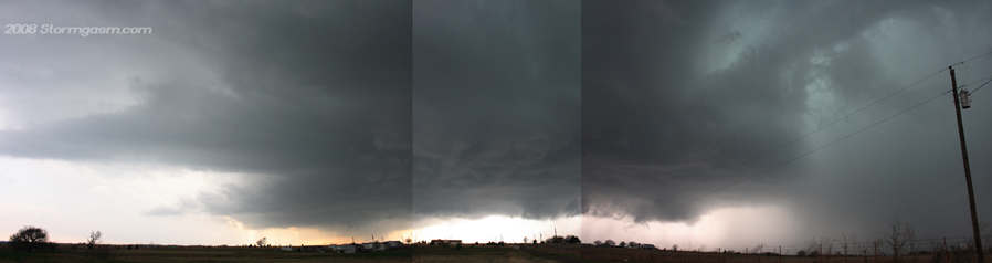
The pic on the right is a panaramic pic I created by combining multiple pics taken with in seconds of eachother, which is a larger version of the one at the top of this page. This pic shows the supercell around the time it looked its best near Madill, OK. |
 |
|
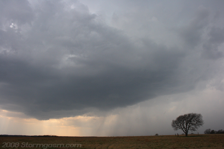
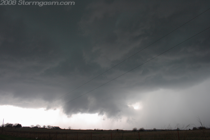
The supercell near Madill showed great signs of mid-level rotation, but only briefly showed signs of low-level rotation, which I believe prompted a tornado warning from NWS. The pic on the left is looking west at a wall cloud west of Madill, OK; this is the closest I ever thought this storm got to producing a tornado the whole day, which wasn't really that close, because this wall cloud only showed signs of weak rotation. We followed the storm east on SR 199. The pic on the right is a large hailstone (larger than a golfball) near Madill. |
 |
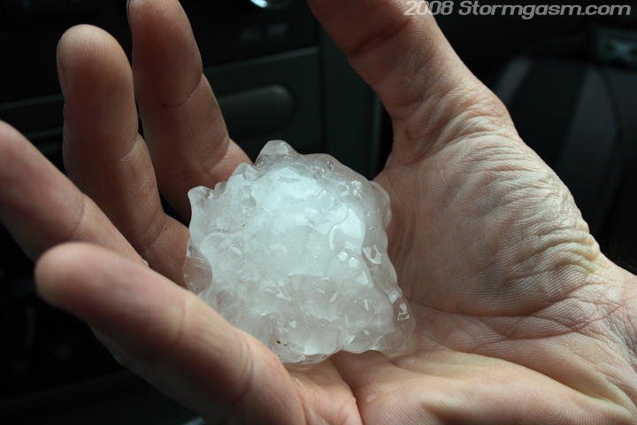 |
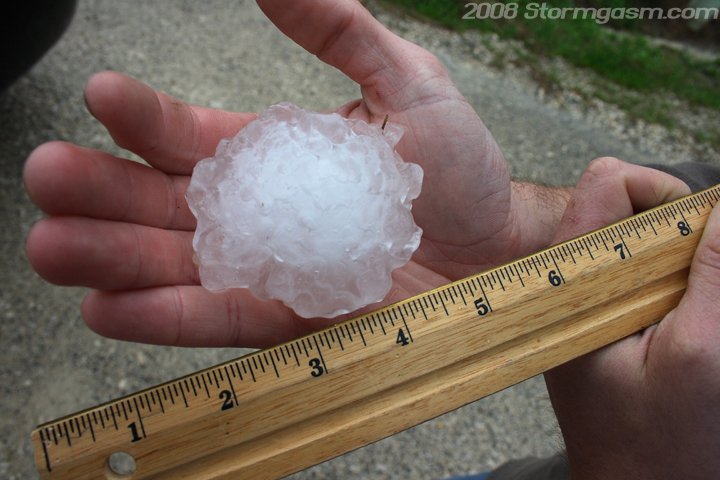
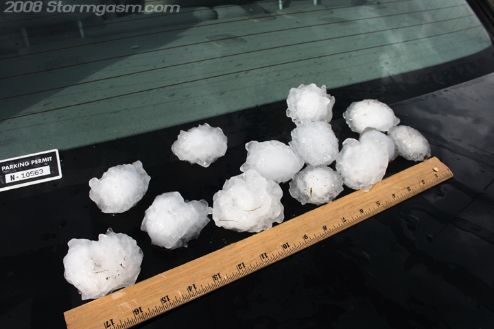
| Just west of Little City, OK (yes, that's the name of the town) we encountered multiple baseball-sized hailstones on the ground. The largest hail stone was measured at 3.25 inches in diameter! Most were around baseball-size or smaller. The pics on the right show one of the larger hail stones around 3 inches in diameter. | 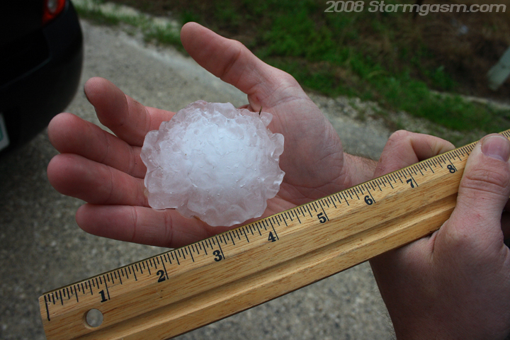 |
 |
|
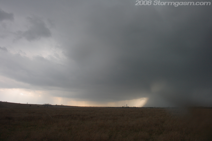
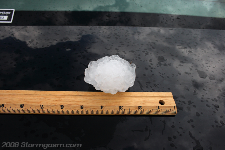
The pics on the right show some of the hailstones we found west of Little City, OK. Around this time a tornado was reported, but we had a good view of the updraft base and never saw anything suspicious. |
 |
 |
|
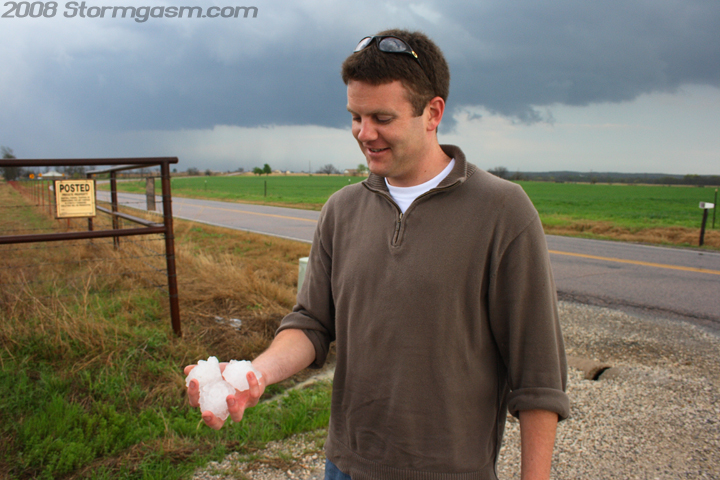
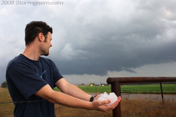
We stayed at that spot, probably too long, near Little City, OK gawking at the hail stones. The pics on the right show Cory with the hail. |
 |
 |
|
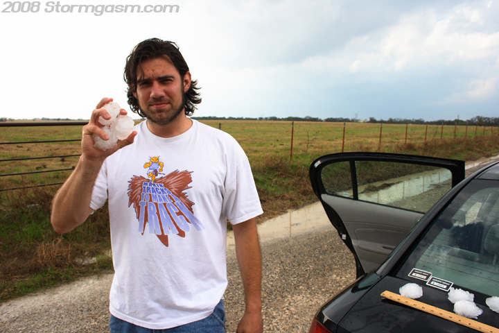
The pic on the right is yours truely with the hail...I don't want to sound like a girl or anything and I don't normally focus on appearance, but I look really 'ghetto' in this pic. I hadn't shaved in a week and my hair was matted from wearing a hat all day. |
 |
|
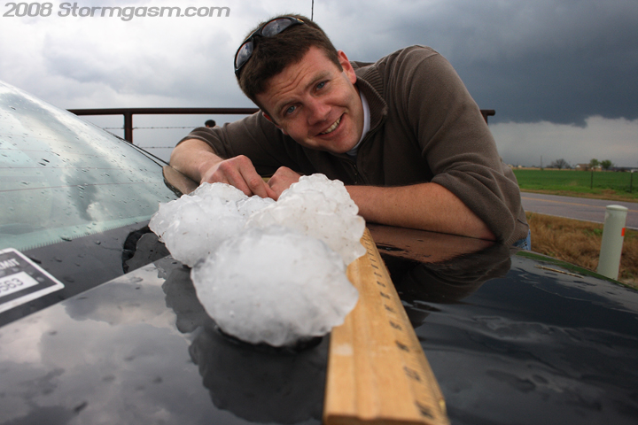
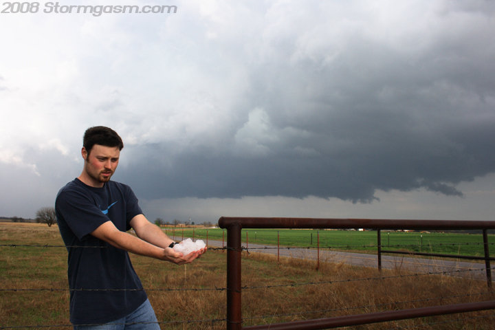
Pics on the right show Shawn with the hail with the updraft base of our storm in the background. |
 |
 |
|
The pic on the left is the last one I took with most of the big hailstones against a ruler on the trunk of the car. The pic on the right was looking NNW at the updaft west of Hugo, OK. The storm was continuously undercut by its own outflow all day, and it tracked due east between SR 3 an SR 70. We said farewell to the storm NNE of Hugo, OK on SR 147. We got a pounding from a line of storms, which developed along an advancing cold front along SR 3, so we had a long wet drive home. |
 |
 |
Home
| Storm Store | Photo
Gallery | Message
Board | Storm Chases | Latest
News
Stock Footage | About
| Contact | Editorial
| Weather Links
Copyright 2004 Stormgasm.com. All rights reserved.