March 30, 2007 Southwest Texas Supercell
|
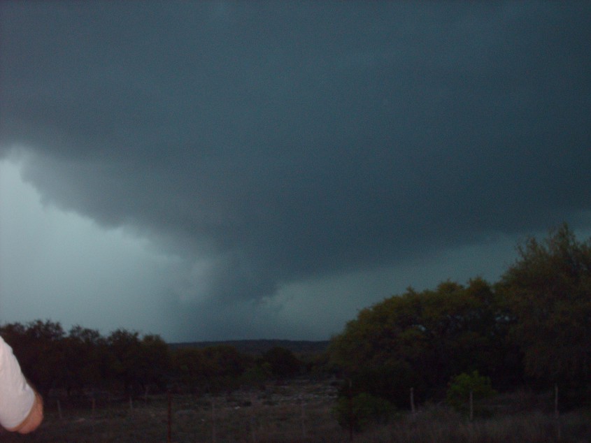
Jim Bishop and MaryLeigh Sanders left Houston at 6:45am on Friday, March 30, 2007. The plan was to drive west to San Antonio and stop at the Flying J truck stop to look at weather data via WiFi on the laptop. Enroute Simon called up Jim and gave him some nowcasting data, and advised him to go west to the town of Comfort. Jim and MaryLeigh intercepted an hp supercell in Comfort and followed the storm north and east on small country roads. They witnessed a weak wall cloud near Comfort. Futher to the northeast they came right up next to the mesocyclone and experienced incredible inflow into the storm. Scud fingers were forming at the cloud base, but no funnel or tornado was observed. Another mile up the road they came across an incredible flood from a creek overflowing onto the road. The water reached 3 feet deep and large tree branches were being carried by the water across the road. Jim was forced to drop the storm and find the quickest route back to I-10 in hopes of catching another storm further west. After driving south for another 12 miles, they found a small west bound road that lead back to Comfort. Unfortunately about 3 miles east of comfort they encountered an even more impressive creek flood. It looked like a river was flowing over the road, with water reaching nearly to the top of a stop sign. The water must have been 4-5 feet deep! Later that afternoon Aaron Ruppert informed them of an isolated supercell developing west of Del Rio. Jim was in Junction, and drove southwest of a state highway towards the storm. Near the intersection of 277 & 377 they intercepted the storm. Below are the pictures. This supercell had incredible structure. Looking to the west they could see a textbook RFD occlusion. The photos don't really show it, but a funnel did form and dissapeared in the rain. The rotation associated with the low level meso was quite impressive, and it's quite likely that at least a brief rain wrapped tornado was seen. After that meso occluded a new wall cloud developed just west of the road. The wall cloud crossed the road and the chase was over! |
Supercell north of Del Rio, near the intersection 277 & 377.rm Chasing
 RFD occlussion |
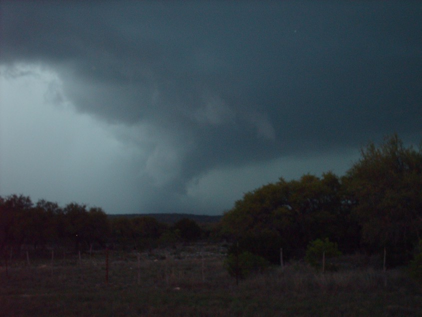 Funnel and probably rain wrapped tornado |
 looking north at new wall cloud about to cross road |
Home
| Storm Store | Photo
Gallery | Message
Board | Storm Chases | Latest
News
Stock Footage | About
| Contact | Editorial
| Weather Links
Copyright 2004 Stormgasm.com. All rights reserved.