March 26, 2009 Saint Jo, TX Tornado
|
March 26, 2009: Juston Drake and Simon Brewer intercepted a tornado and parent supercell in Northcentral Texas in Montague and Cooke Counties. The tornado was documented around 7:15-7:30 pm CDT. The tornado was causing debris on the ground between 1.5 and 2 minutes. This setup was conditional (but aren't all setup conditional?): relatively cold mid-level temps were in place over the Red River region of OK/TX, a dryline-warmfront intersection had developed west of Gainesville, TX, a small area of low-level cloud cover had mixed-out east of the dryline and 60 deg F surface dewpoints had advected into the 'triple point' area. The NAM and RUC forecasted 2000-3000 J/kg of SBCAPE in a relatively small region near the 'triple point' and forecasted convection in the evening over that location. We thought a small imbedded wave in the mid-level flow would help add some upper-level forcing to initiate convection near the 'triple point'. Juston and I targeted the 'triple point' along the Red River west of Gainesville, TX. We thought there would be a small window of oppurtunity for a storm to stay surface-based and produce a tornado due to a small region of surface-based instability.
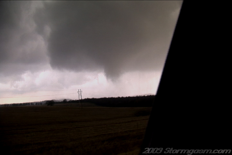
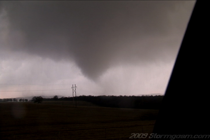
Image on the right shows the tornado west of Saint Jo, TX south of Highway 82 in its early development. Notice the nice RFD clear slot 'cutting' east (left of the meso in image) of the meso or tornado cyclone. |
 |
|
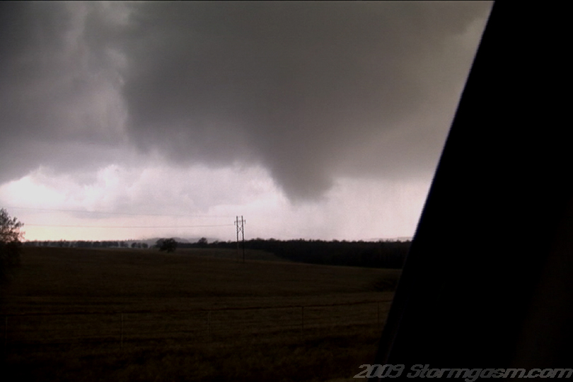
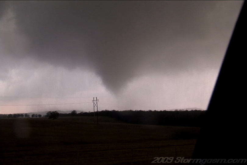
The warm front lifted northward and stalled along the Red River in the late afternoon. Dry air advected over the dryline and helped to mix-out the low-level cloud cover a few counties east of the dryline. By early evening convective towers had developed near the dryline-warmfront intersection. One storm developed on the Oklahoma-side of the River, but dissipated. A few more towers made failed attempts, and eventually a cell developed near Ring Gold, TX. The cell pulsated and eventually became organized and developed supercell characteristics near Nocona, TX. The storm then fluctuated in intensity most likely due to interactions with a weak cell the developed south of the storm. The supercell then regained organization and occluded a meso or tornado cyclone south of Highway 82 west of Saint Jo, TX. A bowl-shaped funnel developed under a rapidly rotating wall cloud a debris cloud quickly developed under the large funnel. The funnel then morphed into a cone-shape and rain wrapped around the tornado vortex. Tornadic wind speeds appeared to be affecting the surface for ~1.5 to 2 minutes. The tornado cyclone then weakened and shrank in area as it was further occluded. Image on the right is still looking SSW at the tornado south of Highway 82: the structure was awesome, but we were getting some rain at our location at the time of the image. |
 |
|
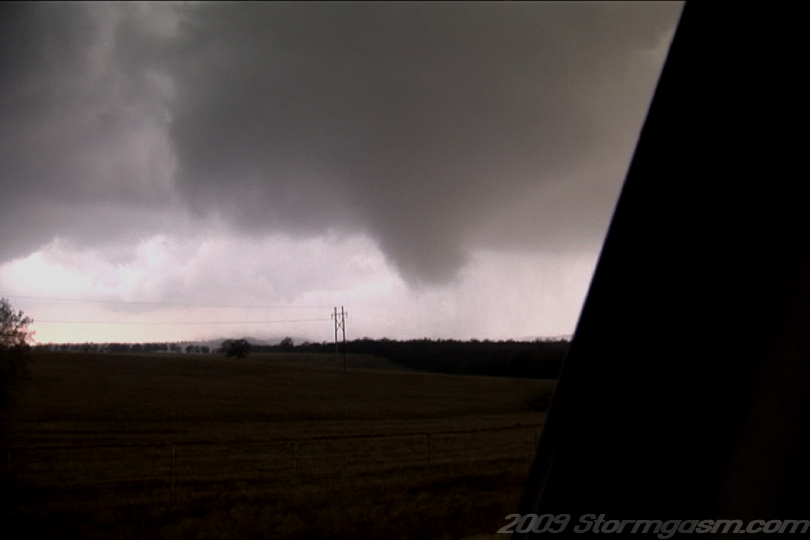
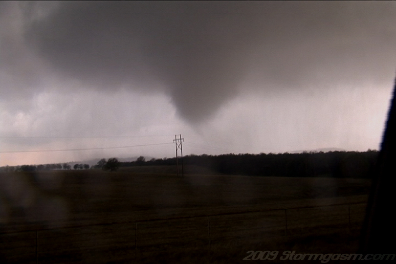
The image on the right shows the tornado in its early stages south of Highway 82 west of Saint Jo, TX, well, the tornado was never able to finish the 'classic' cycle: it began as a 'bowl-shaped' funnel with debris at the surface, morphed into a cone-shaped funnel with debris at the surface, and then became a broad bowl-shaped funnel again and weaked in intensity. It was never able to tighten into a 'rope-shaped' funnel or vortex. |
 |
|
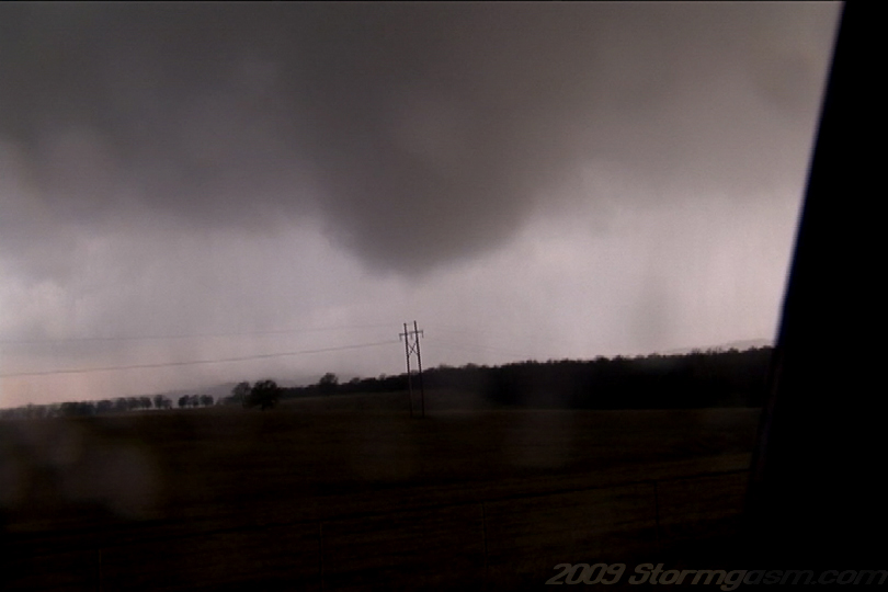
Image on the right shows bowl or cone shaped tornado west of Saint Jo, TX.
|
 |
|
|
 |
|
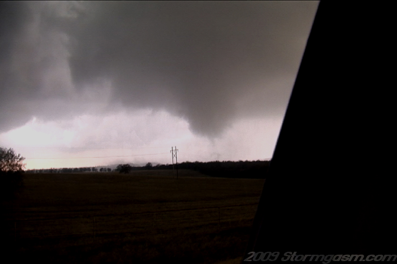
Image on the right shows the tornado south of Highway 82 west of Saint Jo, TX: the tornado is at or near its peak intensity in this image. Rapid scud fragments connecting the bowl/cone shaped funnel with the ground quickly developed and evaporated, rapid rainband rotation was seen, and debris was near or at its peak in this image.
|
 |
|
Image on the right shows the tornado as it took more of a 'cone' shaped appearence.
|
 |
|
Tornado was stil in progress...
|
 |
|
Tornado was still in progress...
|
 |
|
The image on the right shows the tornado at the end of its cycle; there is a bowl-shaped funnel rotating over the Texas landscape with rain bands wrapping around the vortex. The tornado vortex appeared to have weakened below tornado wind speed standards at the surface shortly after this image. We, also, moved shortly after this image and the tornado vortex crossed Highway 82 at this location as a rain-wrapped mass of scud and a rope funnel. The supercell, despite showing an impressive radar signature, appeared to become elevated, or drawing its moisture above the boundary layer, after producing the initial tornado. We followed the storm to Gainesville and called it a day. |
 |
Home
| Storm Store | Photo
Gallery | Message
Board | Storm Chases | Latest
News
Stock Footage | About
| Contact | Editorial
| Weather Links
Copyright 2004 Stormgasm.com. All rights reserved.