March 2nd, 2008 Eagle City, OK Tornado
|
March 2nd, 2008: Simon Brewer intercepted a tornadic supercell in Western/Central OK. The supercell produced a tornado near Eagle City, OK northwest of Watonga, OK. The two pics on the right are from SR 33 WSW of Watonga, OK looking north at a very photogenic tornado. |
 |
 |
|
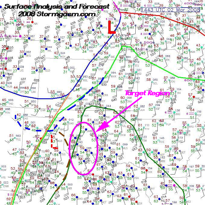
The pic on the right is a surface analysis and projected forecast with forecasted sfc boundaries and target area I created before I left in the morning; a high amplitude shortwave was digging into New Mexico and small perturbations in southwesterly flow helped to mix the dryline east and initiate storms across KS, OK, and TX. I forecasted the dryline to mix into Western OK and NW TX, while the cold front surged south and southeast into NW OK and the TX Panhandle. The center of my target was Hobart, OK, so I took Highway 9. I wanted to stay north of the Red River where low-level shear was best and I didn't want to go too far north of I-40 due to problems with the cold front undercutting storms. |
 |
|
I parked on a gravel road a few miles north of Hobart and sat with my dog 'Molly', while waiting for the CAP to break along the dryline. The pic on the left is of weak towers showing up to my west along the dryline. Larger towers began developing further north near I-40 I began driving north towards Cordell, and took the pic on the right of an small anvil to my northwest towards I-40. |
 |
 |
|
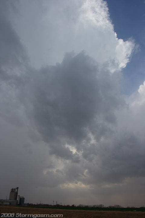
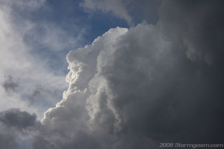
I filled up the tank in Cordell and decided to move further north to Clinton. I parked on the south side of Clinton and watched large towers develop along the dryline to my northwest, west and southwest. The 2 pics on the right are of a more vigorous tower west-southwest of Clinton. |
 |
 |
|
Pic on the left is a radar image showing the large cluster of towers and small storms developing along the dryline in Western Oklahoma. According to the data my nowcasters (Jim Bishop and Aaron Ruppert) were relaying to me there was no 'hot spot' to be; so I decided to use visual interpretation of my surroundings to guide me to the right storm. Pic on the right shows multiple updraft bases and rain shafts to my west. |
 |
 |
|
The pic on the left is a mid-level funnel southwest of Clinton associated with one of the more vigerous updrafts in the cluster of storms. The pic on the right shows a well developed and heavy rain shaft as 2 updrafts merge southwest of Clinton. |
 |
 |
|
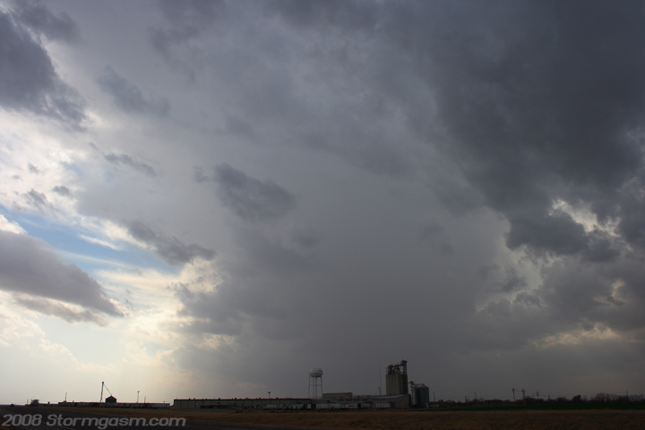
The pic on the left shows better organization of the cells as they merge west of Clinton and move northeast. I left my location south of Clinton and drove north on SR 183 to keep up with the organizing storms. I drove through some heavy rain and graupel, turned ENE on SR 33 and stopped northeast of Thomas and watched a lone supercell take shape. The pic on the right shows the single updraft and FFD of the new supercell. |
 |
 |
|
The pics on the right are at the same location NE of Thomas, OK. They show the storm getting better organized with a growing flanking-line and small amounts of scud under the center of the strengthening mesocyclone. |
 |
 |
|
I was really getting excited at this point, because an RFD clear slot can be seen punching into the middle of the updraft base in the left pic. The pic on the right shows the top of the updraft seen from my location. |
 |
 |
|
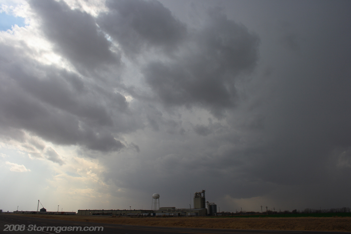
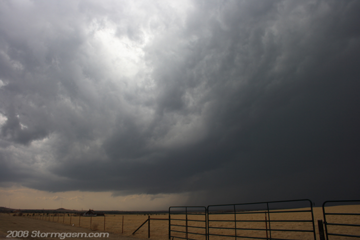
Well, the RFD punched pretty deep into the updraft and made a nice occlusion, but little to no scud developed in the process, and the backside of the updraft was showing fluctuations between 'fluffy' and 'crisp' structure. I was concerned this region didn't get as much daytime heating and the CAPE might have been insufficient for the storm to continue intensifying. Pics on the right show the flanking line and RFD clear slot. |
 |
 |
|
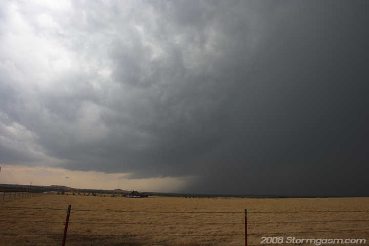
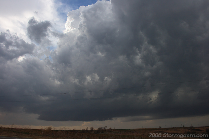
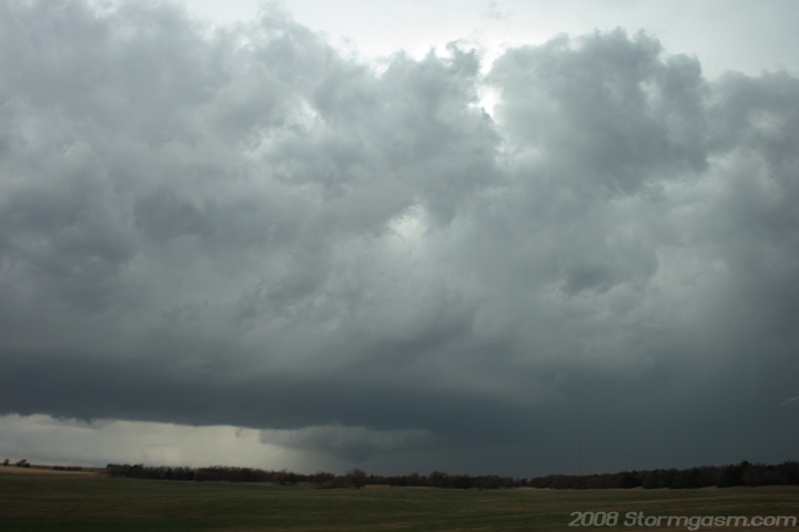
Here is where I made my biggest mistake of the day and almost cost me witnessing the Eagle City tornado: The pic on the left was from northeast of Thomas and shows a nice supercell, but the cold front can be seen in the background in the form a big gustfront and cloud bases. I made a bad decision and tried to go south on SR 54 after a supposedly more intense storm south of Weatherford. Only a few miles south on SR 54 I saw incredible amounts of scud rising into the occlusion on the supercell I just left!!!! I made an immediate U-turn and gunned it back north and northeast on SR 33. Due to my bad decision I lost considerable ground on the supercell and was playing catch-up. |
 |
|
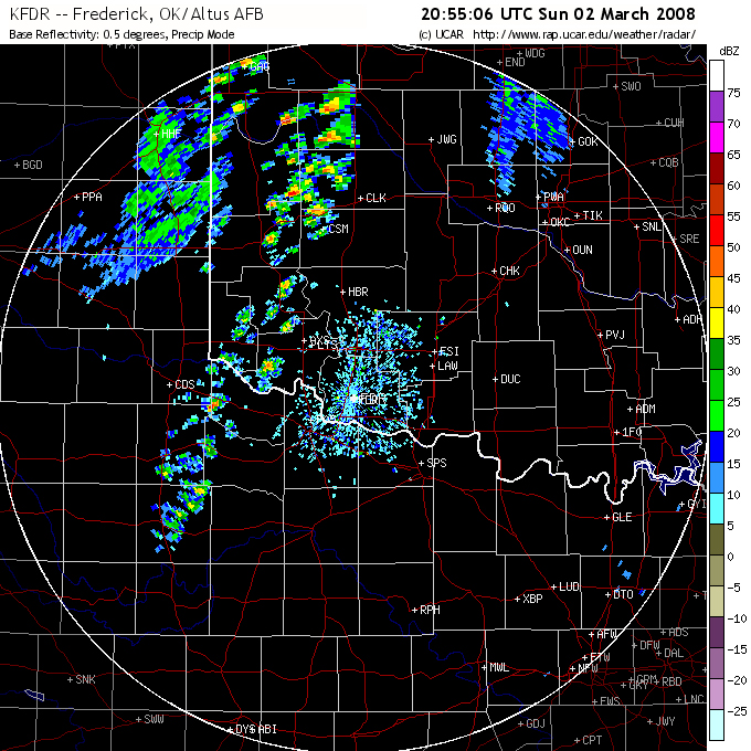
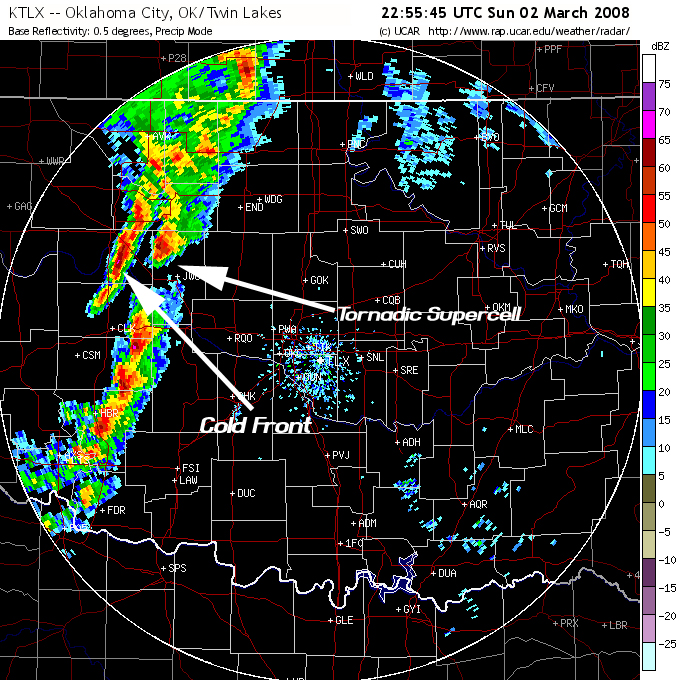
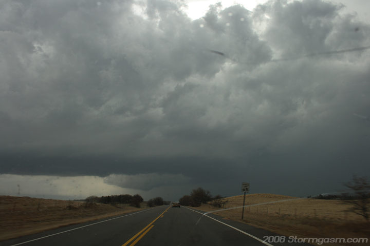
The pic on the right is of the supercell I just left after I made a U-turn on SR 54 and was gunning it north. A large bowl funnel can be seen on the occlusion. The pic on the left is a radar analysis near the time of this picture showing the supercell and close location of the cold front. |
 |
 |
|
The two pics on the right are video stills of the tornado as the full condensed vortex was on the ground. I got only seconds of video at this point because I was driving fast and holding an obtrusive video camera in the general direction of the tornado. Shortly after this time the tornado took more of a 'cone' or 'bowl' funnel shape with a small dirt debris cloud underneath the funnel. |
|
|
|
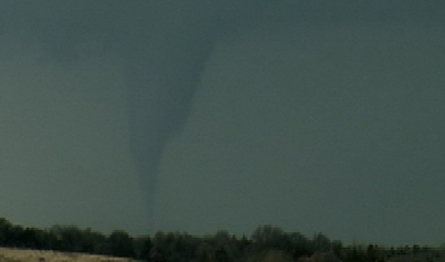
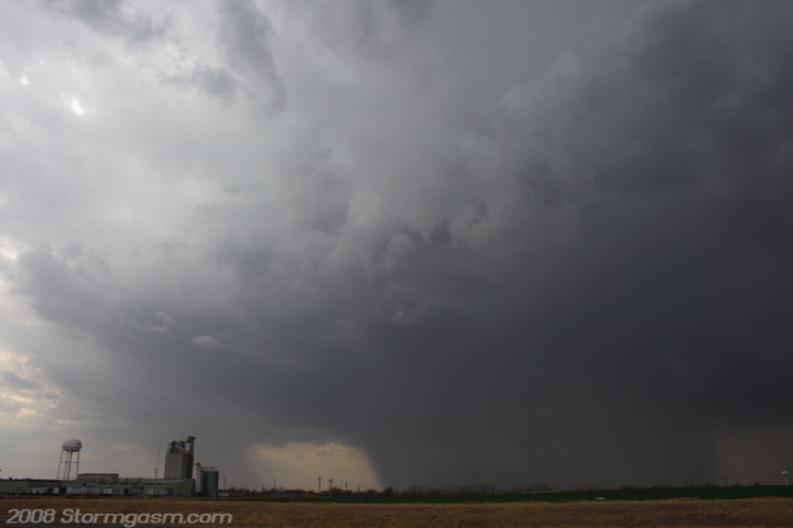
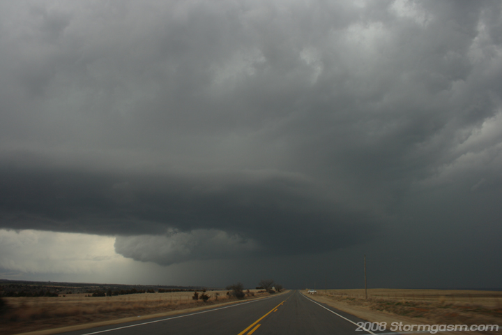
The 2 pics on the right show incredible 'text book' supercell structure with a large well defined flanking line, RFD clear slot, and occluded tornado cyclone! These pics are looking north from near the intersection of SR 33 and SR 270 west of Watonga. The tornado is on the ground at this time and can be seen as a cone/bowl funnel in these pics. |
 |
 |
|
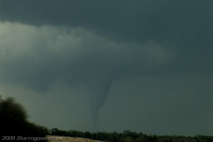
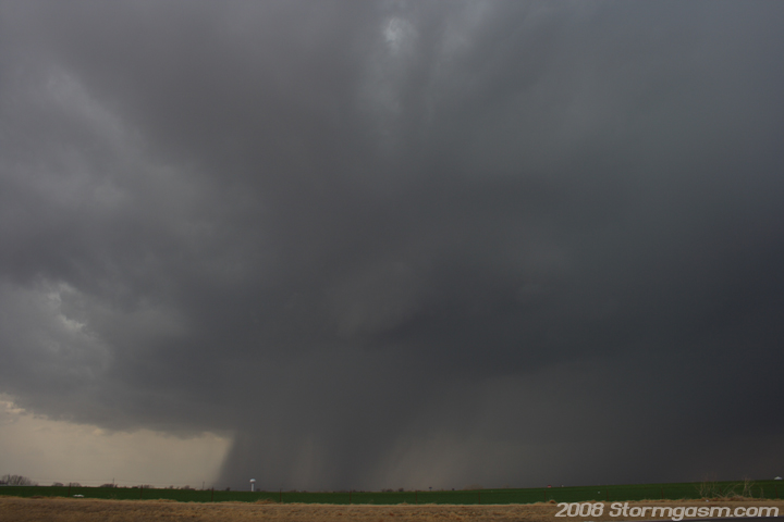
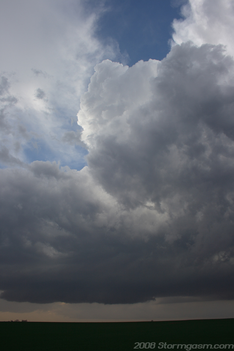
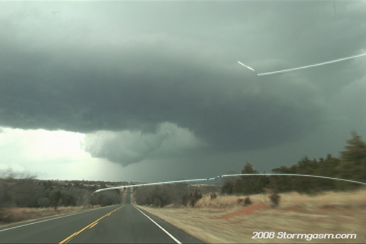
The 2 pics on the right are from SR 58 looking due north at absolutely incredible supercell structure!! This storm transformed from a multicellular mess into absolutely 'classic' supercell! Tornado is apparently still on the ground with debris; funnel can clearly be seen and I witnessed very rapid rotation with the funnel and tornado cyclone. |
 |
 |
|
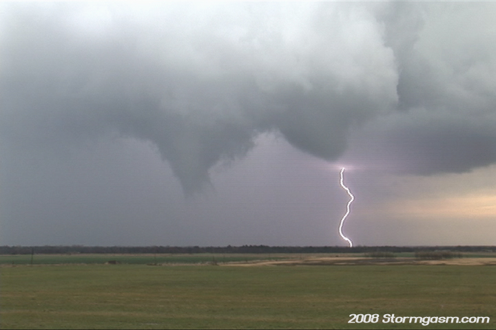
I parked on the south side of Canton and video taped the funnel and wall cloud to my east as the storm propagated northeast away from my location. The pic on the left is a vid still as the tornado crossed SR 58 to my north, while I still was playing catch-up. The still on the right shows the wall cloud and bowl funnel (on right side of wall cloud) with lightning in background. A huge gust front (the cold front) overtook me at about this time and the temp dropped quickly. It was the end for this supercell. |
 |
 |
|
The
cold front surged ESE and undercut the supercell, so I hauled it southeast
hoping to catch some decent storms before nightfall near or south of
I-40. Aaron Ruppert informed me the cells south of I-40 were merging
into a line, so I decided to try my chances at lightning south of Minco,
OK. I parked south of Minco for a bit of time and watched the approaching
gust front, but not many CG's were occuring, so I headed back to Norman.
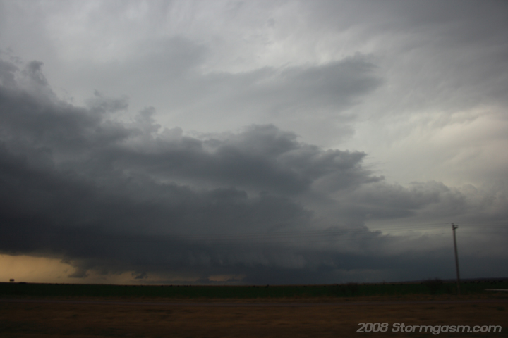
Pic on the right is the shelf cloud associated with the cold front storms
taken near Watonga.
|
 |
|
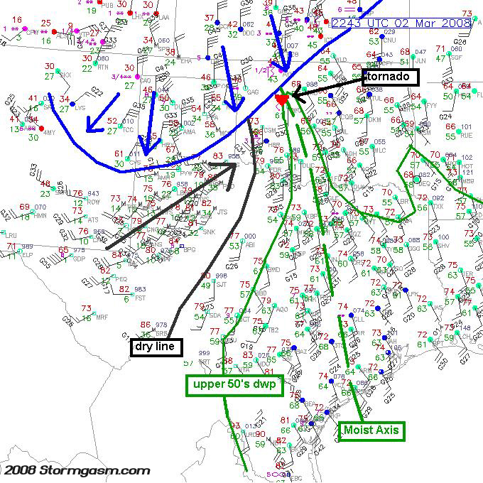
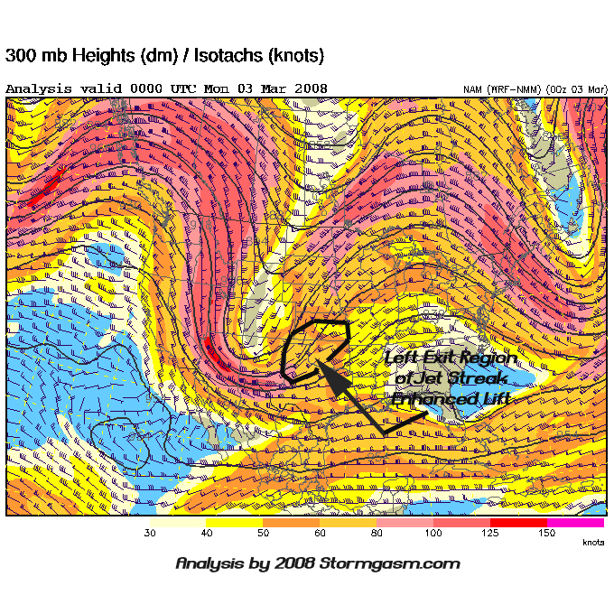
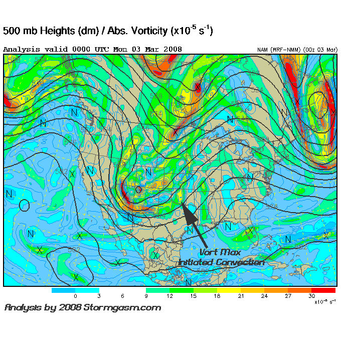
Pics on the right show post analysis I conducted after arriving in Norman using NAM 500mb Vort and 300mb analysis data at 0z on Mar 3rd. Also, is my post analysis of a NCAR surface map from near the time of the Eagle City, OK tornado. |
 |
 |
 |
Home
| Storm Store | Photo
Gallery | Message
Board | Storm Chases | Latest
News
Stock Footage | About
| Contact | Editorial
| Weather Links
Copyright 2004 Stormgasm.com. All rights reserved.