February 21, 2010 Kaufman County, TX Supercell and Funnels
|
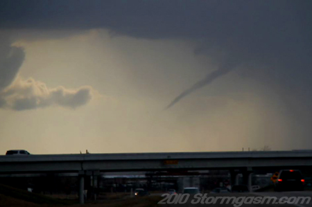
February 21, 2010: Simon Brewer documented a supercell and two funnel clouds in North Central Texas. Simon's Report: I left Norman in the late morning and drove to Fate, TX. A region between Denton, Dallas, Mount Pleasant, and Tyler, TX appeared to be favorable for strong storms: an upper-level clear slot was moving over North Texas and low-level clouds were evaporating in its wake, deep-layer shear appeared adequate for supercells, a dryline was quickly mixing east providing warm temperatures near the dryline boundary, relatively high surface dewpoints in the mid-50's were in place, and an east-west pseudo warmfront/outflow boundary was located along I-20. There was a moderate vort-max associated with a strong shortwave rotating toward the region, which might provide the necessary upper-level lift to initiate storms. I was concerned about the progression of the cold front near the Red River, which could surge too quickly, undercut storms, or force an elevated thunderstorm complex. The image on the right is a video still looking south-southwest at a rope funnel cloud in western Kaufman County, TX. |
 |
|
A storm developed to my west-southwest in the afternoon near Dallas, TX and slowly tracked southeast. The storm exhibited supercell structure; a single dark rain shaft, large rainfree base, flanking line, inflow bands, and eventually a low-hanging wall cloud. I watched a relatively large bowl funnel develop then turn into a cone, and then rope-out. I was approximately 15 miles from the funnel cloud and never saw debris from my location. The mesocyclone appeared to be occluded, so I decided to drive south closer to the updraft of the storm. I was driving south a new rope funnel developed at the edge of the forward flank downdraft and I quickly pulled over taking a few pictures and grabbing a few seconds of video. I did not have a good view of the ground under the rope funnel cloud, so I do not know if any debris was at the surface. I called Jim Bishop and he relayed my report to the DFW NWS Office. I don't believe this storm ever acquired a severe thunderstorm or tornado warning.
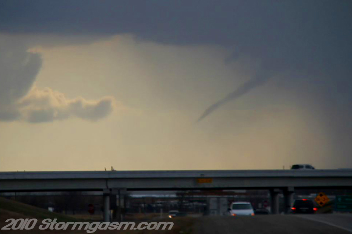
The image on the right is a video still looking south-southwest from the intersection of FM 148 and I-20 at a funnel cloud in western Kaufman County, TX. |
 |
|
I continued driving south and eventually southeast staying east of the supercell thunderstorm. The storm formed a new rotating wall cloud, but it was quickly undercut by the cold front. The updraft continued to rotate, but it was decreasing in size and was elevated behind the cold front as it surged southeast. It felt incredible outside with temps in the low 70's and dewpoints in the mid-50's. I ended my day shooting sunset images on FM 3080 east of Mabank, TX.
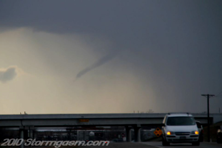
The image on the right is a video still looking south-southwest from the intersection of FM 148 and I-20 at a funnel cloud in western Kaufman County, TX. |
 |
|
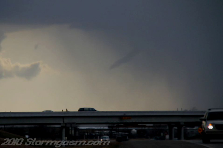
The image on the right is a video still looking south-southwest from the intersection of FM 148 and I-20 at a funnel cloud in western Kaufman County, TX. |
 |
|
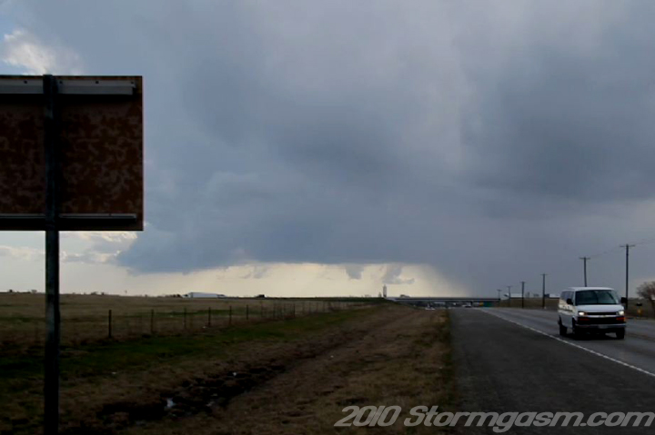
The image on the right is a video still looking south-southwest from FM 148 at a supercell in western Kaufman County, TX.
|
 |
|
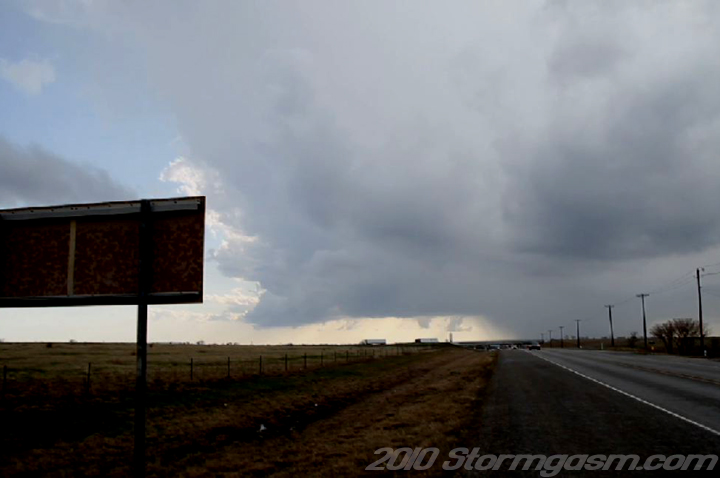
The image on the right is a video still looking south-southwest from FM 148 at a supercell in western Kaufman County, TX.
|
 |
Home
| Storm Store | Photo
Gallery | Message
Board | Storm Chases | Latest
News
Stock Footage | About
| Contact | Editorial
| Weather Links
Copyright 2004 Stormgasm.com. All rights reserved.