February 11, 2008
Rare Texas MCS Event
|
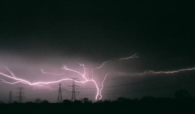
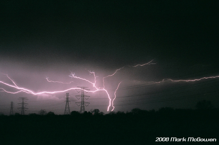
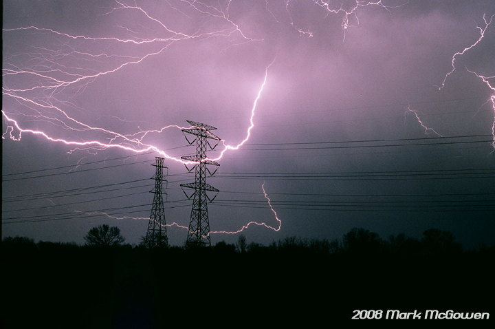
On February 11th, 2008 Mark McGowen intercepted a rare tightly packed mcs south-southwest of Houston, TX. The compact complex of storms developed during the afternoon and continued into the night. Analysis of radar, surface, and UPA data suggests the strong circulation in the storm was not a supercellular-mesocyclone, but instead a meso-low driven by latent heating of the low and mid-levels of the storms. The 2 pics on the right are incredible lightning shots by Mark on the north side of the storm complex. |
 |
 |
|
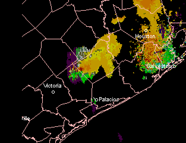
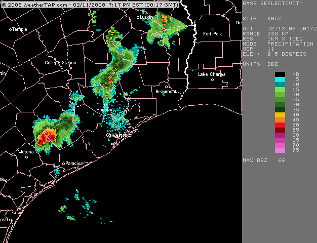
Pic on the left is a link to a radar loop of the storm complex near full strength. Pic on the right is a link to SRVEL Tilt 1 loop, which show a large and very intense circulation. Notince in the base reflectivity loop the lower DBz in the center of the storm. |
 |
 |
|
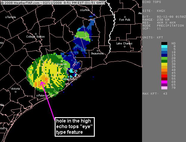
The pic on the left is a link to the Houston radar loop of the storm near peak intensity. The pic on the right is an echo tops image of the storm; notice the 'hole' or lower echo top data in the center of the higher 'doughnut-like' ring of high echo tops. This suggest sinking motion in the center of the storm kind of like and 'eye' in a tropical cyclone. |
 |
 |
|
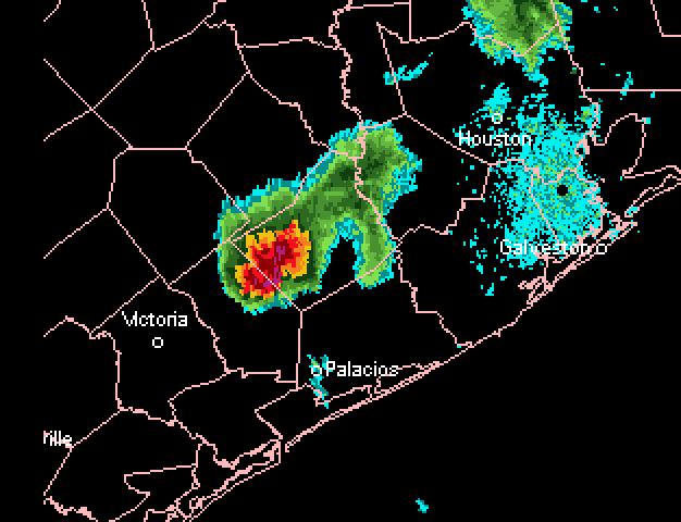
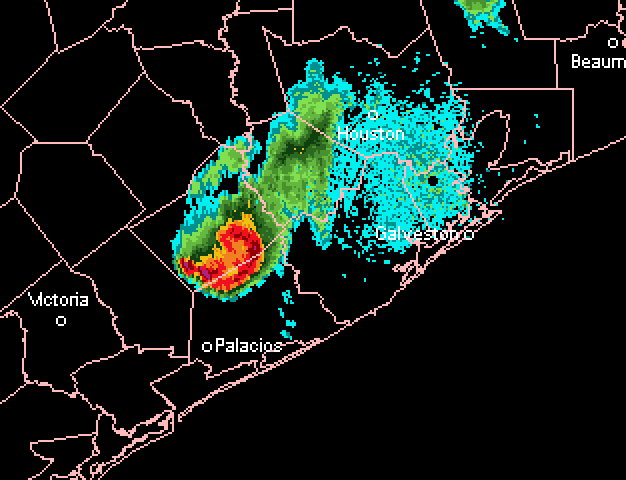
Pics on left and right are links to radar loops as the storm complex was passing SSW of the Houston Metro Area. These loops are show the storm losing its structure and wrapping in dry or cool air and moving into a region of lower CAPE. It's late into the night and the boundary layer was no longer mixed. The radar loops clearly show the storm 'bowing-out' or turning into a larger bow echo instead of the compact system. Nice bookend vortex on north side of bow echo, sometimes those regions produce brief, but sometimes strong tornadoes. |
 |
 |
|
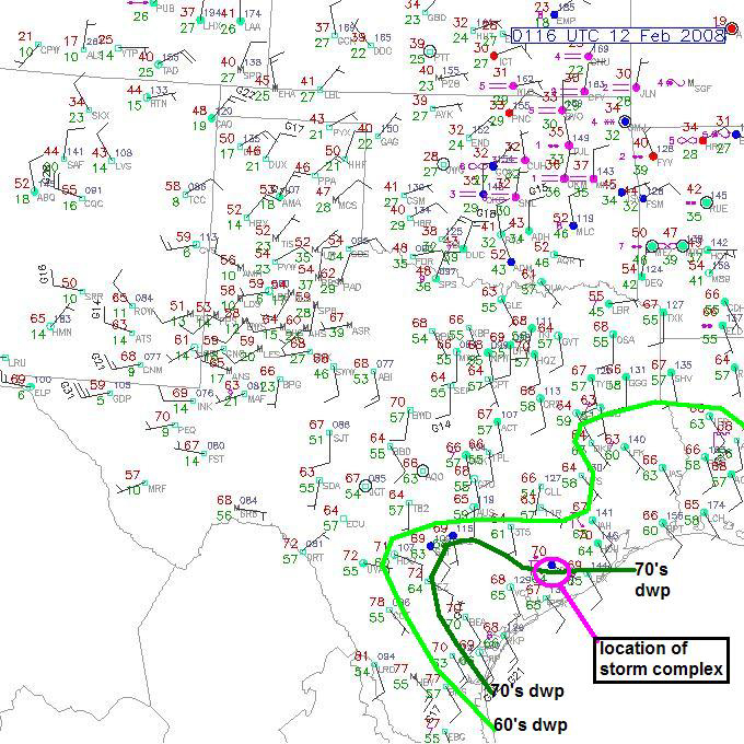
Pic on right is a surface analysis showing the mid- to upper-60's and 70's dewpoint contour, which the storm seemed to be following due east towards the Gulf of Mexico. The pic on the right is an analysis of the Corpus Cristi sounding SSW of the storm complex; it clearly shows a significant amount of CAPE and a very weak inversion at 0z. I wish this storm would have passed directly over a surface observation station at its peak intensity, because I would believe winds sustained between 40 and 55 mph with higher gusts were possible in a 5-15 mile radius surrounding the center of circulation. INCREDIBLE EVENT! Hopefully someone will do a further analysis of event with more data than I've shown on this web page. |
 |
 |
Home
| Storm Store | Photo
Gallery | Message
Board | Storm Chases | Latest
News
Stock Footage | About
| Contact | Editorial
| Weather Links
Copyright 2004 Stormgasm.com. All rights reserved.