February 10, 2009 Oklahoma Tornadic Supercells
|
February 10, 2008: Simon, Juston Drake, and Shawn Maroney documented multiple tornadic and non-tornadic supercells across central Oklahoma. An unseasonably favorable setup for tornadic supercells appeared evident over the weekend prior to this day: an intense shortwave trough propagating across the southwestern U.S. and into Texas provided upper-level ascent, cold mid-level temperatures, more than adequate shear combined with Gulf moisture produced an environment favorable for severe weather in mid-February. My forecast focused on a region in the front left quadrant (left-exit-region) of the mid-level jet axis, west of the low-level jet axis, and over the region of the deep low-level moisture nose, which by Tuesday morning, the 10th of February, appeared would be across central Oklahoma by late afternoon. It appeared deep low-level pressure falls associated with a deepening surface low over the Texas Panhandle region in advance of the intense Southwestern U.S. trough would hold the dryline further west than initially anticipated Monday night across western Oklahoma and northwest Texas for most of the day Tuesday allowing relatively deep low-level moisture to advect northwest under very cold (~ -20 deg C) 500mb temperatures across central Oklahoma. I decided to play the edge of the deep low-level moisture nose, which was southwest to northeast orientated north of the I-44 corridor by mid-afternoon. It appeared the mid-level winds would be from the south-southwest, which would support a north-northeast storm motion, which would allow for stronger 'right-turning' storms to move northeast nearly parallel to this low-level moisture gradient. |
|
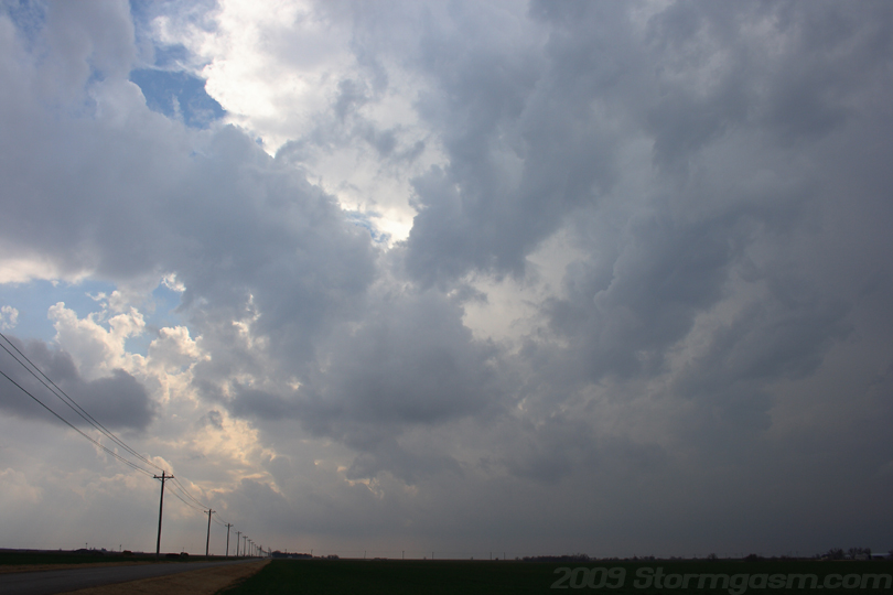
We drove west from Norman, OK around noon with great anticipation; this was the best February Southern Plains setup I've seen in many years. I knew there would probably be multiple tornadoes on this day, so I was going to do my best to see one. Upon leaving Norman convective towers were already visible to our northwest, and soon after we were seeing convective towers to our southwest. The towers to our northwest appeared to be in a poor environment and would quickly move into a much less favorable environment. We focused our attention on a rapidly developing cell near Anadarko, OK, which had a rather weak, but broad region of reflectivity. If this cell were to continue devoping it appeared it would move into our target region and have a good chance to produce tornadoes. We parked on the side of the road near a farm west of Tuttle, OK. The once weak Anadarko cell quickly developed an intense precipitation core to our southwest and radar was detecting 35k foot echo tops. We decided this would be our storm. Image on the right shows an rapidly growing infant anvil and part of the distant precipitation core associated with our initial storm. The image is looking south from a location east of Tuttle, OK. |
 |
|
The storm was rapidly intensifying and had a great shape on radar, but it still appeared to be organizing, so we repostitioned to our north (on SR 152 east of Union City) to keep a more favorable position on the storm. We had to punch through a portion of the FFD to gain visual of the main updraft, or at least what we thought was the main updraft at the time. We drove east of the rain and pea and penny-sized hail and watched what appeared to be a long gust front. Not until later review of the radar reflectivity did I realize there were two subtle maximum regions of reflectivity associated with this elongated cell, which implied there were two large competing updraft associated with this developing storm. Image on the right was taken ~5-10 miles east of Union City looking south at one of two main updrafts associated with this developing cell in central Oklahoma. The second updraft was behind my location and I originally thought it was a large inflow band (beaver's tail) flowing into this updraft. |
 |
|
We were briefly overtaken by the precip (small hail and heavy rain) and punched east to gain better position on the updraft, then I noticed a lowering quickly developing a few mile to our north. The northern of the two updrafts had quickly taken over and was now the dominant updraft for this storm. The lowering began to rotate and an inflow tail rapidly developed. A small funnel cloud quickly developed and then dissipated. An RFD gust front then developed and punched eastward. This storm, which moments ago was relatively linear and unorganized, was now a full fledged supercell. The image on the right is looking north at a portion of the young rotating wall cloud (left side of pic) and the RFD gust front (top-center portion of pic). The wall could showed rapid rotation at the time of this picture. |
 |
|
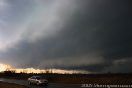
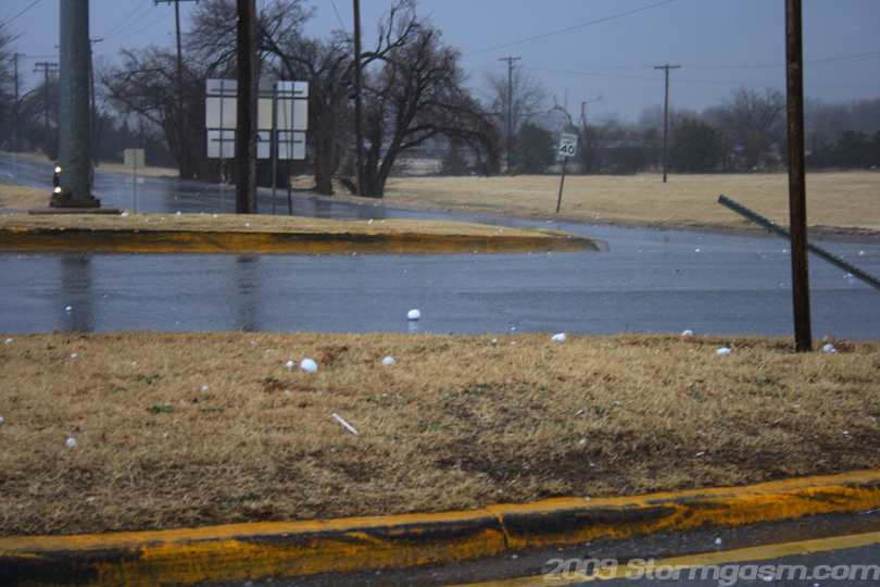
We turned north on SR 92 and crossed I-40 into the west-side of Yukon, OK. The structure was incredible at this time with a violently rotating wall cloud to our north and very powerful RFD winds hitting us. We encountered large hail ranging from golfball to baseball size across the west side of Yukon. Upon entering the west side of Yukon a tornado warning was issued for this storm. It sucked, but we wanted thought this cell had the was in the best environment and position to produce tornadoes, so we were forced to navigate heavy traffic, multiple traffic lights, and suburban streets to catch up to this storm. Image on the right shows a few baseball-sized hail stones in the grass and street on the northwestern side of Yukon. I wanted to stop, measure, take video and pictures of the large hail, but we had to catch the fast moving storm. It was horrible; we were hearing reports of damage, powerflashes, and "tornado on the ground" over the radio, while navigating the northwest side of OKC. We finally got on the Kilpatrick Turnpike, hauled it to I-35, and blasted north toward Edmond. We got to the east side of Edmond at the 'Waterloo Road exit and could see a massive wall cloud to our west with a dark rotating rain shaft associated with the wall cloud. We couldn't see the tornado from our position, but Shawn was watching live chopper tornado video on from Channel 5 on his netbook in the backseat, so we knew there was a tornado on the ground. We wanted to cut north and ahead of the wall cloud on I-35, but two police cruisers cut in front of us and created a road block on the interstate, so we exited at Waterloo Road and tried to keep up with the storm on pothole-covered, tree-lined, back roads to the east of I-35 and of course the tornado lifted, and the storm raced away from us. |
 |
|
We stopped, looked at some data, and decided to stay north of OKC and wait for more storms to approach our location and with in minutes another cell came to us. A supercell with an hook feature on radar approached and crossed our location on Douglas Blvd northeast of Edmond, OK. We documented nickel and quater-sized hail with this storm as it passed over our location. There appeared to be weak low-level rotation associed with a poorly organized wall cloud, so we let the storm pass. And what would you know, that storm quickly organized to our northeast and regained a tornado warning and I think may have eventually produced a tornado later in the afternoon/evening. The image on the right shows well-developed RFD gust front associated with the second storm as it passed over our location northeast of Edmond, OK. |
 |
|
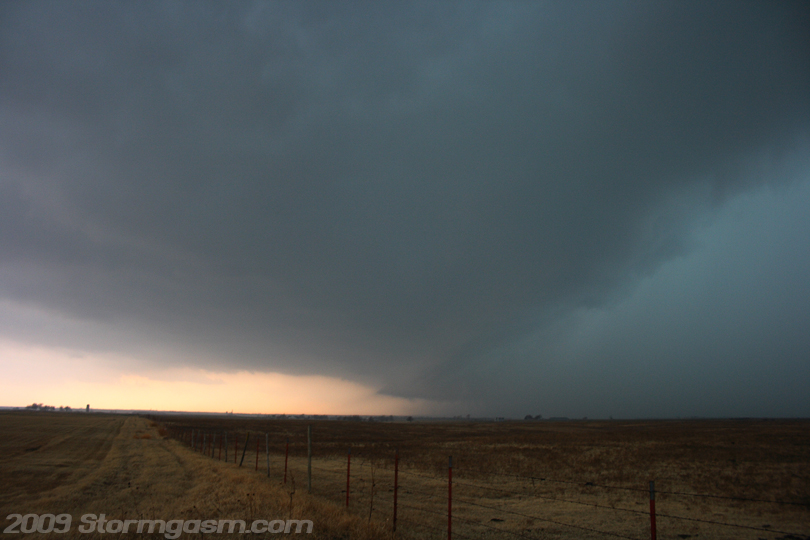
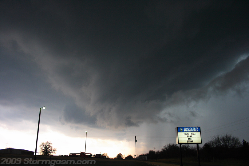
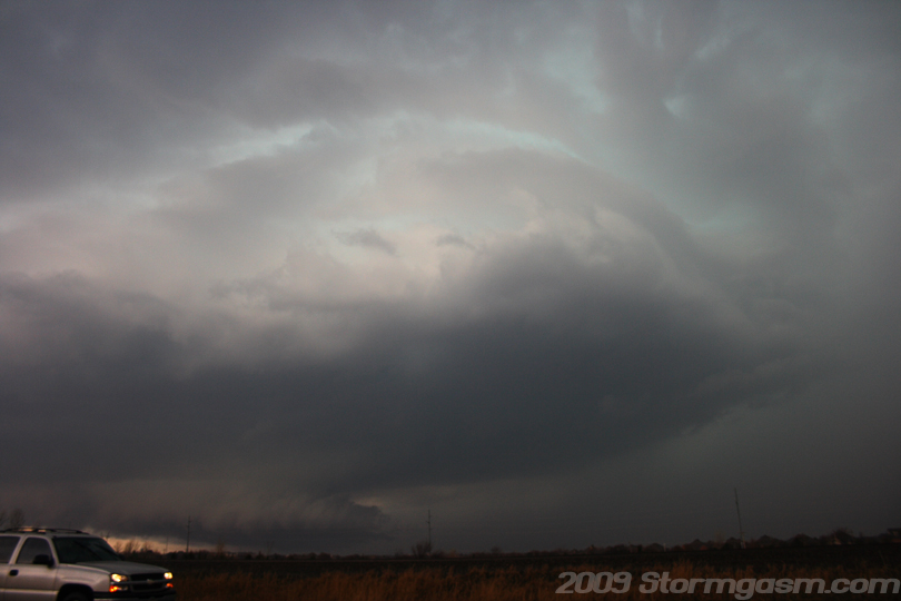
A tornado-warned supercell with good-looking radar signature was passing over Yukon and propagating northeastward in the direction of Edmond. We drove WSW and positioned ourselves on the northwest side of Edmond, OK and found a favorable location with a relatively good view to our southwest. The image on the right shows our third supercell of the day (third storm to pass over Edmond area) southwest of our location. The pic is looking southwest at a well-developed storm; mid-level rotation was evident, RFD gust front can be found on the lower left side, the wall cloud (bottom-center) appeared to have weak rotation, and relatively good right to left motion was observed with the tail cloud (bottom-right attached to right-side of wall cloud). This third storm had beautiful structure, but it appeared to have trouble in the lowest levels near the base of the wall cloud, possibly due to training over saturated rain cooled ground. |
 |
|
Image on the right is looking WSW at the third supercell of the day approaching our location. |
 |
|
Image on the right shows a well-structured supercell approaching Edmond, OK. |
 |
|
Image on the right shows a wall cloud approaching Edmond, OK. The wall cloud, though ominous, appeared to show little threat of producing a tornado; only weak rotation was observed with this wall cloud. |
 |
|
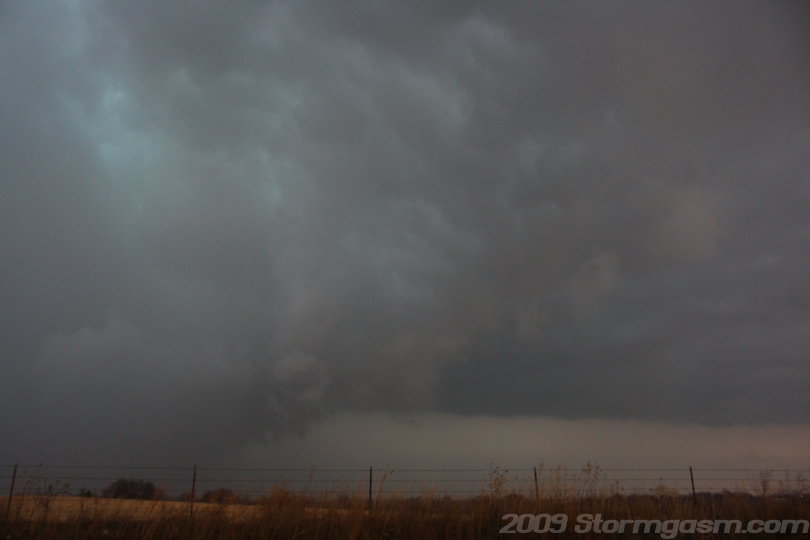
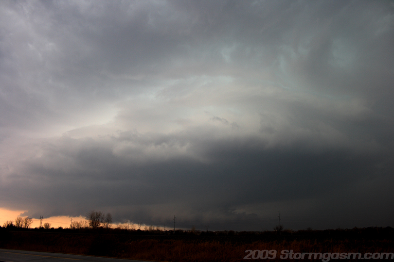
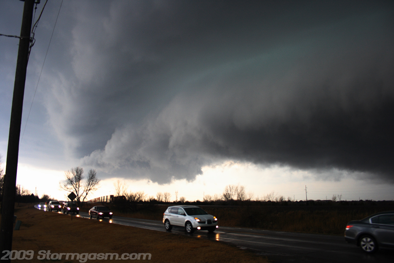
The image on the right is probably my favorite pic of this day, which shows a well-developed wall cloud and RFD gustfront structure to the southwest of our location on the northwest side of Edmond, OK.
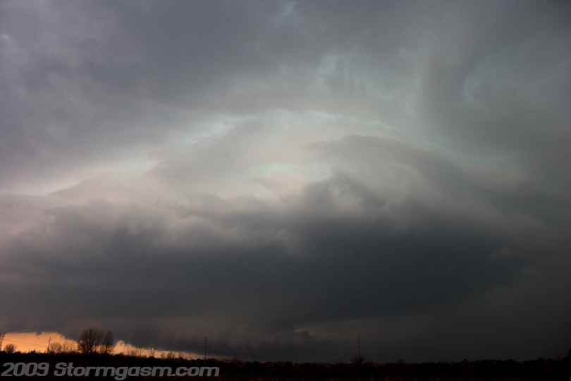
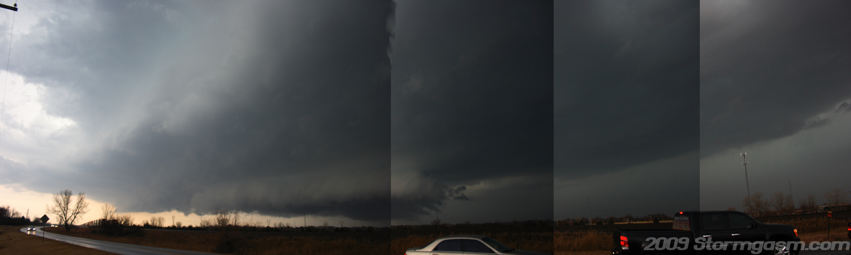
The next image is a composite panarama image I developed to show most of the updraft structure of this supercell storm as it approached Edmond, OK. Sorry, for the wierd blotches on the top-center portion of the image; I was attempting to 'smudge' the image as a test. |
 |
 |
|
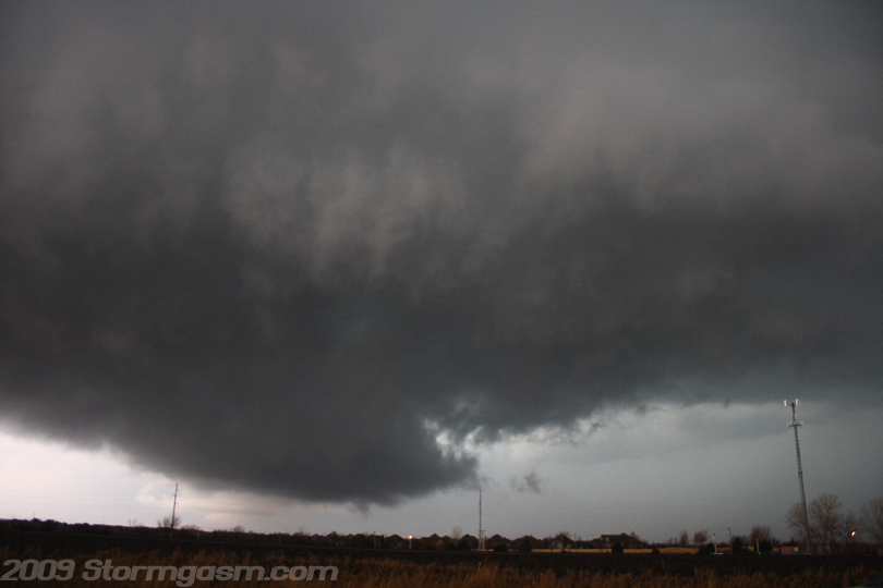
Image on the right shows a benign wall cloud approaching Edmond, OK. |
 |
|
Image on the right shows a well-developed RFD gustfront as a supercell storm approaches Edmond, OK. |
 |
|
Though
this storm was not the most intense (that trophy goes to the first supercell
we chased on this day, which produced a damaging tornado in Edmond,
OK) it was the most photogenic supercell for us, at least from our great
location on the northwest side of Edmond. The image on the right shows the slowly rotating wall cloud as it passed northwest of our location. There appeared to be a brief funnel cloud development on the right side of the wall cloud closse to the tail cloud. We let this supercell cross to our north and then we deliberated on the next plan of action; which took us hauling northeast towards Perkins, OK. By the time we reached Perkins most of the cells had become elevated behind a massive squall-line gust front. We then dived southward on SR 18 and then met up with Highway 177 south of Shawnee in an attempt to intercept the newly developed Texas supercell that had fired east of the squall-line near the Red River. The Red River supercell eventually put down the Lone Grove/Ardmore killer tornado. The 'Lone Grove' supercell began to merge with the squall line, so we turned back towards Norman and called it a day. Can't argue with an awesome chase day in mid-February! |
 |
Home
| Storm Store | Photo
Gallery | Message
Board | Storm Chases | Latest
News
Stock Footage | About
| Contact | Editorial
| Weather Links
Copyright 2004 Stormgasm.com. All rights reserved.